MahaNakhon SkyWalk

Today we visited the MahaNakhon Observatory and skywalk. The imposing 14-meter MahaNakhon Tower dominates Bangkok’s skyline. The MahaNakhon SkyWalk on the 78th floor of this imposing building is a state-of-the art observation deck boasting the city’s most epic views at a height of 314 meters. If you have the right view, you can see it from most hotels in the city.

This was our first trip to the capital of Thailand. While many tourists arrive in the country looking to explore its exquisite temples and dream beaches with turquoise-blue water, Bangkok is a city of contrasts with its own unique draw that sets it apart from other skyscraper cities in the world.

The MahaNakhon skyscraper is located in the heart of Bangkok. Standing at 314 meters (1,031 feet) tall, it was the tallest building in Thailand till 2018 and the ninth tallest building in the world. The building was designed by German architect Ole Scheeren and was completed in 2016.

Even as you enter the building you can sense a place where luxury meets privilege. Inside the lobby you can find the ticket counter for MahaNakhon SkyWalk. Apart from premium shopping areas, the 78-story building is home to the Ritz-Carlton Residences, one of the most sought after residences in all of Bangkok.

Tripods are not allowed inside the MahaNakhon Observatory

We were asked to leave the tripod behind on the ground floor. Lockers are provided to store your tripods safely. I am sure many visitors end up here not knowing that tripods are not allowed at the skywalk and the locker is a big benefit for them.

Video-themed elevators

After securing the tripod, we proceeded to the elevator boarding area passing through a Bangkok-themed digital corridor.

Just prior to catching the lift, we passed a section where they were shooting pictures of visitors on a green screen. You can buy a printed set of these photos when you leave.

The lift was already full and we were the last ones to get on. I believe it can hold around 15 people at a time. As the lift started a fly-through video started on the walls of the lift. It was fun to watch.

You can also buy MahaNakhon skywalk tickets from beforehand on their official website.

Facts about MahaNakhon Tower

Mahanakhon is a mixed-use building, with retail and dining outlets occupying the lower levels, while the upper levels are home to luxury residential apartments and the MahaNakhon SkyWalk. The building’s name, “MahaNakhon,” is derived from the Thai word for “great metropolis,” a fitting name for a building that dominates the skyline of one of Southeast Asia’s most vibrant cities.

The tower was opened to public in August 2016 following an eight-year planning and construction phase. The total project value of the construction is near to 21 billion baht (US$620 million).

The tower defies the typical podium typology, creating a skyscraper that has been carved to introduce a three-dimensional ribbon of architectural pixels that coil up the tower’s full height. The distinctive cut that snakes around the building gives it an unfinished appearance from a distance.

In a play of one-upmanship by a competing development the MahaNakhon tower lost the title of tallest building in Bangkok in 2018, when the Magnolias Waterfront Residences Tower 1 was completed with 315m, just one more than the MahaNakhon.

MahaNakhon SkyWalk Indoor Observatory

The lift brought us up directly to the Observatory on the 74th Floor. It says in the booklet that it takes just 50 seconds to travel the 74 floors. The observatory and the Sky Bar occupy floors 74th to 77th.

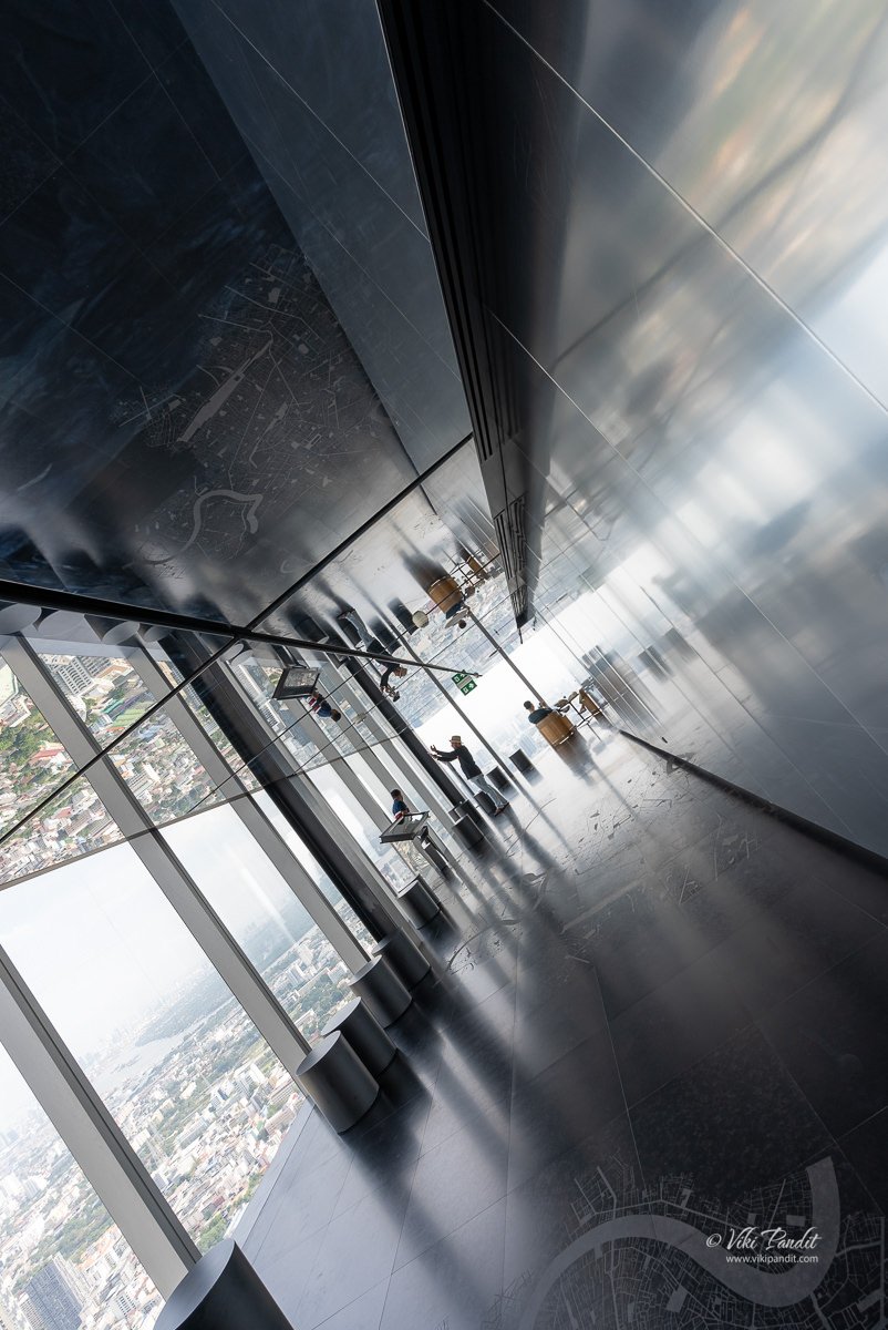
The 74th floor offers a unique 360 degrees view over the city of Bangkok while educating the viewer on the city’s heritage and history through inscriptions and city maps engraved on the floor, while the two top floors are outdoor spaces occupied by the Sky Bar and Skytray and are meant for leisure and amusement of visitors.

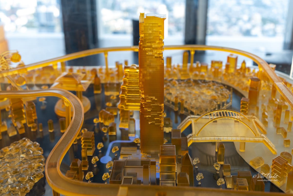
All the sides have continuous glass walls from which you can see the stunning Bangkok skyline. On the observatory floor, you can also find a miniature model of the MahaNakhon building.

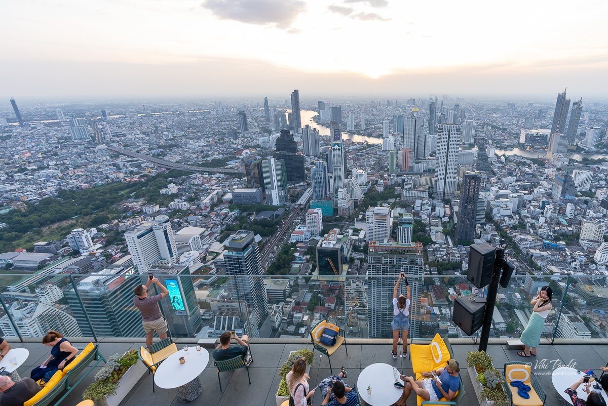
The top of the tower houses a three-floor Sky Bar and restaurant with double-height spaces and an outdoor rooftop bar with 360º views, floating 310 meters above the city.

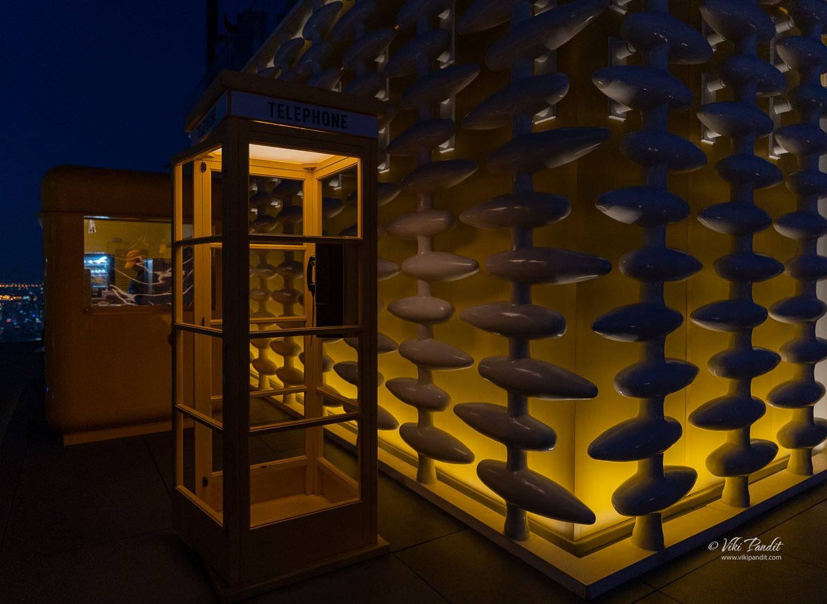
This Post Box is a replica of the very first mailbox of Thailand.

From the observatory you will need to go up an escalator to the 75th floor. From here a spiral staircase leads up to the terrace. Alternatively, you can also use an elevator to go up to the terrace.

You will be provided a shoe cover here for going on to the glass tray

The staff here might tell you that you cannot come down to the observatory once you go to the terrace but you very much can. You have to use the stairs beside the circular stairs on the 75th floor to go down.

Even though it was November, you could feel the stifling heat as you come out onto the open terrace. Bangkok is more near to home than I could have imagined.

As we walked toward the edge of the terrace, we could see the city emerging.

Glass tray at MahaNakhon

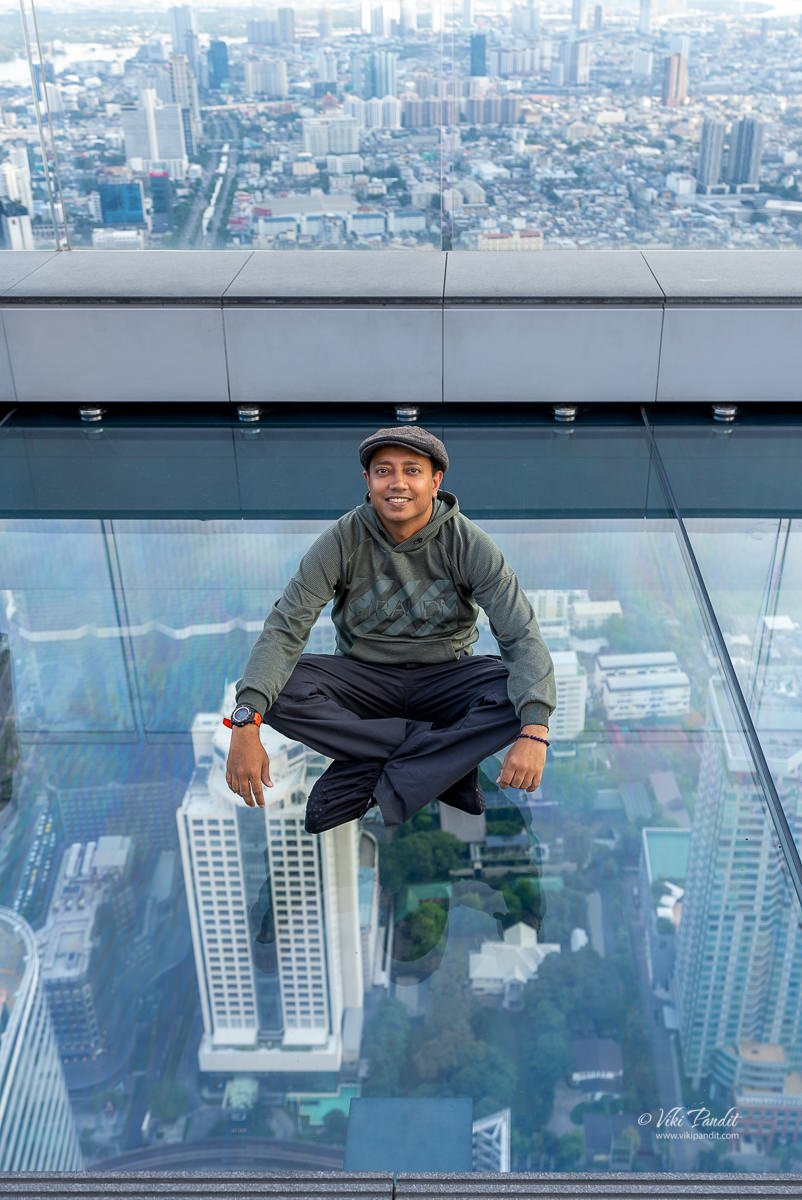
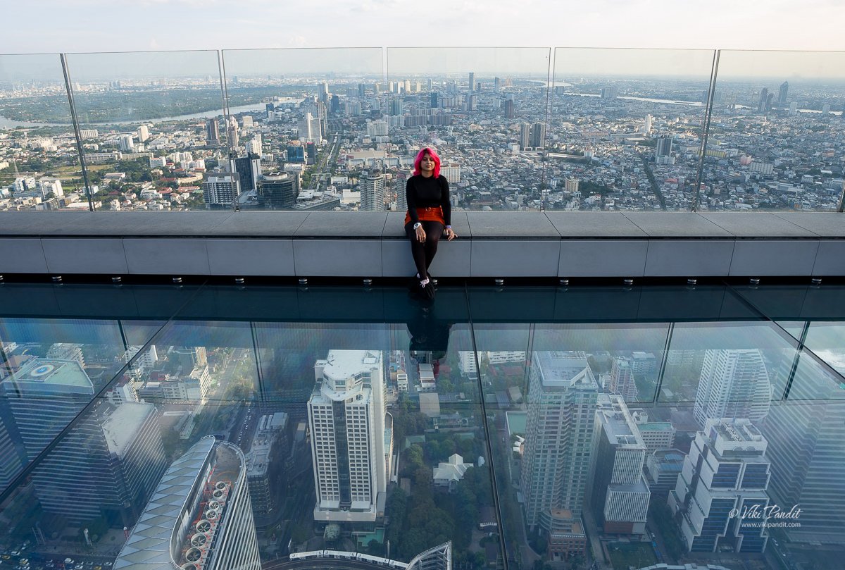
The glass trays are at a height of 300 meters. It is is cantilevered out from the building to give visitors views directly down to the ground below. It was the main attraction for us: to stand on this glass tray with a bird eye’s view of the beautiful skyline below. Visitors are required to cover their shoes with the disposable shoe cover provided on the 75th floor.

This attraction is known as the Skytray, a walkable glass platform of 4.5×17.5 meters that is not only sure to attract thousands of visitors every year but also ensure that these visitors post breathtaking photos of them walking on the glass platform on their social media.

Please note that visitors are not allowed to take any loose items including mobile phones, camera, selfie sticks and other items to the glass tray.

The glass floor, constructed and laminated by Sedak, is fabricated from six multi-layered panels, each measuring 4.14 x 2.69 m. Each panel comprises seven pieces of 12 mm heat strengthened low-iron glass alternated with 1.52 mm SentryGlas®, creating a 13-ply glass/interlayer construction, which still offers excellent clarity. For those feeling unsure on getting on to the glass tray, SentryGlas® ionoplast interlayer is tougher and 100 times stiffer then the older PVB interlayers.

Photography of the glass tray is only permitted from a photo taking area outside of the glass tray.

If you do not have anybody to take your photo while you walk on the glass tray, the staff will help you.

Thailand’s highest rooftop bar with signature drinks and cocktails.

Gazing at the unobstructed view of the city we enjoyed some chicken pie from the Skybar.
Note: The snacks are a bit on the expensive side.

The MahaNakhon Terrace

MahaNakhon was recognized as Thailand’s Tallest Building (2016 – 2018), certified by the Council of Tall Buildings and Urban Habitat in April 2016. Its luxury ‘mixed-use’ development is specifically designed to complement the city’s existing skyline and gives Bangkok an iconic architectural landmark.

Sunset from MahaNakhon

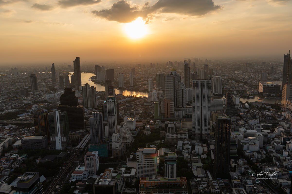
As we approached the Golden hour, the cityscape turned into a glowing orange with light that is soft, warm, and golden.

The Bangkok skyline at sunset is a breathtaking sight to behold. The city is known for its towering skyscrapers, which seem to rise up from the ground and stretch towards the sky. As the sun begins to set, the city is bathed in a warm, golden light that gives the skyscrapers a beautiful, glowing appearance.

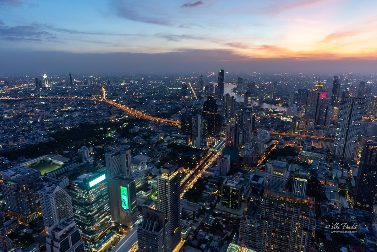
The towering skyscrapers seem to glow with an otherworldly radiance, and the city’s many temples and shrines are lit up in a way that is both beautiful and serene. It is a truly breathtaking sight to see, and one that is sure to leave a lasting impression on anyone who witnesses it. Night falls gently in Bangkok and lights come on across the city.

My Nikon 810 was struggling to capture this beautiful cityscape so I switch to my Sony AS3 in hope more than anything that maybe it can do better.

The beautifully lit building in the above photo is that of ICON SIAM. I haven’t been there yet. Hope to go therein the future as it looks pretty appealing.

Along the ICON SIAM, you can see the Chao Phraya River. The river is an important source of food for the people of Thailand, and it is also home to many floating markets where people buy and sell goods from boats. It is a popular tourist destination, with numerous boat tours and cruises available for visitors to experience the sights and sounds of the river. The Chao Phraya River is home to several important temples and landmarks, including the Wat Arun temple and the Grand Palace in Bangkok.

On the way out we grabbed the set of printed photos, photoshopped to look as if taken from the terrace.

Since its completion, MahaNakhon has become a popular tourist destination in Bangkok. In addition to the observation deck, the building also features a rooftop bar and restaurants. It is a popular spot for both locals and tourists to take in the breathtaking views of the city and enjoy a meal or drink at one of the many dining and entertainment options.

King Power MahaNakhon building was conceived to reflect the ambition and excitement of one of the world’s most dynamic cities. It is a showcase of one of the most significant examples of contemporary architecture and urban design in all of Thailand. Designed by an award-winning architect, Ole Scheeren, the MahaNakhon Building spirals up through the urban jungle of Bangkok, representing this vibrant city. Bangkok, with its contrasting mix of traditional temples and modern skyscrapers, has developed an eclectic skyline and the MahaNakhon Building fits right in.

From the summit of MahaNakhon, the panorama unfolds into a mesmerizing tapestry of urban brilliance. Perched above the bustling city, the view encapsulates the vibrant energy of Thailand’s capital. Gazing out, one witnesses the convergence of modernity and tradition, as gleaming high-rises stand in juxtaposition with historic landmarks. The Chao Phraya River meanders through the urban sprawl, reflecting the glimmering lights of the cityscape. At night, the skyline transforms into a dazzling display of colors, and the bustling streets below come alive.

Thanks for reading! I hope you like my story. Please leave a comment if you have any questions.

Visitor Information

What are the open hours for MahaNakhon?

Daily from 10.00-19.00 hrs. (last admission 18.30 hrs.)

How do I reach MahaNaknon using Skytrain?

BTS Skytrain via Chong Nonsi Station, exit 3

What is the price of admission tickets to MahaNakhon Skywalk?

Adults: ฿880.00
Kids: ฿250.00
Seniors (Age 60+) : ฿250.00

Visitors can also avail some package options that come with complimentary drink and food coupons. Various offers are also available during festival times when they offer discounts on the price of the tickets.
The Dazzling White Temple: Wat Rong Khun

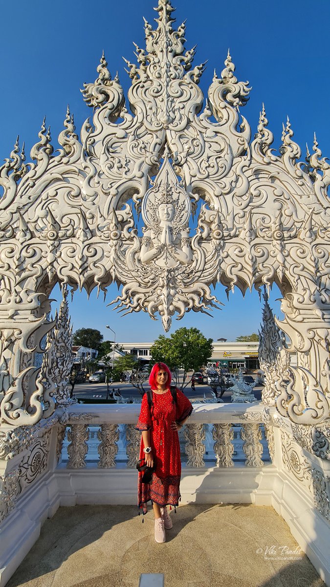
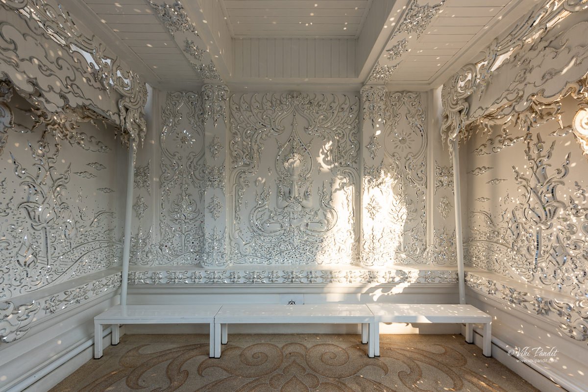
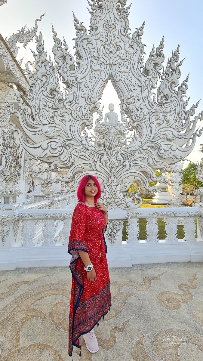
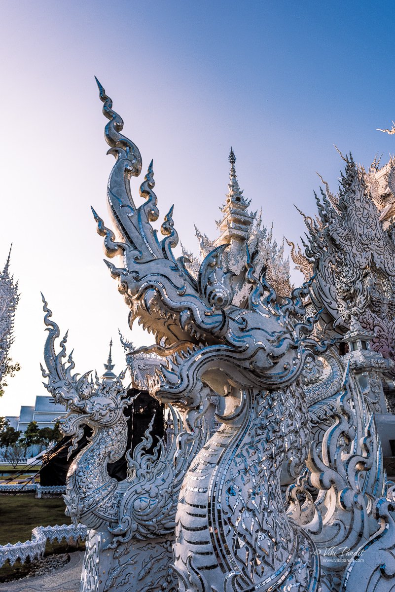
Nestled in the serene landscape of Chiang Rai, Thailand, Wat Rong Khun, commonly known as the White Temple, is a contemporary Buddhist temple. The temple’s design is unique and striking, featuring an intricate structure covered in white plaster and adorned with pieces of mirrored glass. This reflects the sun’s rays, creating a dazzling effect that symbolizes the purity and wisdom of Buddha.

The temple was designed and built under the visionary guidance of renowned Thai artist and architect Chalermchai Kositpipat and is proof of his artistic brilliance. Chalermchai’s vision has not merely bestowed upon the local residents a place of worship but has also transformed it into a sought-after tourist destination.

The white temple had been on my radar since the time a fellow photographer posted some pictures on 500px several years ago. When my dream of visiting Thailand was finally becoming a reality, there was no way I would miss this opportunity to visit one of the most iconic complex in all of Thailand.

Wat Rong Khun is not just a religious site but a masterpiece that has captivated the hearts of visitors worldwide. Chalermchai has been successful in creating a temple that not only serves as a place of worship but also as a work of art that transcends cultural and religious boundaries. Tourism in Thailand is seen as a way to increase the country’s reputation in the world. as a source of national pride and a modern symbol of the nation, the temple has now become an iconic landmark within the province and, to a significant extent, across the entire country.

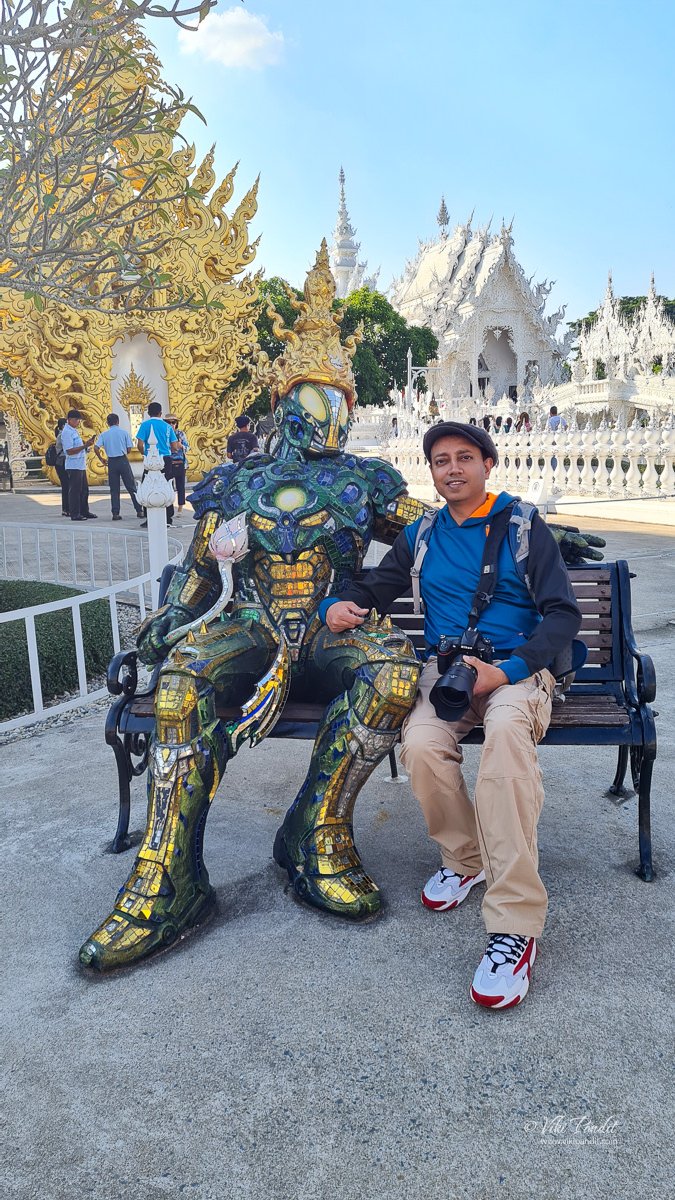
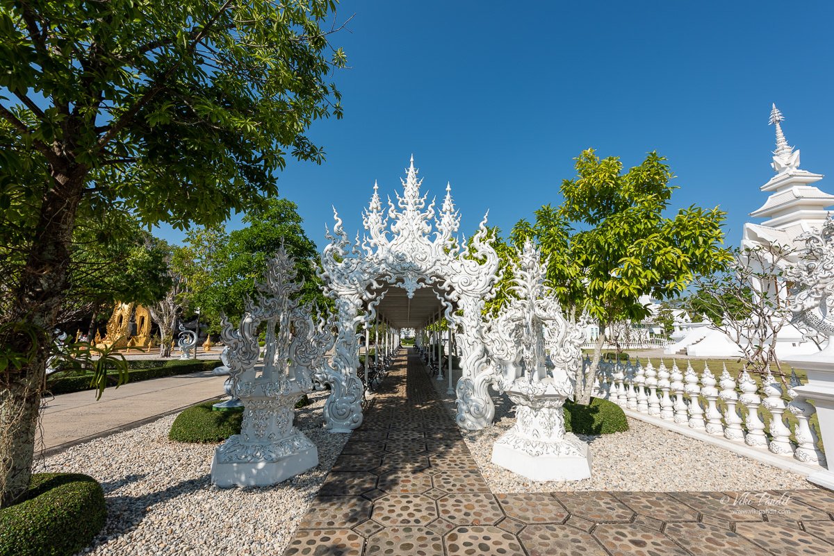
The temple opens to the public after 8 am but since it is not hidden behind any enclosure, if you wish to observe the temple sans the crowds, you can come anytime in the early morning. There is a small shopping arcade nearby where you can wait for the temple to open over a fresh glass of fruit juice. The outer premises of the temple is decorated with statues of demons and other supernatural beings, manga characters, as well as depictions of several action heroes like Venom and Predator.

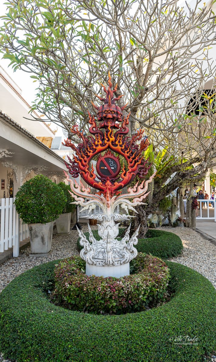
Even common signages like a No-smoking sign have been tackled in a creative way making them part of the architectural design of the temple.

Brief history of White Temple

Before we go into the intricacies of the temple it is important to know the name behind this masterpiece. Chalermchai Kositpipat was born in Chiang Rai. He is a renowned contemporary Thai artist and the visionary behind the iconic Wat Rong Khun, or the White Temple. His artistic journey has left an indelible mark on the cultural landscape of Thailand, blending traditional Thai artistry with modern expressions.

Built in the 1950s, Wat Rong Khun initially stood as one among numerous small village temples in Thailand. By the 1990s, this four-decades-old temple required extensive repairs. The dining hall and grand gate underwent reconstruction, supervised by Phra Khru Chakhriyanuyut, who also introduced a herbal sauna for the rehabilitation of drug addicts. Nevertheless, the main structure, known as the bot or ubosot, also demanded restoration, as it had become unsuitable for religious worship.
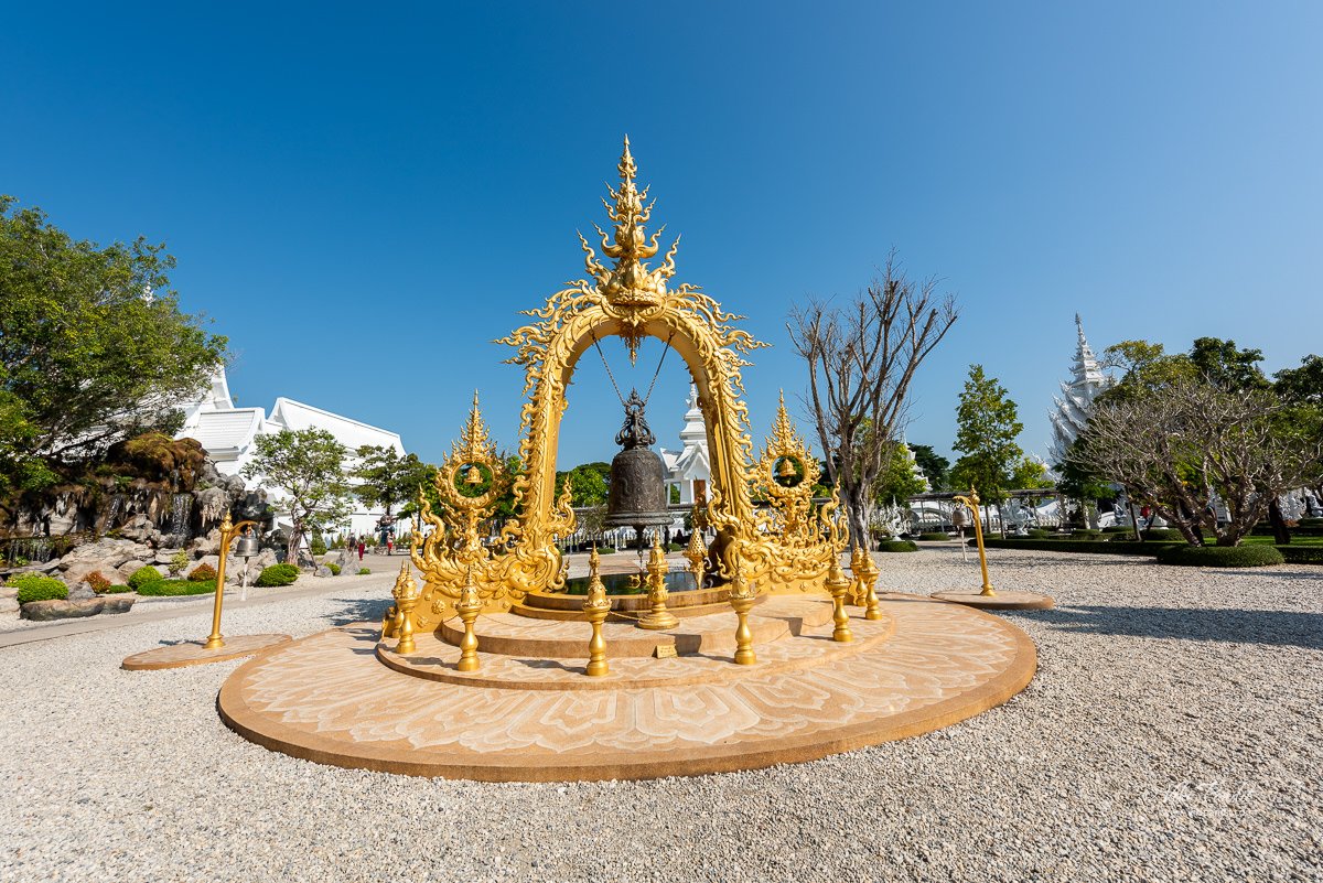
In 1996, the decision was made to demolish the old bot or ubosot to pave the way for a new hall. Regrettably, a year later, the financial crisis of 1997 gripped the entirety of Thailand. Faced with economic hardships, the villagers lacked the resources to contribute to the reconstruction efforts, resulting in the abandonment of the project and leaving them without a bot. Given that Rong Khun is his hometown, Chalermchai, determined to lend a helping hand, took charge of the situation.

In the late 1990s, he embarked on the ambitious project of transforming the decaying Wat Rong Khun into a masterpiece that stands as a symbol of Thai culture and spirituality. Wat Rong Khun is not only a place of worship, but also a symbol of Ajarn Chalermchai’s vision of a “new art form” in which traditional Buddhist teachings are blended with modern ideas and images.
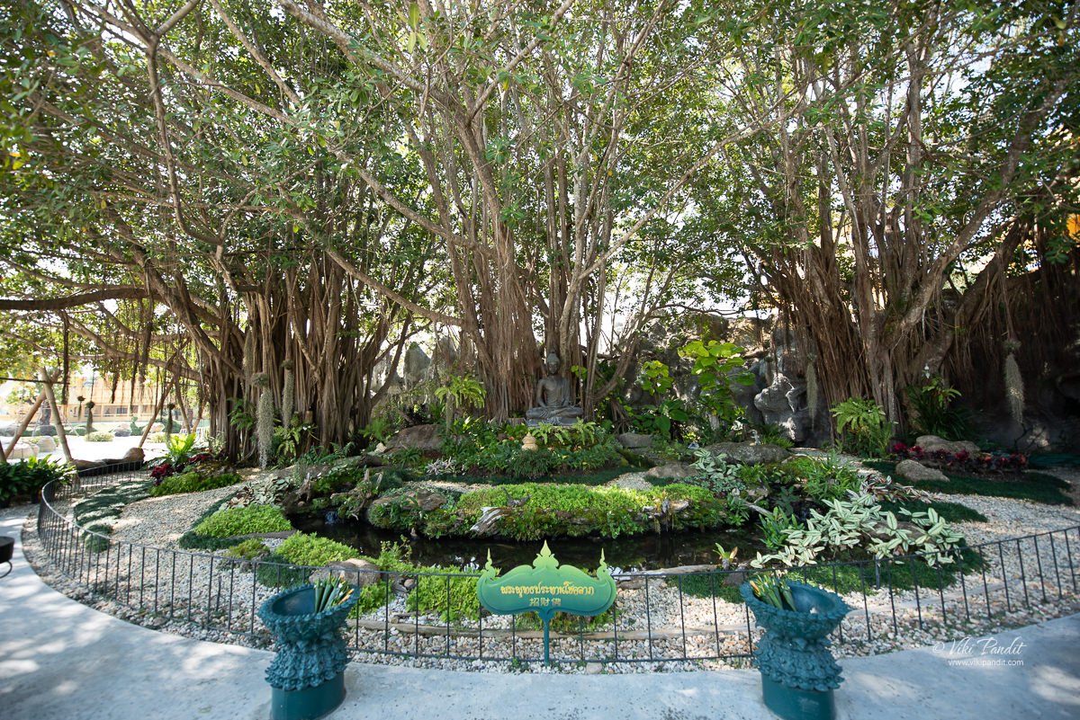
The construction of the new temple was undeniably a monumental undertaking, unparalleled in scale across Thailand. The initial temple occupied 4 rai, equivalent to 6400 m2, a typical size for a village temple. However, Chalermchai’s expansive vision surpassed this modest scale, necessitating additional space. To accommodate his grand design, surrounding rice paddies were procured and integrated into the temple grounds. Consequently, the temple now spans 10 rai and 100 square wa, equivalent to 16400 m2, making it notably larger in comparison to other village temples in Thailand.
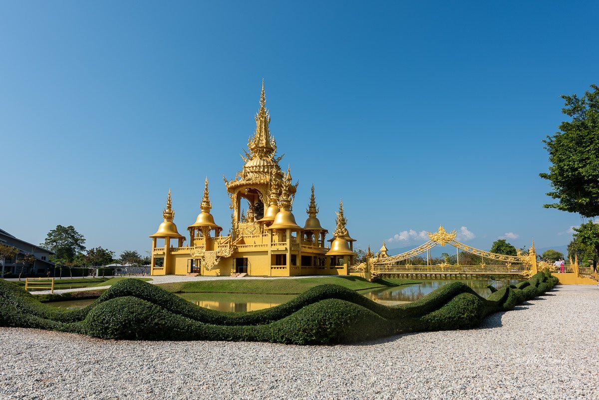
The construction of Wat Rong Khun began in 1997 and most of it was ready by 2008 when it was opened to the public. The temple is a testament to his artistic genius, featuring intricate handcrafted details, stunning architecture, and a fusion of Buddhist symbolism with contemporary themes. Kositpipat, however, has an even mega plan for the site. Once finished, the complex of the White Temple will comprise nine structures, incorporating the current ubosot, a relics hall, a meditation hall, an art gallery, and residential spaces for monks. By the time of writing this article, the project has cost him more than $30 million of his own money. If all goes well, the temple should be finished by 2070.

White Temple

The temple ground is rectangular, with a walkway as its main east-west axis. The ground is then divided into three sections, two on the southern side of the walkway and one on its northern side. The temple currently has nine main buildings, three in each section and some other minor ones. These three main sections are the Karawat, the Sanghawat and the Buddhawat. The Karawat is the section for the laity, with a shop, a bathroom and a preaching hall. The Sanghawat, the section for the monks, has the crematorium, the kuti or the residence for the monks, and a hall of contemplation. The Buddhawat is the section for the Buddha, where we find the bot, the pavilion of relics and the pavilion of images.

Buddhawat

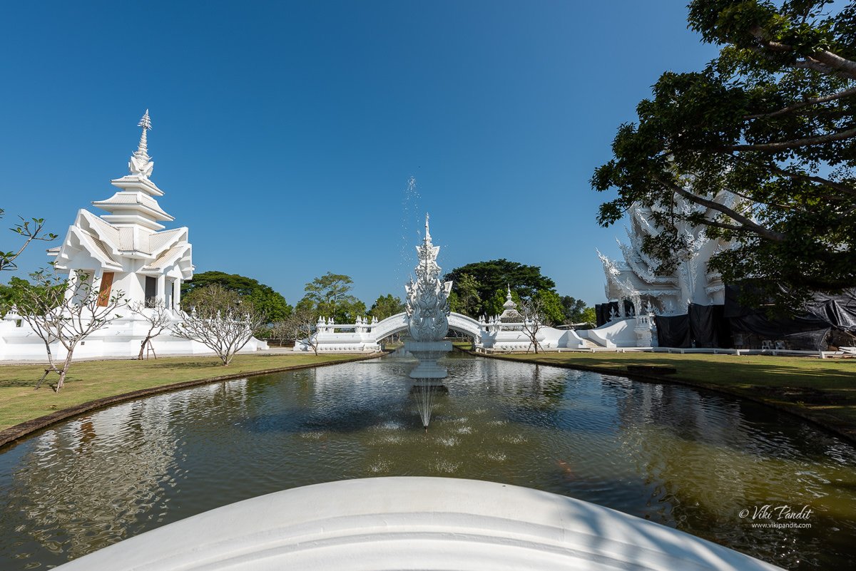
The Buddhawat occupies the entire northern expanse of the temple, separated from the Karawat and the Shangawat by a white picket fence. Within this section, three principal structures – the bot, the pavilion of relics, and the pavilion of images are aligned in a straight formation, with two bridges interspersed between them. This arrangement is complemented by various auxiliary constructions, forming an intricate and ornamentally adorned ensemble. The Buddhawat features an array of embellishments, including fountains, water pools, freestanding statues, meticulously tended trees, and bridges one situated in front of the bot and another linking the pavilion of images and the pavilion of relics along with other decorative elements.
The bridge of “the cycle of rebirth”

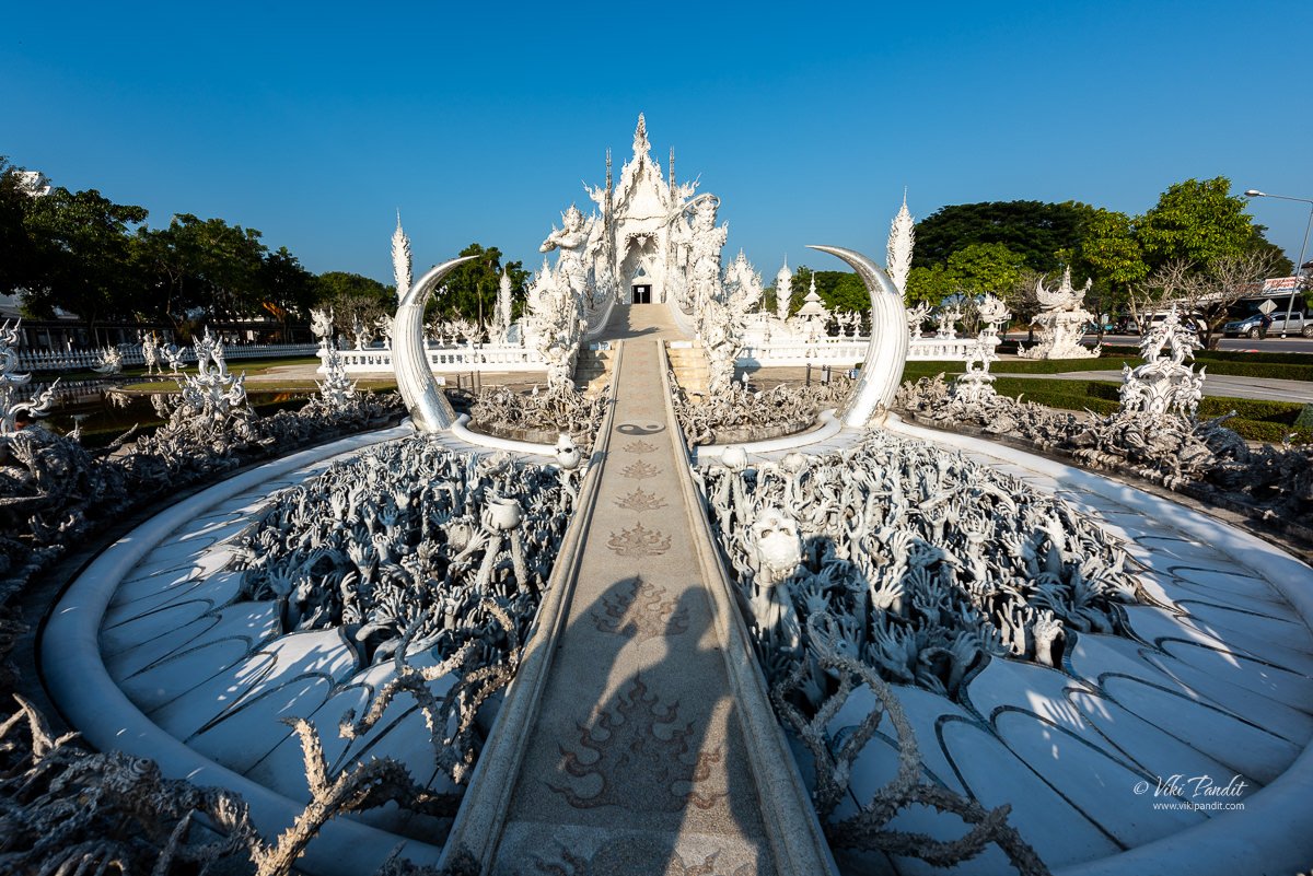
Once we crossed the gate into the Buddhawat, we were directed towards a path leading to the “bridge of rebirth.” It is the most iconic feature of Wat Rong Khun, which leads to the main temple. The “Bridge of the Cycle of Rebirth,” is a long, white, and narrow bridge that stretches over a small pond. It is covered in intricate designs and symbols, including depictions of demons and other figures from Buddhist and Hindu mythology.

Before reaching the bridge, however, the visitors need to walk over Mara’s mouth, in which you can find hundreds of hands as well as a few feet and faces of people damned to hell. These hands and feet are close to the visitors, making this a physical and graphic journey through hell. This section of the temple attracts a lot of attention.

The bridge represents the journey from the cycle of birth and death to the path of enlightenment. The hands reaching up from the depths of hell symbolize the struggle to overcome worldly desires, while the heavenly figures on the other side signify the attainment of spiritual liberation. The bridge serves as a symbol of the journey from the material world to the spiritual world, and the process of attaining enlightenment.

The demons are meant to represent the obstacles one must overcome in order to attain enlightenment. The white color of the temple symbolizes the purity of the Buddha and the glass and mirror decorations are meant to represent the Buddha’s wisdom and the reflections of the visitors.
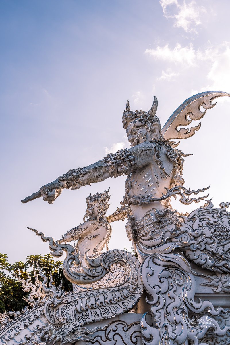
After traversing the representation of hell, visitors encounter two stylized demons, positioned on either side of the Bridge of Rebirth. While statues of demons are commonly seen in Thai temples, the ones at Wat Rong Khun differ significantly from the more conventional depictions typically found in expansive, traditional Thai temple grounds. The demons here at Wat Rong Khun bear a closer resemblance to characters found in graphic novels rather than adhering to the conventional styles of traditional Thai art.

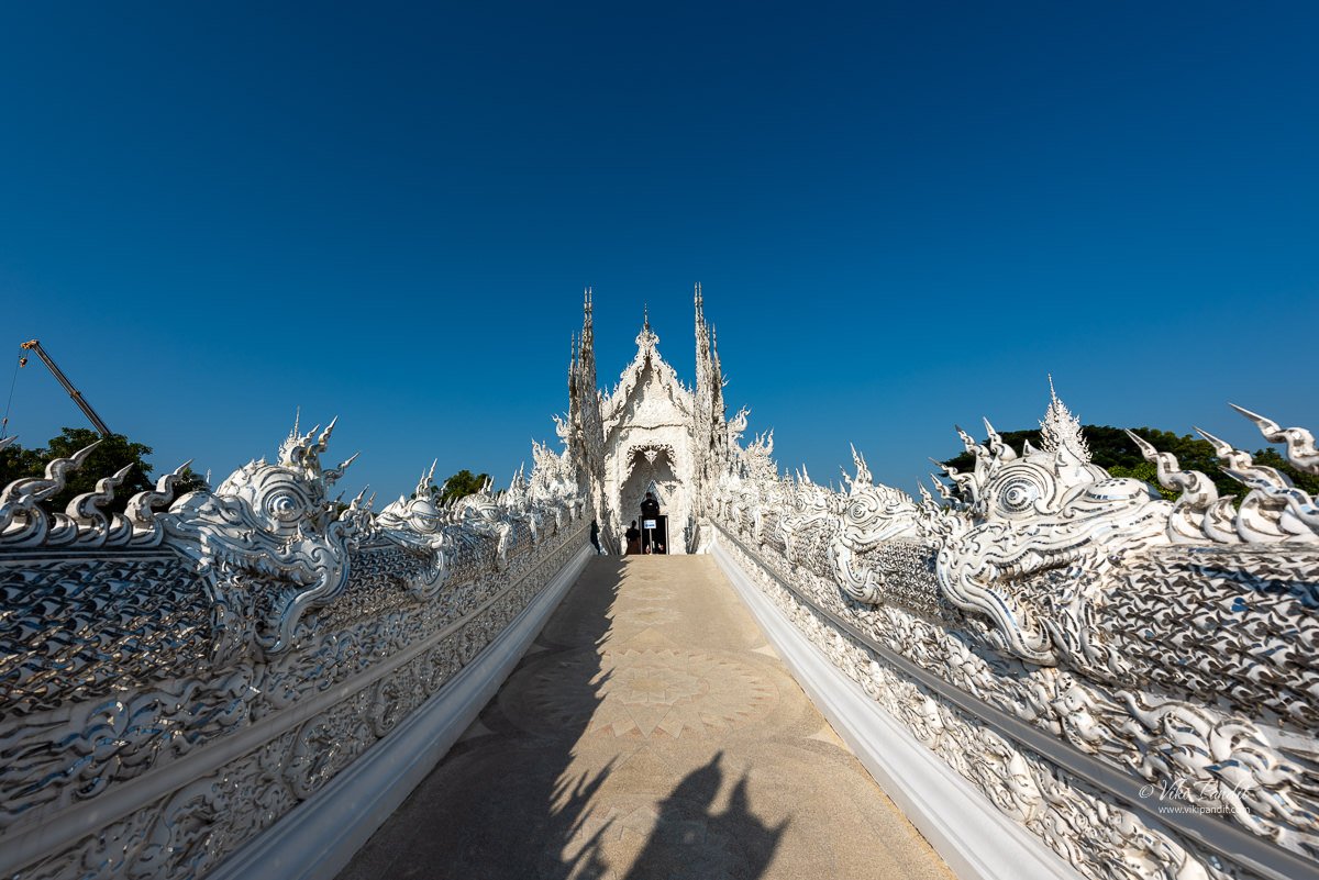
Visitors must cross the Sukhawadee Bridge to enter the temple, representing the transition from the material world to the spiritual world. As they walk on the bridge, they pass by the statue of demons and other figures, which serves as a reminder of the negative qualities and obstacles that one must overcome in order to achieve enlightenment.

Gate of Heaven

Upon crossing the bridge, visitors reach the “gate of heaven,” protected by two creatures symbolizing Death and Rahu, determining the fate of the deceased. In front of the ubosot, numerous meditative Buddha images are displayed.

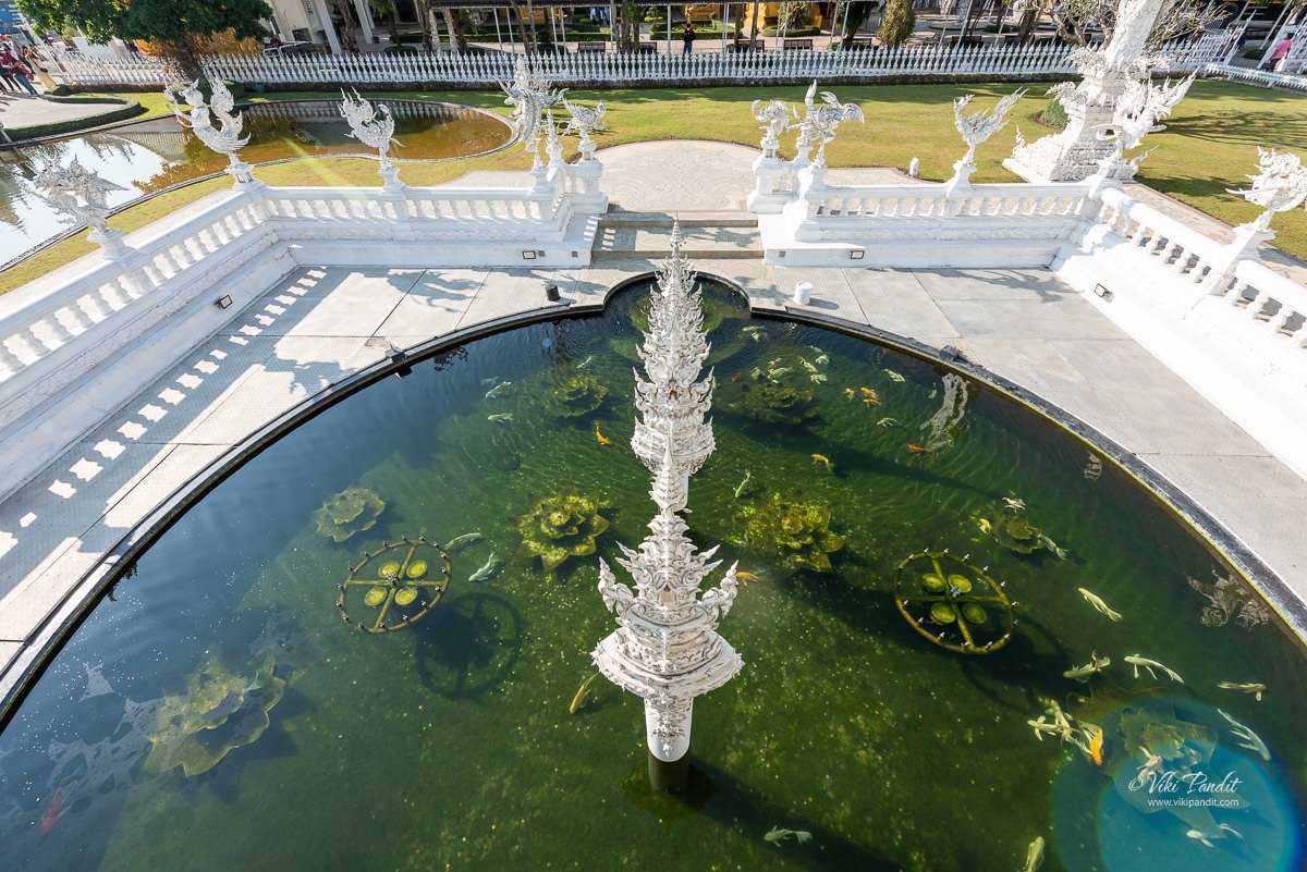
Below the gate, you can find a cute little pond with Koi fishes swimming in the clear transparent waters.

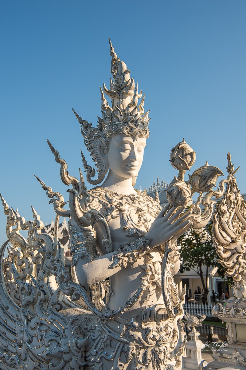
A statue of a Kinnaree is located just before the main hall of the temple. The statue is depicted with a serene expression and is holding a lotus flower, which is a symbol of spiritual purity and enlightenment. This statue serves as a reminder of the beauty and grace that can be attained through spiritual practice.

A Kinnaree is a mythical creature that is typically depicted as a half-human, half-bird being. In Thai Buddhism, the Kinnaree is associated with beauty, grace, and spiritual purity. The Kinnaree is often depicted in art and architecture, particularly in temples, as a symbol of the spiritual journey and the attainment of enlightenment.

In addition to the statues, the Kinnaree is also depicted in various other forms of art and decoration throughout the temple, such as in the murals and frescoes. This serves as a reminder of the importance of art and culture in Buddhism, and how it can be used to convey spiritual messages.

Ubosot

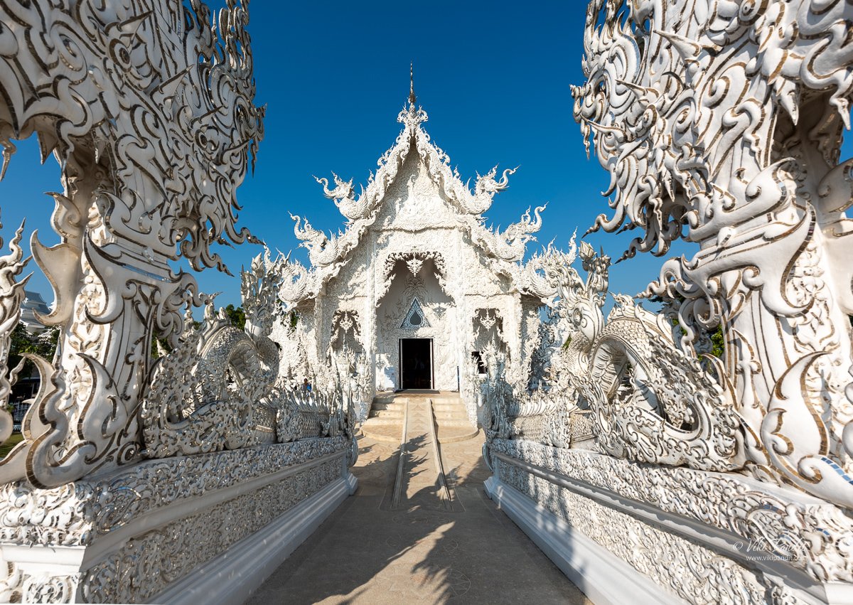
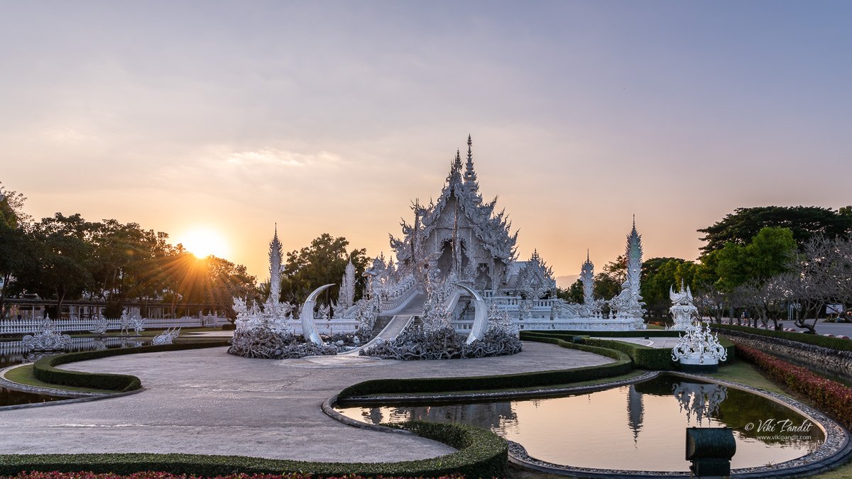
As I followed the only path available, I crossed the enchanting Bridge of Rebirth, finding myself standing in awe before the most captivating structure on the temple grounds – the Ubosot (main hall). The leaf-like patterns at the top of the bridge unfolded a story of Mount Meru, while the fountain-like structures beneath, nestled in the pool, mirrored the embracing mountain range.

My eyes were drawn to the four flame-like structures at the corners of the bot, each adorned with small human figures symbolizing the Buddha’s early disciples. As I gazed up at the pinnacle of the bot, the roof finials took on the shapes of stylized animals, gracefully representing the four elements: fire, water, air, and earth. The intricate details painted a vivid narrative, making my journey through Wat Rong Khun an immersive and personal experience.

The temple is also adorned with pieces of glass and mirrors, which reflect the sunlight and give the temple a shimmering appearance. The main hall of the temple, known as the “Ubosot,” features a statue of the Buddha made of black glass and gold leaf.

The Ubosot is a large, all-white building that serves as the center of the temple complex. It is the place where the main altar is located and where ceremonies and rituals are held. The Ubosot is adorned with intricate details and symbols, including depictions of demons and other figures from Buddhist and Hindu mythology. You will have to carry your shoes in your hand while entering the Ubosot.

The main attraction of the Ubosot is the statue of the Buddha made of black glass and gold leaf. The statue sits in the center of the hall and is surrounded by other statues and sculptures. Photography is not allowed inside. The statue is a representation of the Buddha’s teachings and serves as a reminder of the path to enlightenment.

A large mural in front of the statue depicts the struggle between Buddha and the demon Mara. It represents the final conflict of Lord Buddha’s own demon before he attained enlightenment. The eyes of the demon have George Bush and Bin Laden painted in the pupil area. When asked about these depiction, Ajarn Chalermchai had responded that it was to caution both as violence hurts entire humanity.

The Ubosot also features several other statues and sculptures, including statues of the Hindu god Ganesha and the bodhisattva Avalokiteshvara. These statues serve as a reminder of the universality of spiritual teachings and the importance of transcending cultural boundaries in the pursuit of enlightenment.

Once you come out of the Ubosot, you can find a small enclosure that seats about three people at a time. Here you can get back into your shoes.

From here you can continue on the circumambulatory passage going around the temple hall. On both sides of the main hall, there are beautiful depictions of Buddha sitting inside a lotus.

Just behind the main hall lies the Buddha Relics Tower. But it was closed at the time of my visit

In addition to the demon head and multi-armed statue, the Wat Rong Khun also features other monster idols such as a giant serpent and a demon emerging from the ground. These statues serve as a reminder of the dangers and obstacles that can arise on the path to enlightenment, and that one must always be vigilant in order to overcome them.

To come out of the temple you have to come out through this southern gate.

The exit gate features two of the most beautifully designed dragons.

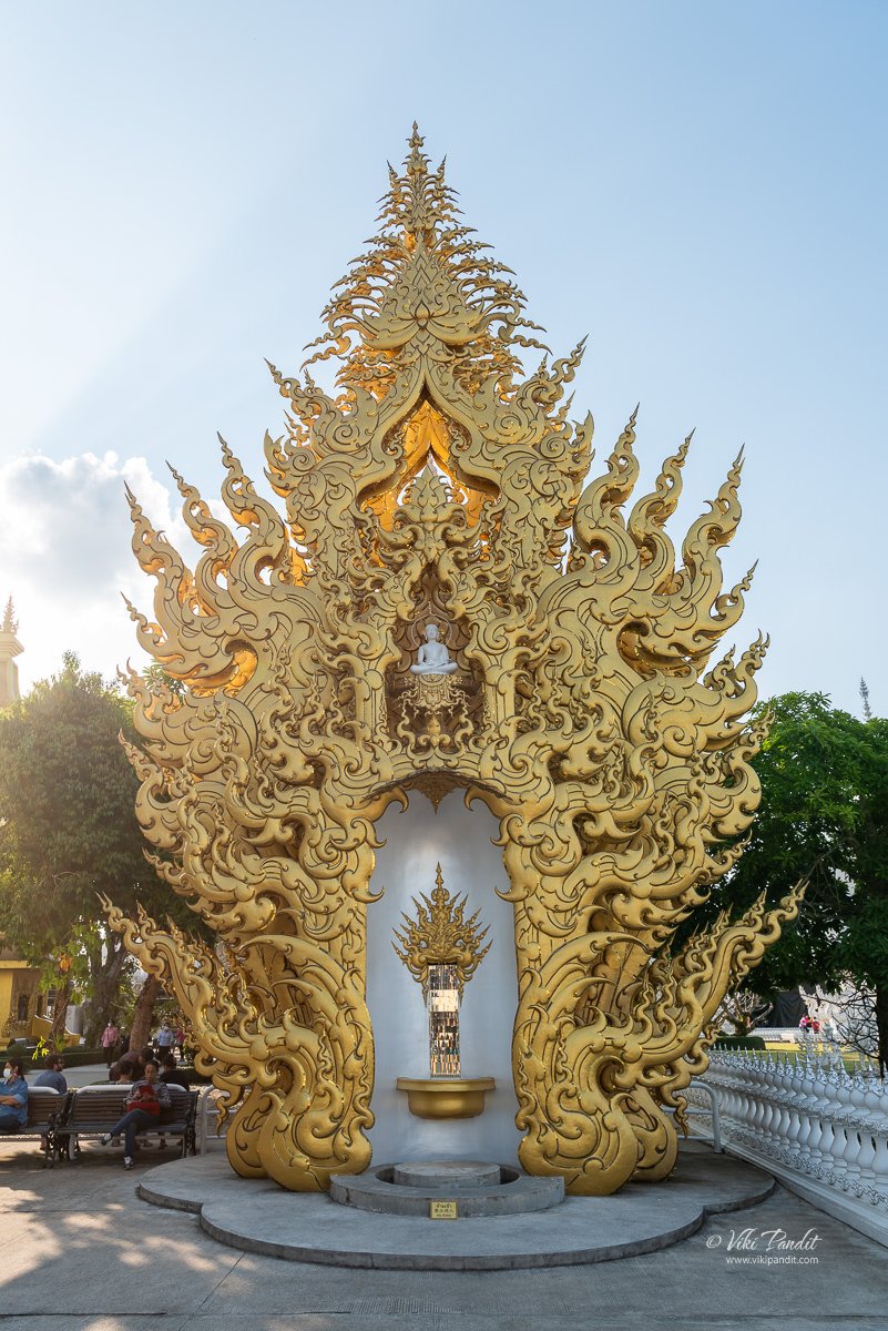
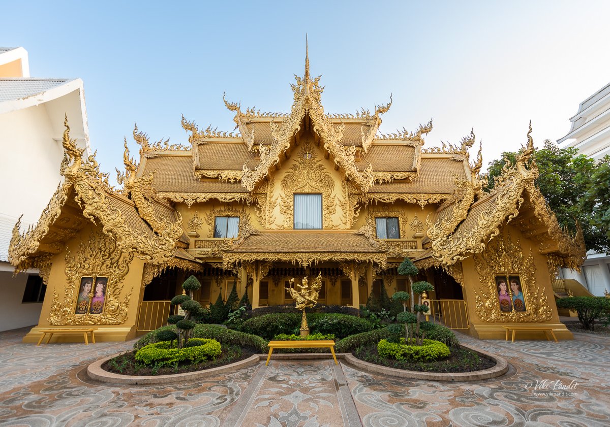
Coming out of the main temple you will find yourself in front of another beautifully designed golden building. It is a restroom. Of course, when everything else is following the same pattern why not the restroom as well?

Just beside the restroom, there is an intricately decorated walkway that leads to the farther areas of the temple.

As we walked through the walkway, on the right we could see certain areas of the temple that were undergoing renovation.

When this area is finished, it will lead the visitors directly to the Buddhist Tower connected by a small bridge known as the Sukhawadee Bridge.

Buddhist Tower

Belfry at Wat Rong Khun

Dhamma Garden

Ganesha Temple

One of the most prominent symbols is the statue of Ganesha, the Hindu god of wisdom, knowledge and new beginnings.

Ganesha is often depicted as a figure with an elephant head and a human body. He is known for his intelligence and his ability to remove obstacles, making him a popular figure in Hinduism and Buddhism. Ganesha is often invoked at the beginning of any new venture or undertaking as a symbol of good luck and success.

At the Wat Rong Khun, the statue of Ganesha is placed prominently at the entrance of the temple. It serves as a reminder to visitors to approach their spiritual journey with wisdom and knowledge and to be open to new beginnings. The statue also serves as a reminder that obstacles may arise on the path to enlightenment, but with the guidance of Ganesha, one can overcome them.

The statue of Ganesha at Wat Rong Khun is also unique in its design as it is fused with traditional Thai art and culture. It showcases the blending of different cultures and religions, and how they can coexist in harmony. The statue symbolizes the universality of spiritual teachings and the importance of transcending cultural boundaries in the pursuit of enlightenment.

Wat Rong Khun has become a major tourist attraction, drawing visitors from around the globe to Chiang Rai. The unique blend of traditional Thai spirituality and contemporary artistry has created a cultural landmark that transcends the boundaries of religious affiliations. The temple has not only contributed to the local economy but has also elevated Chiang Rai’s status as a must-visit destination in Thailand.

The temple’s popularity has led to increased tourism, benefiting local businesses and creating employment opportunities. Additionally, the revenue generated from entrance fees and donations is often reinvested into the maintenance and restoration of the temple, ensuring its continued splendor for future generations.

However, Wat Rong Khun has also been the subject of controversy and criticism. Some have criticized the temple for its commercialization and the inclusion of non-Buddhist elements in its design. Others have raised concerns about the temple’s environmental impact, as it was built on a rice field and required the excavation of a large area of land. Some also criticized the temple for its lack of religious significance, as it is primarily used as an art exhibit.

Despite the criticism, Wat Rong Khun continues to be a major tourist attraction and a symbol of Ajarn Chalermchai’s unique vision. The temple’s intricate and striking design, combined with its message of peace and unity, make it a worthwhile destination for those interested in Buddhism, art, and architecture. The temple is a reflection of the artist’s creativity, originality, and his passion for conveying the Buddhist teachings in a modern way. Wat Rong Khun is a thought-provoking and inspiring place that challenges traditional notions of Buddhism and art.

After thoroughly explorig the Wat Rong Khun, we walked into the Karawat gift shop. Unlike the usual gift shops associated with temples, especially those attracting tourists, Karawat breaks away from the norm. Instead of the typical religious-themed merchandise like amulets, Buddha statues, or Buddhism-related literature, this gift shop stands out by offering printed reproductions of the artist’s paintings, multiple biographies about him, as well as t-shirts and postcards featuring images of the temple itself.

What caught my attention was the absence of conventional Buddhist teachings and religious paraphernalia that are commonly found in gift shops at other temples. Positioned between a museum gift shop, showcasing art reproductions and coffee table books, and a typical tourist attraction gift shop with various t-shirts, caps, keychains, and trinkets, Wat Rong Khun’s gift shop is truly distinctive. It provides a unique opportunity to purchase printed copies of Chalermchai’s original works, adding an artistic flair to the temple visit. I myself purchased a canvas painting for my study room.

My heartfelt gratitude to each one of you who took the time to read through my article. If you liked it, please leave me a comment. If there are areas where you think I can enhance the storytelling, I would greatly appreciate your feedback.

Inuyama Castle

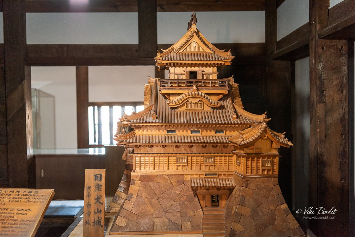
Located in the outskirts of Nagoya, Inuyama Castle is one of the 12 original Japanese castles. Founded in 1440 CE along the Kiso river, it dominates the quaint town of Inuyama from its stunning position over the hill.

After an interesting morning at Gifu Castle, we took the JR train to Unuma Station. From the station its a 25 minute walk to the Castle. Please note that I used the JR line because I had the JR Pass on me. If you are paying for tickets, it would be more meaningful to use the Meitetsu line and get down at the Inuyamayuen station which is a lot closer to the castle.

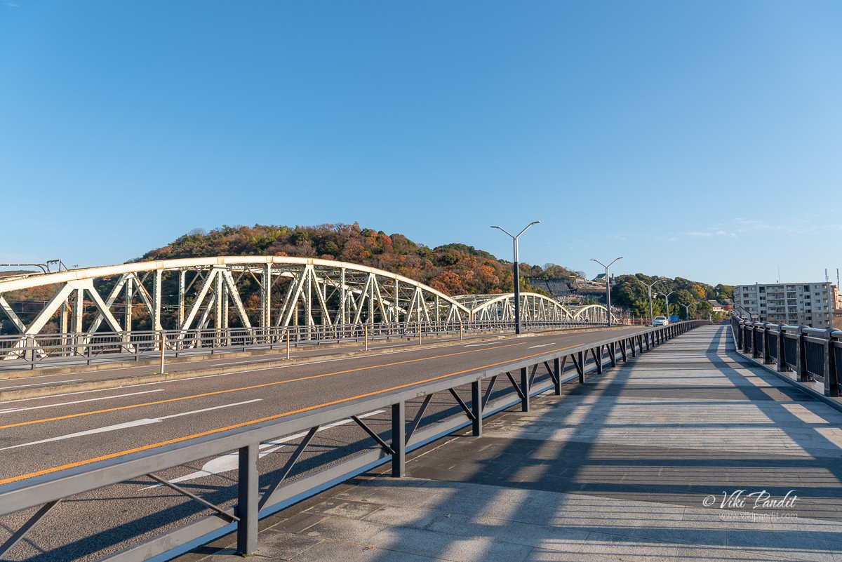
It was a beautiful weather and in the soft cool breeze, the walk to the castle was just lovely. After a few minutes we reached the Inuyama Bridge. Opened to the public in 2000, the iron beam bridge beautified with three arches, connects Kakamigahara in the Gifu Prefecture with Inuyama in the Aichi Prefecture. On the opposite side of the walkway you can see the Meitetsu Inuyama Line running parallel to the road.

Right after crossing the bridge over the Kiso river, we turned right, into a paved path lined with colorful momiji trees.

This straight path goes on for about 10 minutes before you hit a narrow winding elevated road that leads you to a huge white Torii. The path leading via this gate will lead you directly to the castle via the Nezutsu Shrine. However if you are one of those explorer types… follow me.

Sanko Inari Shrine

Just left to the huge white Torii, you will see a series of red torii gates. These gates lead to the Sanko Inari Shrine.

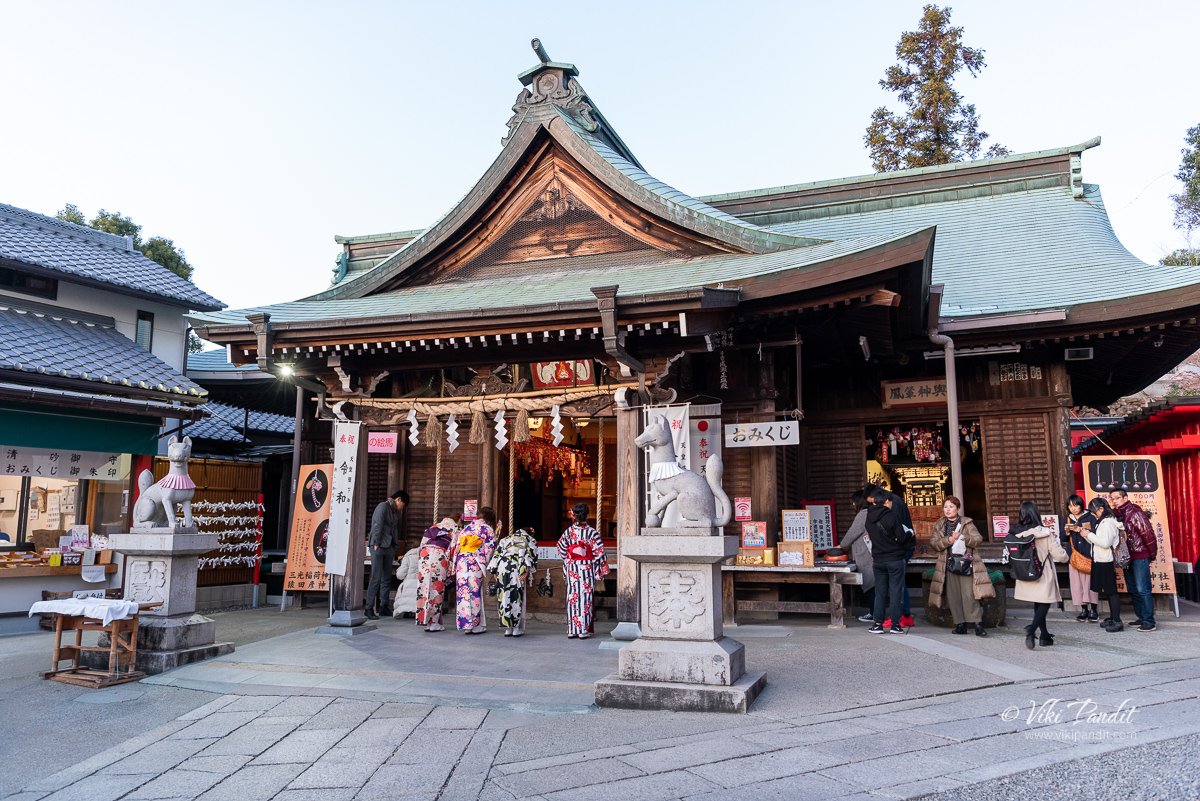
Located at the base of Inuyama Castle, Sanko Inari Shrine has a long, rich history. It’s name was originally Sankojisan and it is a highly revered place of worship for locals and tourists alike. In the Meiji period of Japan, because of the separation of gods and Buddhas, it became the Sanko Inari Shrine.

Every year on July 22, there is a traditional festival custom where families visit the shrine after dark carrying small red paper “chochin” lanterns hanging from branches of bamboo.

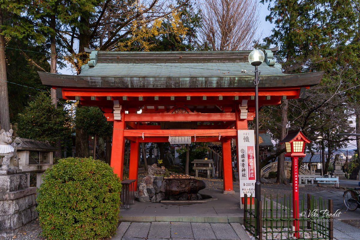
Before you enter through the red torii, you can find the Chozuya on your right, where you can wash your hands and purify yourself before praying at the shrine.

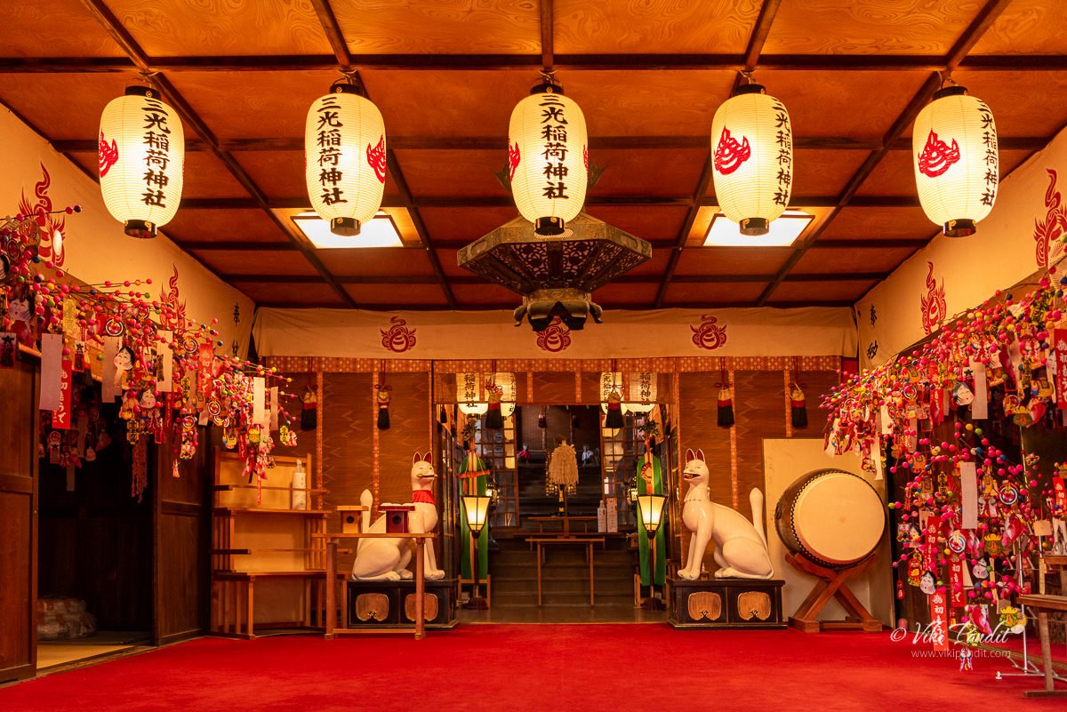
Although the exact date is unknown, the shrine is said to have been built in the 1500s. The shrine is particularly known for its cute, heart-shaped ema (wooden wishing plaques). Praying at the shrine is said to bring fortune in matchmaking.

Another compelling legend is the “omokaru” stone. This special stone sits on a red cushion on the side of the main hall. You need to close your eyes while standing in front of the stone and hold a wish in your mind while imagining lifting the stone. It is said your wish will be as easy to realize as the perceived weight of the stone that you felt in your mind.

As an “inari” shrine, visitors also come to pray for a prosperous business. According to one legend, it is said that placing money in a perforated basket and washing coins with sacred water on the shrine grounds will increase the amount of money several times over!

Just beside the main hall of Sanko Inari Shrine lies a short row of torii gates. Walking through the gate only made me desperately want to visit Fushimi Inari Taisha.

Haritsuna Shrine

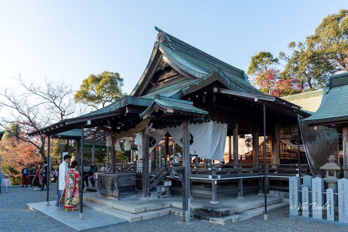
This shrine is listed in the Engi-Shiki, in the chapter that lists Shinto shrines at the time. It is located in the Inuyama area as one of the Five Owari Shrines and enshrines the Sochinju (local Shinto deity) of the Nobi region. The Inuyama Festival at Haritsuna Shrine has been designated a national intangible folk cultural property.

The shrine was relocated to its present location in 1882. The building structure of the shrine looks similar to “Sanko Inari Shrine”, but the atmosphere of coexistence of vicissitudes and solemnity. People come here from afar to pray for easy childbirth, warding off misfortune, warding off evil, traffic safety, and child conception.

After capturing some pictures of the revered shrine we walked back to the stone path. Before joining the stone path, you can see an “Immortal Horse” statue. It is said that the white horse is the patron saint of children, so this Imperial God Horse can pray for children.

The curved stone path led us to the ticket boot. As of writing this article, it cost us ¥500 per person to enter the castle grounds.

In 1871, many of the castle’s outlying buildings were destroyed on the orders of the new Meiji government. The Honmaru-mon Gate, which is the main entrance to the castle is a wonderfully-done reconstruction.

A brief history of Inuyama Castle

The precise year Inuyama Castle was completed is uncertain. The castle guidebook claims it was completed in 1440. According to the Heian period Engishiki a Shinto shrine, the Haritsuna Shrine was moved to make way for the castle. The structure was rebuilt several times in the Muromachi period and the current configuration was largely the work of Oda Nobuyasu, Oda Nobunaga’s uncle in 1537.

Although the antiquated architectural style of the watchtower atop the tenshu has in the past led many historians to believe this to be the oldest extant tenshu in Japan, that honor goes to Maruoka Castle, built in 1576. Construction on the current main tenshu (donjon) at Inuyama began in 1601, and continued through 1620.

Inuyama Castle was the final obstacle against Oda Nobunaga’s unification of Owari Province. After Nobunaga had defeated the Imagawa clan at the Battle of Okehazama in 1560, his cousin, Oda Nobukiyo, seized Inuyama Castle with the support of Saito Yoshitasu on Mino Province. Nobugana recaptured the castle in 1564.

After Nobunaga’s death, Toyotomi Hideyoshi appointed Ishikawa Sadakiyo as castellan of Inuyama. Ishikawa rebuilt the defenses of the castle in line with contemporary designs and the current shape of the donjon is a result of this reconstruction. After the Battle of Sekigahara, the victorious Tokugawa Ieyasu expelled the Ishikawa clan and turned the castle over to Owari Domain.

Under the Tokugawa shogunate, the castle was governed by the Naruse clan, who ruled as daimyō of Inuyama Domain as vassals of the Owari Tokugawa clan until the Meiji restoration. The new Meiji government seized Inuyama Castle in 1871 and destroyed all of its auxiliary buildings except for the donjon; however, after the castle was damaged in the Great Nōbi earthquake, and it was returned to the Naruse family in 1895, on the condition that they repair and maintain it. The castle was thus unique in Japan in that it was privately owned.

Inuyama Castle was privately owned by the Naruse family until 2004 when ownership of the building and grounds was transferred to a non-profit foundation set up by the Aichi Prefecture’s Board of Education in Inuyama.

It was long believed that the donjon of Inuyama Castle was moved to the castle from Kanayama Castle in 1599, until such theory was disproved as a result of examination through a large scale restoration work, involving the dismantling of the donjon, carried out between 1961 and 1965.

After capturing some external shots of the castle, we went up the age old structure. The floor broads creaked like we were going into some kind of haunted house. The roofs are quite low, even for me at 5’10.

You have to remove your shoes to enter the keep, but once inside, the wooden floor boards and naked pillars speak volumes. Oda Nobunaga, Toyotomi Hideyoshi and a host of famous historical samurai figures have trodden these floors.

The castle was for many years the private property of the Naruse clan, who were the lords during the seventeenth century up until 2004, when the management of the castle was entrusted to a public body.

Steep stairs throughout not only saved interior space, but hindered armored invaders, making defense of the castle easier. The first floor is divided into a number of chambers, with wide corridors around these chambers giving the samurai ample space to move in times of attack.

Its four floors contain armories, stock room of the lords and various defense systems. The 唐破風, Karahafu room as it’s called for the beautiful curved gables is located on one of the floors in the castle. The plover shaped windows are unique to Inuyama. The “kara” part of the world signifies the style came from China.

At the top of its steep stairs you will be able to go out and walk on its ramparts overlooking the entire valley and the Kiso River.

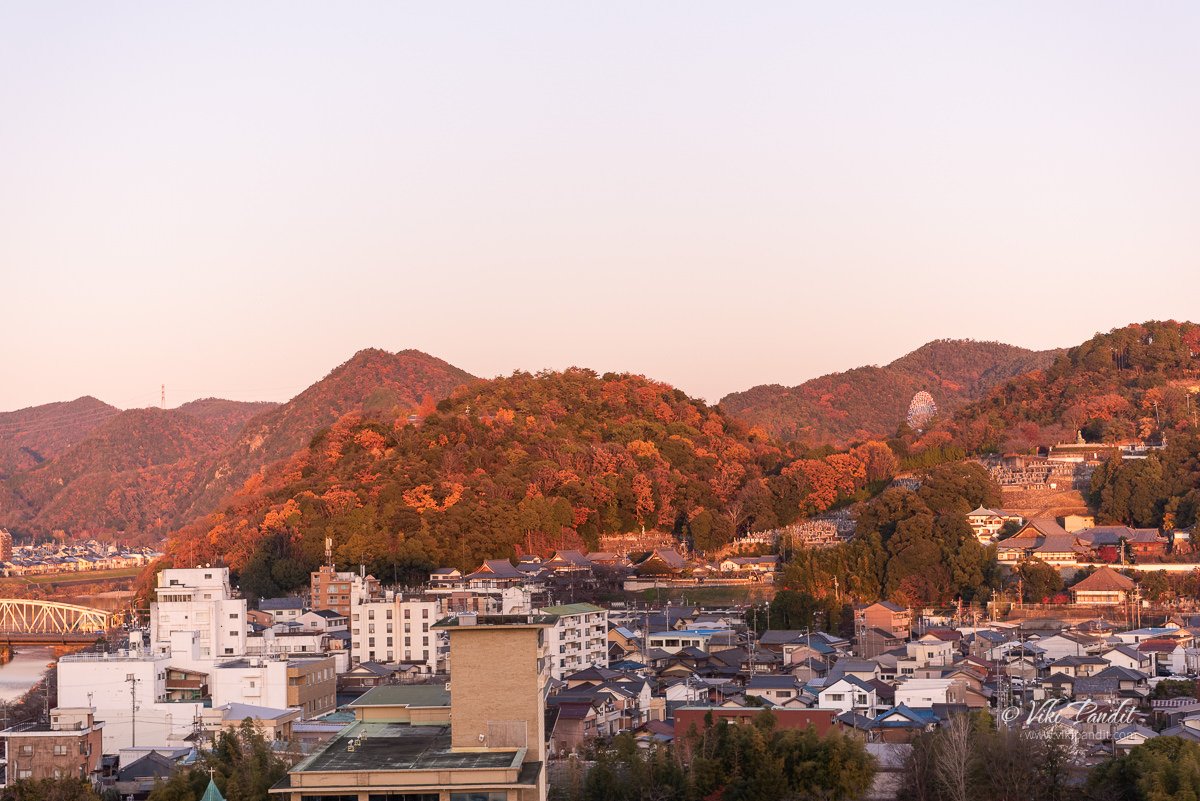
As the Sun gradually started to go away for the day, it cast a beautiful golden glow over the surrounding hills.

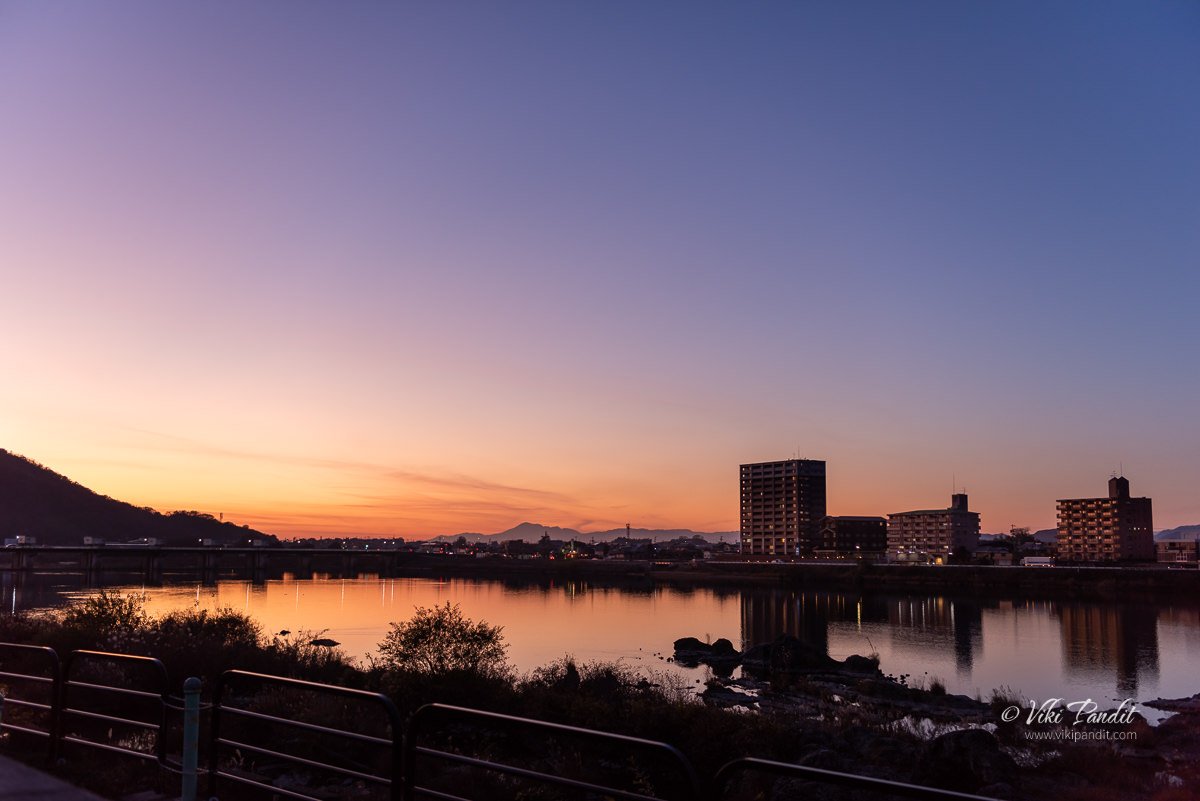
We waited for the sun to slowly die over Inuyama and the mesmerizing twilight to set in. The castle overlooking the Kiso River is perfectly positioned for one of the most beautiful view of the city. This one view alone is worth the trip.

Some of the places around Inuyama Castle still has traces of the old times like Honmachi street where you can still find merchant houses from the Edo period, including the Jo-an tea room near Urakuen garden.

Once it was dusk we climbed down the Castle and made our way back to the Inuyamayuen Station. Even though I was carrying my JR Pass, it made much more sense to use the Meitetsu line to get to Nagoya from where we could easily get a train to Kyoto.

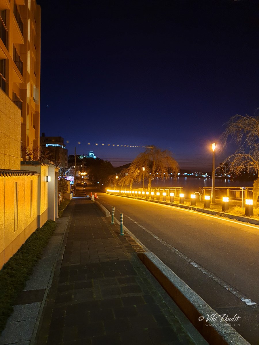
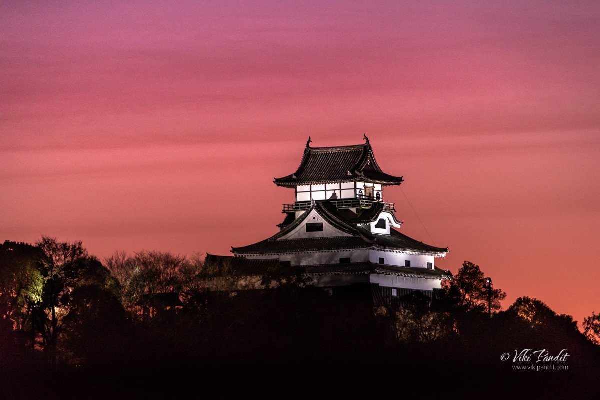
On the Inuyama bridge, I set up my tripod to capture a couple of shots of the illumitaed castle. Strategically positioned on the wedge shaped hill with the wide, fast flowing Kiso River running around and below it, and with unhindered views of the surrounding area, it was the first castle to be owned outright by the warlord Oda Nobunaga, although he didn’t stay long, or use it as a regular base. Instead, he left his uncle as caretaker while he went off to fight more battles.

To get a close-up shot of the castle I used my 80-400mm Nikon lens. It had gotten pretty cold by then. With freezing fingers I quickly captured a few shots of the castle and packed up.

From Inuyamayuen station we caught the Limited Express to Nagoya Station. The station is an unmanned station(at least at that time we were there) so be prepared with a bit of Japanese or you might run into trouble buying tickets at the counter.

Thanks for reading! Please leave me your comments or reviews. If you liked my story please consider following me on Instagram or continue with it as I visit the mesmerizing Fushimi Inari Taisha at night.

Built in

1440 CE

Built by

Oda Hirochika

Admission Fees

¥500 per person

Events at Inuyama Castle

Inuyama Festival | April
During the first weekend of April, the city comes alive for local matsuri and its parade of floats decorate Honmachi Street. These floats are on display in a local museum. Another, in the castle, display weapons and armors from the civil wars of the sixteenth century.

Kiso River Long Run Fireworks | August
This weeklong fireworks festival takes place on the first nine days of August. During the festivities, Inuyama Castle is lit up for an extra exquisite night.

Inasahama Beach

Inasa Beach (稲佐の浜) is one of the most sacred Japanese beaches located in Japan. It is mentioned several times in Kojiki, said to be the oldest written chronicle in Japan. The book written in ancient words and difficult to read even for the Japanese, speaks of ancient Japanese myths and the beginnings of the island nation itself.

According to the scriptures of the Kojiki, there are said to be 8 million gods. The Amatsukami (heavenly gods) were ruled over by Amaterasu Omikami, the sun goddess & the most important deity of the Shinto religion. Amaterasu is the daughter of Izanami and Izanagi who made their daughter ruler of the heaven. The Kojiki further states that the earthly world where the people lived was called Kunitsukami, and inside this very earth, exists the realm of the dead referred to as Yomi no Kuni.

After an entertaining afternoon in Hinomisaki we decided to drop in at Inasahama to catch its mesmerizing beauty during sunset. The bus dropped us off at Izumo Taisha stop and from there we just walked to the beach. You can also get down directly at the beach, it has its own stop. We just needed to get some refreshments and some souvenirs from the shops near Izumo taisha.

If you are coming straight from Izumoshi Station area, the bus ride costs about ¥540 per person. We had however previously purchased the “perfect ticket” which allows for a hassle-free travel on local buses. If you are in Izumo for a few days, I would recommend obtaining the “Enmusubi Perfect ticket” from the Izumo Tourist Information Center, inside JR Izumoshi Station. It enables you free rides on Ichibata trains and buses, including Matsue city buses for 3 consecutive days. The ticket also includes discount privileges at many tourist spots.

After walking for about 15 minutes to the west of Izumo-taisha Shrine, the Inasahama gradually emerges from the Sea of ​​Japan – a beach famous for the mythical story of the country’s inception.

Myths surrounding Inasa no Hama Beach

The myth surrounding Inasa no Hama has many variations, but in essence, it is the tale of how Takamagahara (The realm of the Amatsukami) came to be united with Izumo (A kingdom of Kunitsukami).

Takamagahara is a place of heaven in Japanese mythology. In Shinto, Takamagahara is the dwelling place of the heavenly gods (Amatsukami). It is believed to be connected to Earth by the bridge Ama-no-uki-hashi (Floating Bridge of Heaven).

It is said Amaterasu Omikami, the queen of Amatsukami, took grave offense to see Okuninushi, becoming a king of the land of Izumo in the earthly realm. Since she saw Okununishi’s actions as inconsiderate toward the right to rule given to her by her father, Izanagi, she ordered various messengers and negotiators to Izumo, to cease and desist his activities.

It is said that the messengers of heaven clashed their swords on this very beach and negotiated with Okuninushi for the transfer of land to them. After several negotiations, Okuninushi eventually gave in to the desires of Amaterasu and her grandson, Ninigi no Mikoto-sama ascended to the rule of Izumo. In compensation, he was made ruler of the unseen world of spirits and magic on Earth.

As gratitude toward Okuninushi (or some say it was on a condition requested by him) she had Izumo Taisha built for him, and he was to have responsibility and jurisdiction over spiritual affairs, whereas Amaterasu Omikami-sama and her lineage would have responsibility and jurisdiction over physical affairs and government. Per this agreement, all of the kami, Amatsukami and Kunitsukami, would gather at Izumo Taisha every October to talk about affairs of the physical and spiritual. So the story goes!

Even today, the legend is inherited as “Kami-tei Shinto“, and on the 10th day of the 10th month in the lunar calendar, a bonfire is lit on the beach to welcome the 8 million Gods from all over Japan. Interestingly in all of Japan, the gods are away this month, so the month is called, “Kannazuki,” but in Izumo, where the gods gather, the month is called “Kamiarizuki.” Although there are no fancy illuminations or bursting of crackers, it is a ritual with a strict atmosphere that I would want to see at least once in my lifetime.

After the gods have been welcomed at the shore, people march to Izumo Taisha to the sound of flutes and drums with two sacred tree branches called Himorogi housing dragons, sea snakes, and gods at the head. After the celebration at Izumo Grand Shrine, it is said that the eight million gods stay in Izumo Taisha for a week, in the nineteen shrines to the east and west sides of the main shrine, as they hold a meeting, called Kamuhakari, on various matters related to human life.

Benten-jima

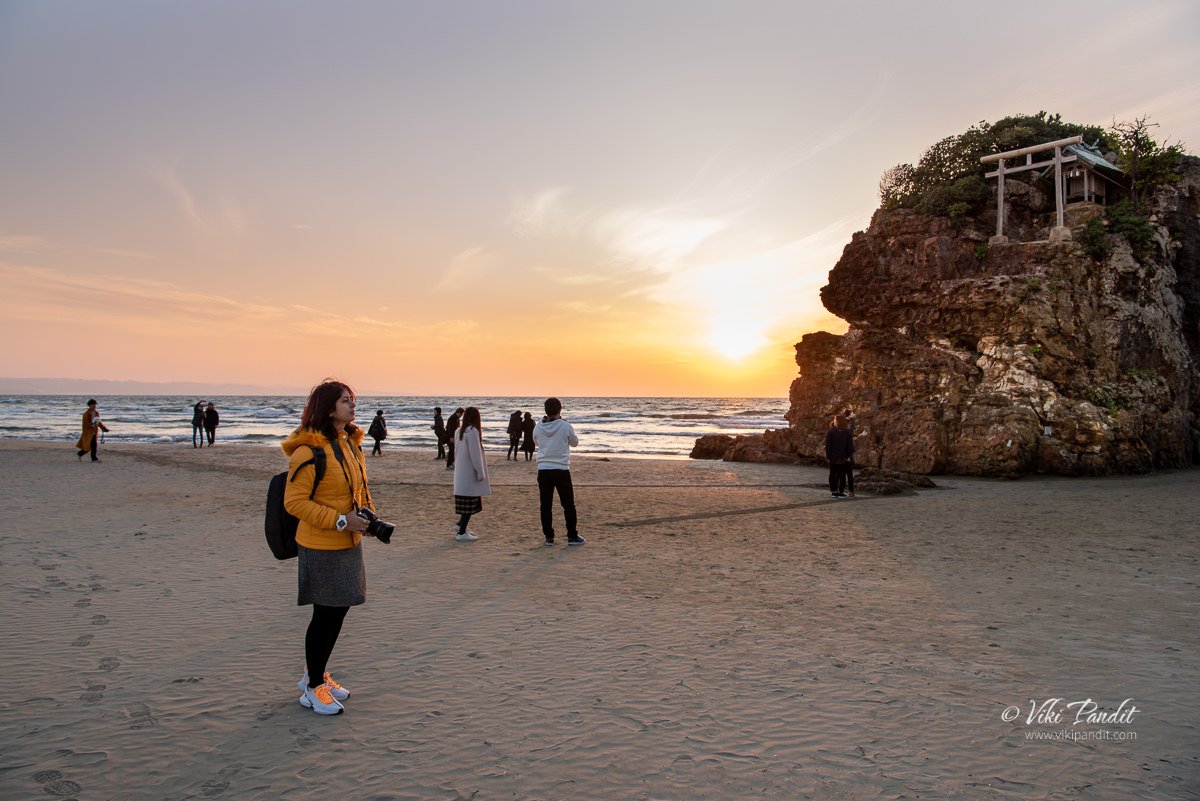
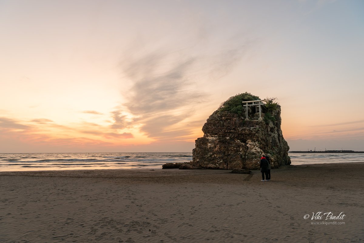
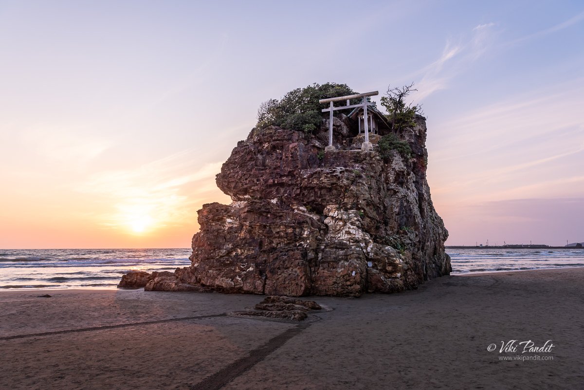
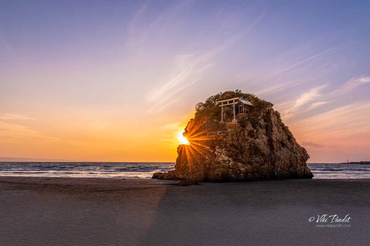
Inasahama has a white sandy beach and a beautiful coastline. This scenic spot has been selected as one of Japan’s 100 Nagisa Beaches. On the beautiful beach, you cannot miss a small lonely rock standing with a miniature torii and a shrine on the top. The prominent round island at Inasa no Hama known locally as “Benten-jima.” In ancient times, it has been referred to as Okino Gozen and Okinoshima.

The Benten-jima Shrine is dedicated to Toyotama-hime, the daughter of Watatsumi – the God of the sea, and is said to protect seafarers. The beach itself, according to legend, was created during the Kunibiki land pulling, as the God Yatsukamizuomizunu used a rope to pull the land to Izumo and this rope later turned into the sandy Inasa no hama beach.

Benten-jima is not really an island as described by the name. The boulder used to be in the sea in ancient times, so the name “island” was given to it at that point in time. Until around 1965, it was only possible to reach Benten-jima using a temporary wooden bridge over the sea. However, due to changes in the tide, sand has gradually accumulated around the island, and now it is connected to the beach and can be walked to on foot. 

Thanks for reading! Inasa Beach is a nice place to relax during the evenings. If you are visiting Izumo-taisha, do not miss this lovely place. It is just a 15-minute walk from the heritage shrine. If you like my story, please leave a comment or follow my story as I continue to explore one of the holiest places in Japan – Izumo taisha.

Sunset at Lake Shinji

Lake Shinji is a brackish water lake in the northeast area of the Shimane Prefecture in Japan. It is the seventh-largest in Japan, with a circumference of around 48 kilometers. The lake is enclosed by the Shimane Peninsula to the north, and the Izumo and Matsue plains to the west and east respectively.

We were staying in the city of Nara. From this western city, we were traveling all the way to Izumo for a short tour of the heritage city. The plan was to stop for a break at Lake Shinji and enjoy the beautiful sunset, which is very popular for.

Getting to Matsue from Nara

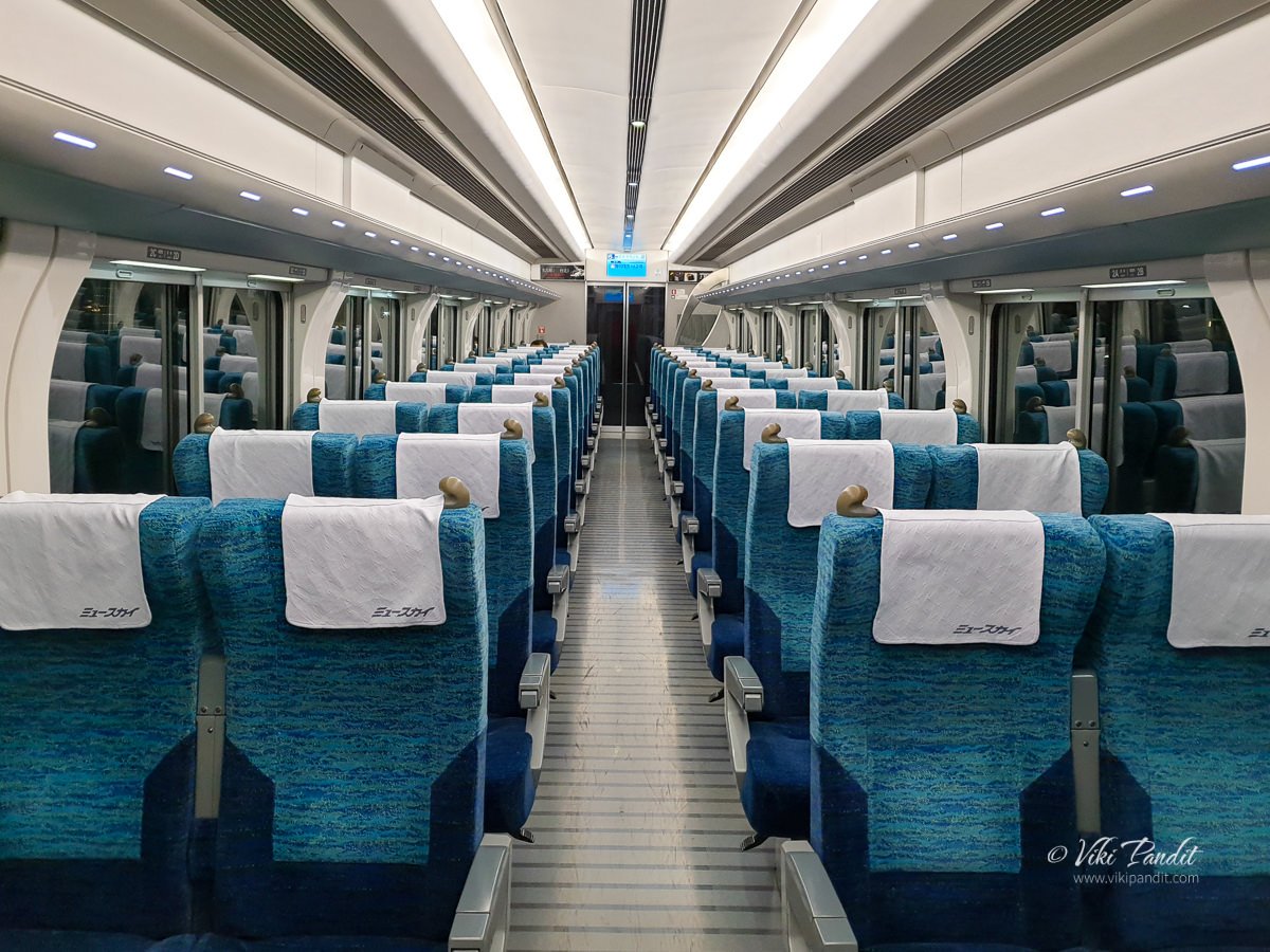
In the early morning, I and my wife, Mani, caught the local train from Nara to Osaka. From Shin-Osaka Station, we took the Shinkansen to Okayama and from there we switched to the Yakumo 16 Limited Express bound for Matsue. The total time for the ride was about 4 hours. Since we were carrying our JR Passes, the full ride didn’t cost us anything.

Please note JR Passes are not entertained on Nozomi and Mizuho Shinkansen trains.

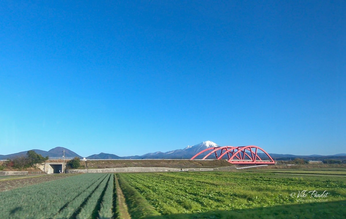
The ride to Matsue of course is something to talk about in itself. The train ride passes through deep forests and countless rivers, nestled in the mountains. In between, we would stop at small stations surrounded by a handful of cute houses.

For many of the Japanese too, this land of untouched beauty remains hidden, its charms, traditions, and secrets only known to the few who make the journey across the mountains, taking one far away, down through the ages to a deep, spiritual world of myth and folklore.

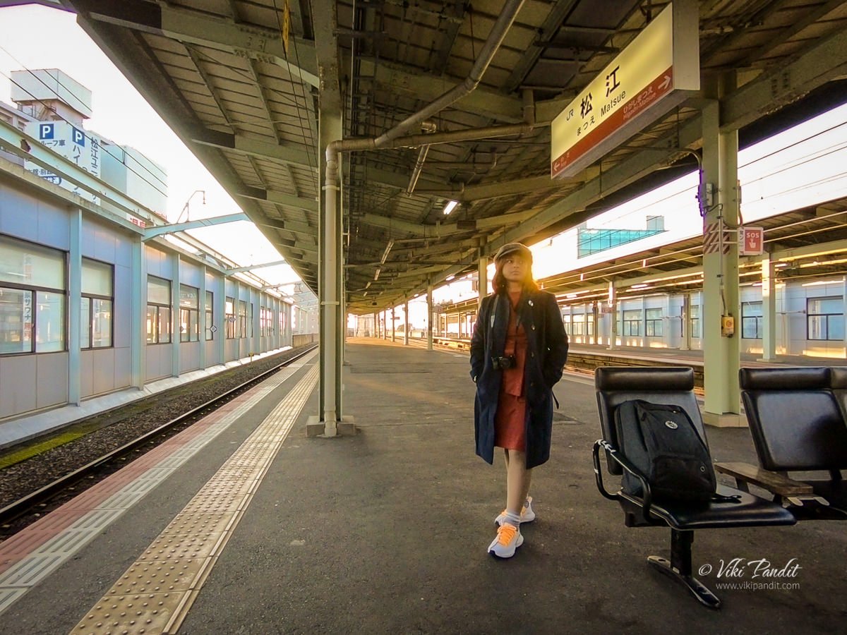
After traveling along the beautiful Shimane countryside for a good part of the day, we reached Matsue Station at around 4 pm. During winter, it gets dark quite soon. It seemed a bit tight but we quickly stored our luggage in a locker at the station and caught a local to the Nogi Station.

From there we literally ran to the edge of the lake. If you love walking, you can also walk to the lake, but we were a little short of time, so we chose to take the train.

By the time we reached the lake, the Sun was just about to set. Hurriedly we walked to the sunset point from where it is the most beautiful to catch the dying rays of the sun over the lake. The view-point is marked on Google Maps, so a quick search will guide you to the exact place.

Lake Shinji

Lake Shinji is connected to the Sea of Japan via Nakaumi Lagoon. This causes the lake to have higher salinity than freshwater, but not as much as seawater. This results in an abundance of aquatic life, such as whitebait, eel, sea bass, and the most famous Lake Shinji delicacy, the Shijimi clam. The Shijini shellfish are caught using a “joren“, a tool unique to Lake Shinji, which is made up of a basket tethered to a rake. The shellfish is often referred to as one of the ‘Shiji-ko Shitchin‘, the “Seven Delicacies of Lake Shinji.”

Origins of Lake Shinji

The lake is assumed to have been formed about 10,000 years ago. The birth of present-day Lake Shinji was a major event in the history of the Izumo region. In the ancient book “Izumo-no-Kuni Fudoki,” written around 1200 years back, referred to the western bay as “Kando-no-mizumi” and the eastern part was mentioned as the Shinji Lake.

According to paleontologists, fluvial deposits from the Hii River may have literally cut off the sea from the Shinji Lake. Fed by numerous streams from the surrounding mountains, water from Shinji began to flow eastward to Nakaumi Bay. However, over a period of centuries, the rising water levels in the east, reversed the direction of flow thus transforming it into a brackish-water lake.

Yomegashima Island

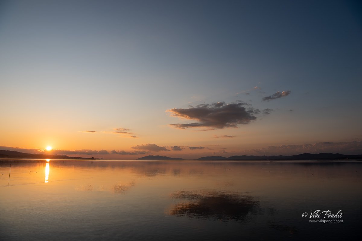
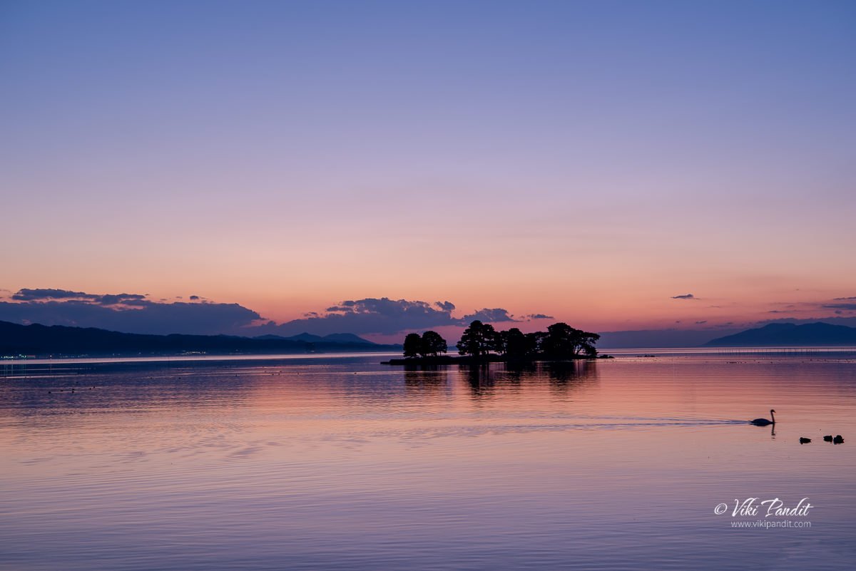
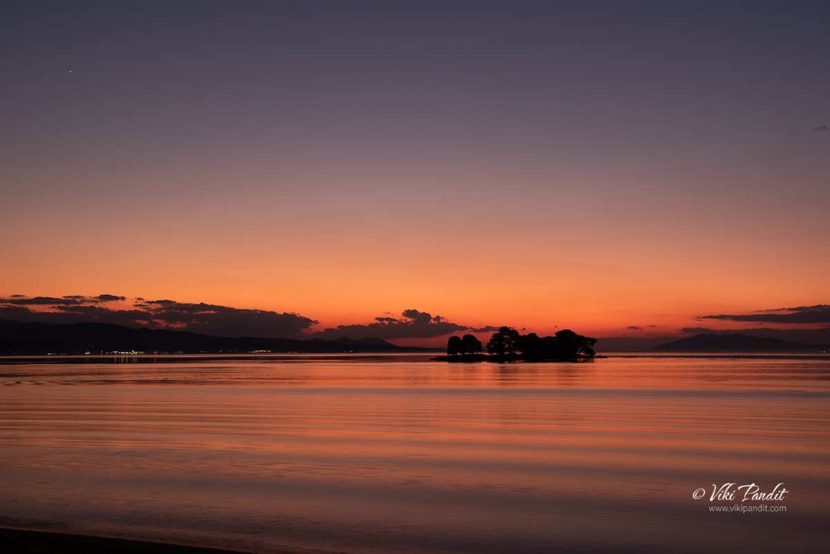
The Sun had already set behind the mountains. The beauty of the clouds, sky, and lake together has been a subject of fascination for many literary artists over the years. If you didn’t know already, Lake Shinji was chosen as one of the best 100 sunset points of Japan.

The small island you see in the middle of the lake is known as Yomegashima. Back in the 8th century when the Chronicles of Ancient Izumo was being compiled, it used to be called “Snake Island,” the reasons for which I am not sure of.

Stretching 110 meters east to west and 30 meters across, the island near the southeast bank of the lake and looks like a round slab of land that floats on the surface of the water. If you are able to zoom into the image above, you will be able to see a Torii among the pine trees. Being a sanctuary dedicated to the goddess Benten, the sacred Torii gate sits at one extremity of the island.

Myths of Lake Shinji

There is a myth attached to this island in the middle of the lake. It is said that a young bride was married off to a cruel family across the lake, and unable to bear their abuse, she decided to run away and go back home. In her hurry, she took a short cut across the lake that had frozen on the surface, but just as she was close enough to see the lights of her home village, the thin ice broke and she fell in and drowned in the icy waters. The gods took pity on her that they made the island spring forth in her honor. Hence, it is also called “Bride Island.”

The only time you can set foot on this island is in October when local guides can take you there explaining the legendary aspects of the island to visitors. You can take your time to wander about its 240-meter circumference.

If you are in Matsue in October, don’t miss the perfect silhouette of the Yomegashima island against the backdrop of the sunset once it is illuminated at night.

In the old times, the locals were a bit worried that the island might be lost to the waves of the lake and so the island has been protected by rows of Jodei-ishi, designed by Kobayashi Jodei (1753-1813), a famous craftsman of the Matsue domain in the Edo period when Matsue was actively ruled by the Lord Matsudaira Fumai. Kimachi stone was used in creating theses Jodei-ishi, which is still taken today from the Kimachi area of southern Matsue to carve into lanterns are other such decorative items.

Kimachi stone is a special sandstone that is made up of volcanic ash and sand that had hardened over time. It is specifically found in the Matsue city’s Kimachi district near Shinji lake. The stone has a certain softness that helps in carving it more easily to create intricate details from the stone. Since the Meiji era, the stone works made from kimachi stone have been regarded as a necessity in landscape gardening, interior decoration, and other stone works throughout Japan.

Jizo Statues at Lake Shinji

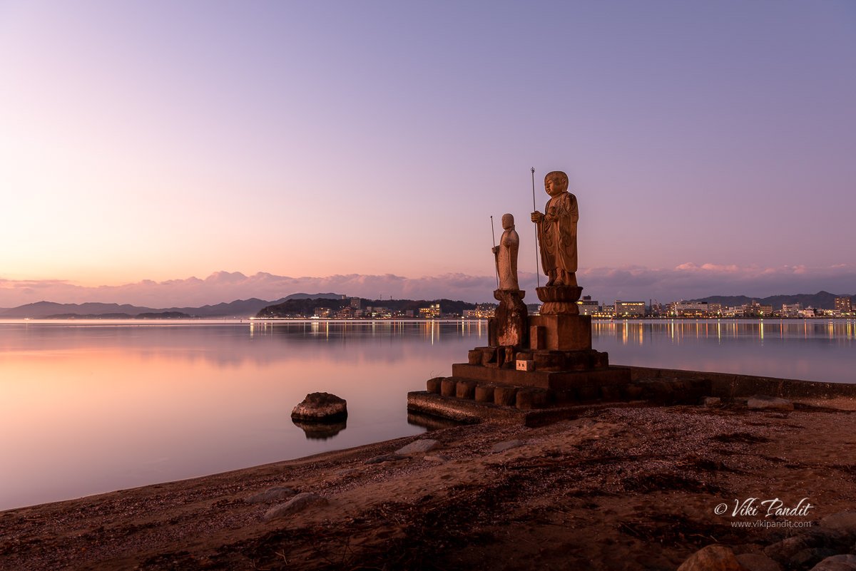
After capturing a few shots of the Yomegashima Island, we walked further north towards a place where a couple of Jizo statues have been installed beside the lakefront promenade. The Sun was already down and it had begun to get cold very quickly.

As we neared our next destination, we could see some of the locals were gathered at its side basking in the beautiful evening. The larger Jizo statue on the left is made of Kimachi stone and is called “Sodeshi Jizo“, and the smaller one is made of Mikage stone and is called “Sekkai Jizo“. If you look closely, you can immediately notice the difference in detailing between the two different stone types. This pair of Jizo statues by the shore of the lake is almost as iconic as Yomegashima itself in Matsue’s famous sunset scenery.

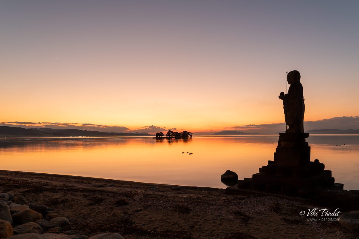
The Jizo is a deity fondly loved by Japanese people. You will find Jizo statues mostly in Buddhist temples and graveyards. Sometimes you can also spot them standing at the side of the road in the countryside or at the corner of some streets in the cities. The statues in alignment with the Yomegashima island make for a wonderful composition.

It is believed that Jizo protects the souls of unborn babies and children who have passed away. In Japanese beliefs, it is thought that the soul of children who die before their parents, consequently bring suffering to their parents and cannot cross the river to the afterlife.

The Jodei-ishi that surrounds and protects Yomegashima were also placed around the Sodeshi Jizo to protect the base of the statue from the waves of the lake. As the natural lights dimmed out, the lights from the castle town of Matsue started to shine. By this time it was really cold. Some of the locals who had come to view the sunset were starting to disperse,

Within a few minutes, the daylight was totally gone. I got one last shot of the island in the middle of the lake before we started to walk to Matsue Station. I recall it was quite difficult to manage the buttons of the camera with the gloves on. I sure was glad we had bought a pack of kairo (hand warmers) from a local Daiso store in Nara just a day before we set off for Matsue.

The roadside lights had come on throwing a gentle yellow light over the promenade. Almost everyone had left by that time. The waves on the lake had also picked up some energy riding on the windy breeze. I zipped up my jacket and packed up my camera gear, all set for the walk to Matsue Station.

On the way, we passed the Matsue Art Museum which was obviously closed by then, but the illuminations were still on. There is lots to explore at the museum as well, but maybe some other time. On the way back to the Station, I guess I made a wrong turn and got us lost for a few minutes. With a little help from Maps, we were back on track in no time.

Once we reached Matsue Station, we caught the next express train to Izumoshi Station. The express train only takes about half an hour to reach Izumoshi Station compared to the local, which might cost you around an hour. I was a bit tired from the long travel and looking forward to a hot bath once I reached the Hotel.

What makes Lake Shinji particularly famous is its sunset view. There are many viewing spots around the lake, including the grounds of the Shimane Art Museum, or along the lakefront promenade. You can also enjoy the view from the lake on a pleasure boat, Hakucho for a sunset cruise.

Thanks for reading! From tomorrow we begin our exploration of Izumo, once considered to be the realm of the Gods, with a visit to the Izumo Taisha Shrine. Please leave a comment if you liked my story or need any information regarding traveling to Shimane. If you would like to connect, you can also follow me on Instagram.

How big is Lake Shinji?

Lake Shinji is the seventh largest lake in Japan with a circumference of 48 kilometres

What is the best time to visit Lake Shinji

Lake Shinji is most popular for its sunset views. If you visit in October you will have the extra advantage of seeing the island in the center of the lake as its illuminated towards the evening.

Monuments on Hemkuta Hill

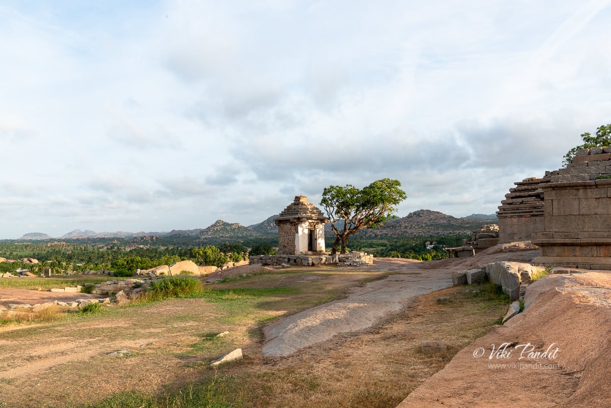
India is a country, rich in cultural heritage with hundreds of ancient archaeological sites – each with its own mythical stories. The monuments on Hemakuta Hill in Hampi is one such cluster of ancient temples, archways and pavilions with local folklore spread over centuries.

Hampi’s claim to fame began when it became the capital of the Vijayanagara empire. However these temples on the Hemakuta Hill are among the oldest cluster of shrines in Hampi, preceding even the Vijayanagara reign.

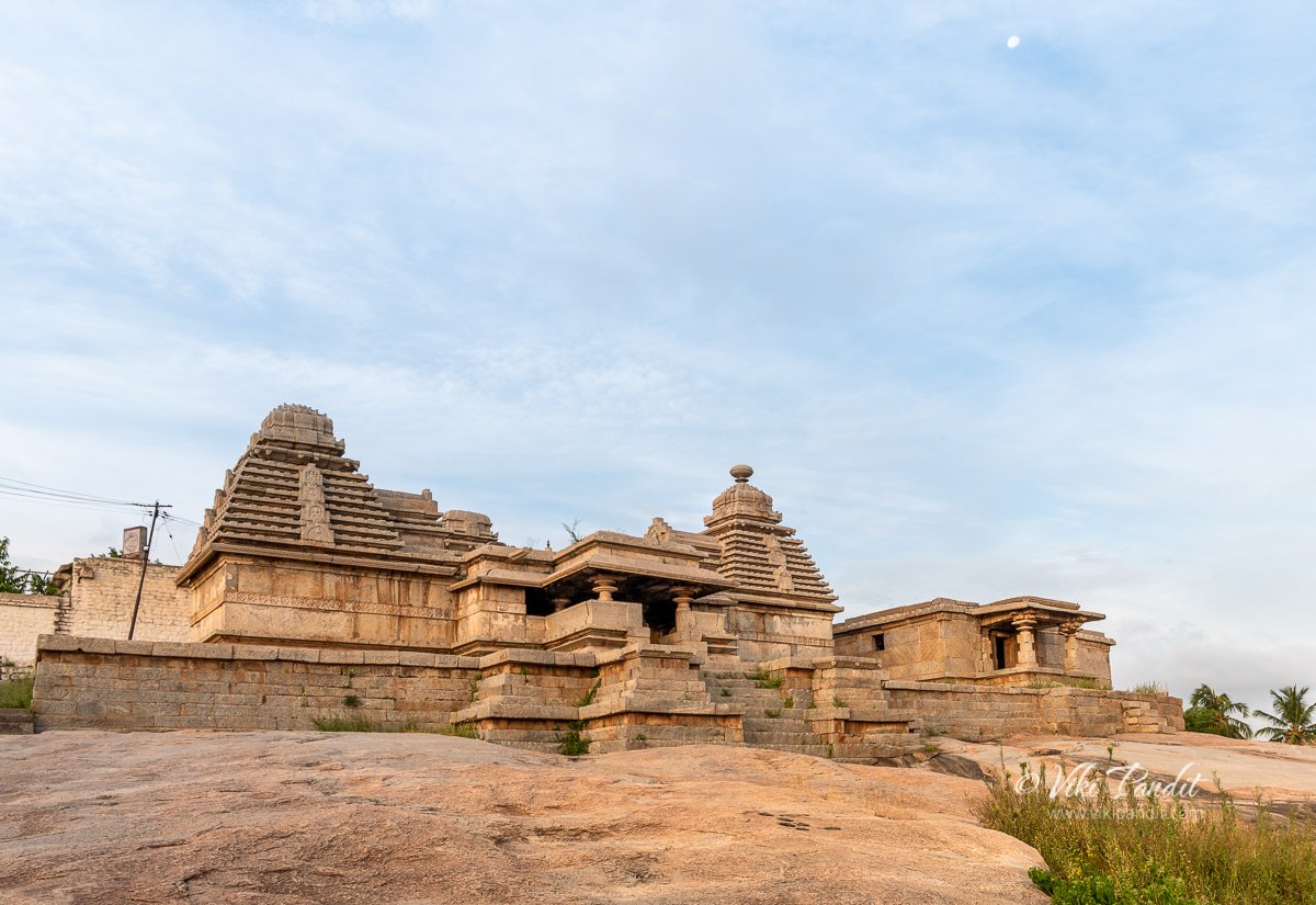
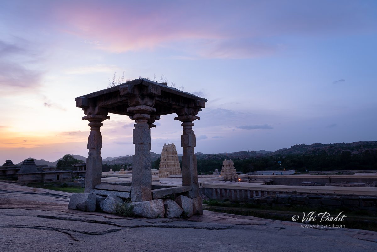
The hill is located on the southern side of the Virupaksha temple, identified quite easily by the slopes dotted with a number of abandoned monuments. When the revered Virupaksha temple was still in its infancy, this hill used to be occupied by Shaivas, devotees of Shiva, who would come from far away parts of South India to pay respects.

You can access the hill via two opposite routes. The first path is just beside the Virupaksha temple’s main entrance. From there, if you are facing Virupaksha, take the left alley up the hill. I chose this route since it was closer to the parking lot.

Otherwise if you already near the Balkrishna Temple, you can take the series of steps up the hill, through the twin storied archway located near the Sasivekalu Ganesha shrine.

History of the monuments on Hemkuta Hill

There are more than 30 structures on the Hemakuta hill that belong to both, pre-Vijayanagara as well as Vijayanagara periods. Celebrated in history, rooted in myths and now a tumbled mass of magnificent residues of an empire, Hampi is probably the most renowned medieval Hindu metropolis in the history of the Deccan plateau. As the capital city of the Vijayanagara Empire, from the 14th to 16th century, it was unparalleled in wealth as well in culture in its time.

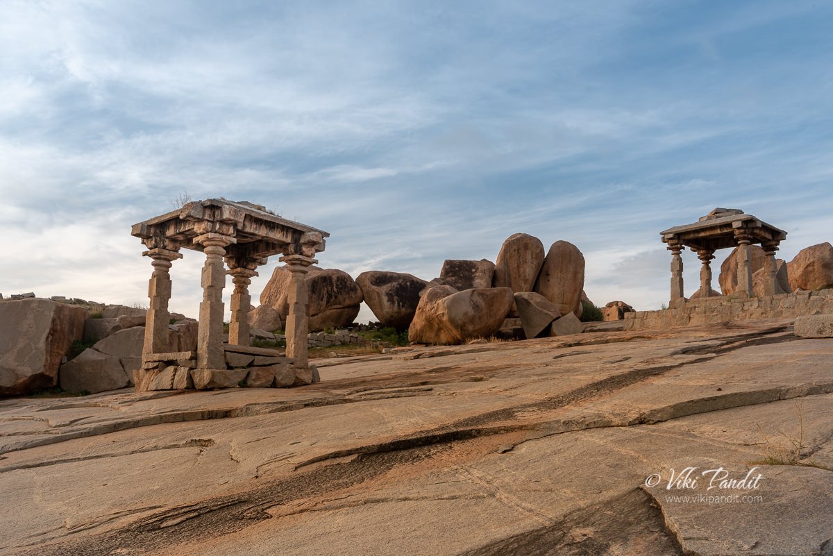
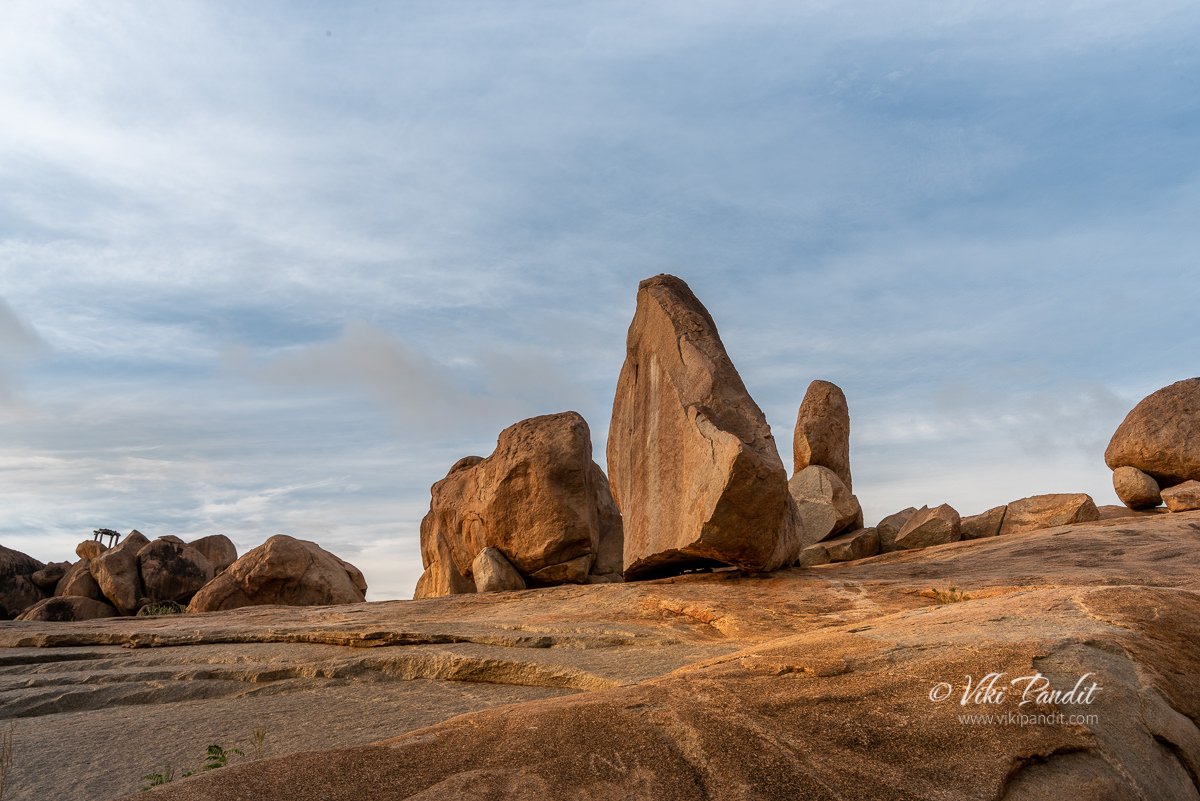
The monuments spread across the face of the hill are centuries old and represent a historical era of art and culture. The hill also contains as many boulders as temples.

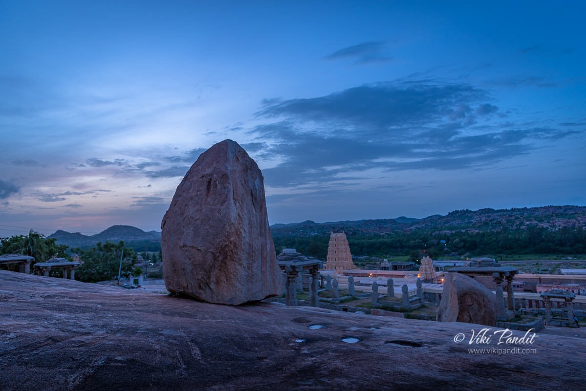
These boulders date back to more than 3 billion years and are believed to be the earliest solidified rock on the planet. From where I stood, the hill appears to be a canvas of stones.

Mythology associated with Hemakuta Hill

Most of the Hemakuta monuments are dedicated to Lord Shiva. According to local folklore, Pampa, a local girl, performed intense penance on Hemakuta Hill, aspiring to marry Lord Shiva. The Stala Purana and the Pampa Mahatme both support this myth. Seeing her intense devotion, Shiva eventually consented to marry her. People say it rained gold on the hill thereafter. Since then this hill came to be known as Hemakuta which loosely translates into the “hill of gold”.

With time, Hemakuta Hill came to be deeply associated with Lord Shiva and many temples were built on the hill to worship this fascinating deity of the Hindu Trinity.

Architecture of Monuments on Hemakuta Hill

The architecture of the temples on the Hemakuta Hill is quite different from the typical Vijayanagara style of architecture found in many other temples in Hampi. The Hemakuta group of temples have a distinct style of their own.

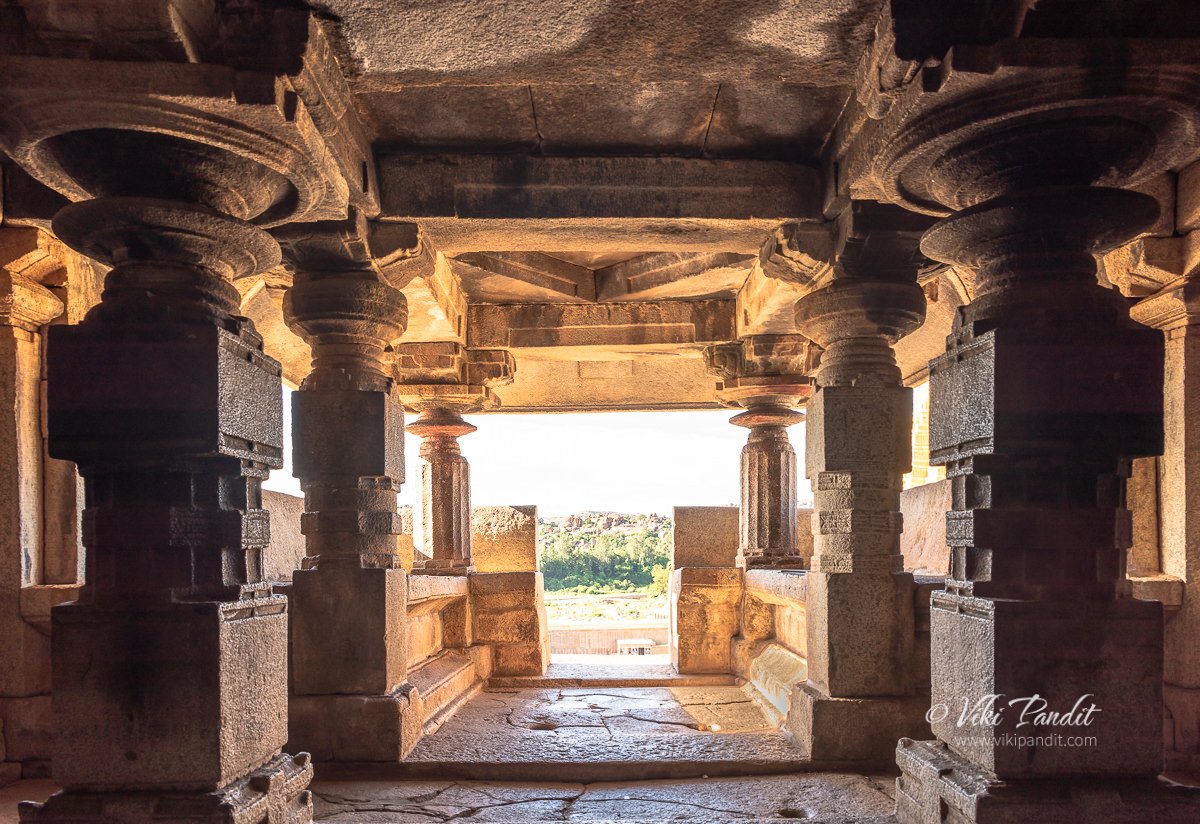
The first marked difference you will see is the lack of carvings on the pillars. If you have been to Vitthala or any other temple commissioned by the Vijayanagar kings, you cannot miss the intricate Yali carvings and decorations on the columns that support the roof. None of the monuments on Hemkuta carry this trademark style.

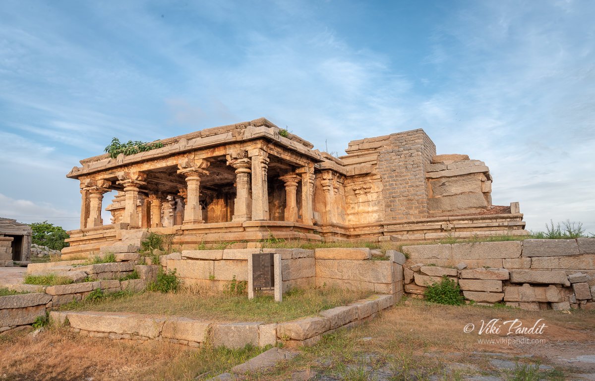
The early 14th century temples on Hemakuta hill built during the rule of Harihara Raya I, incorporates the distinctive stepped Kadamba style.

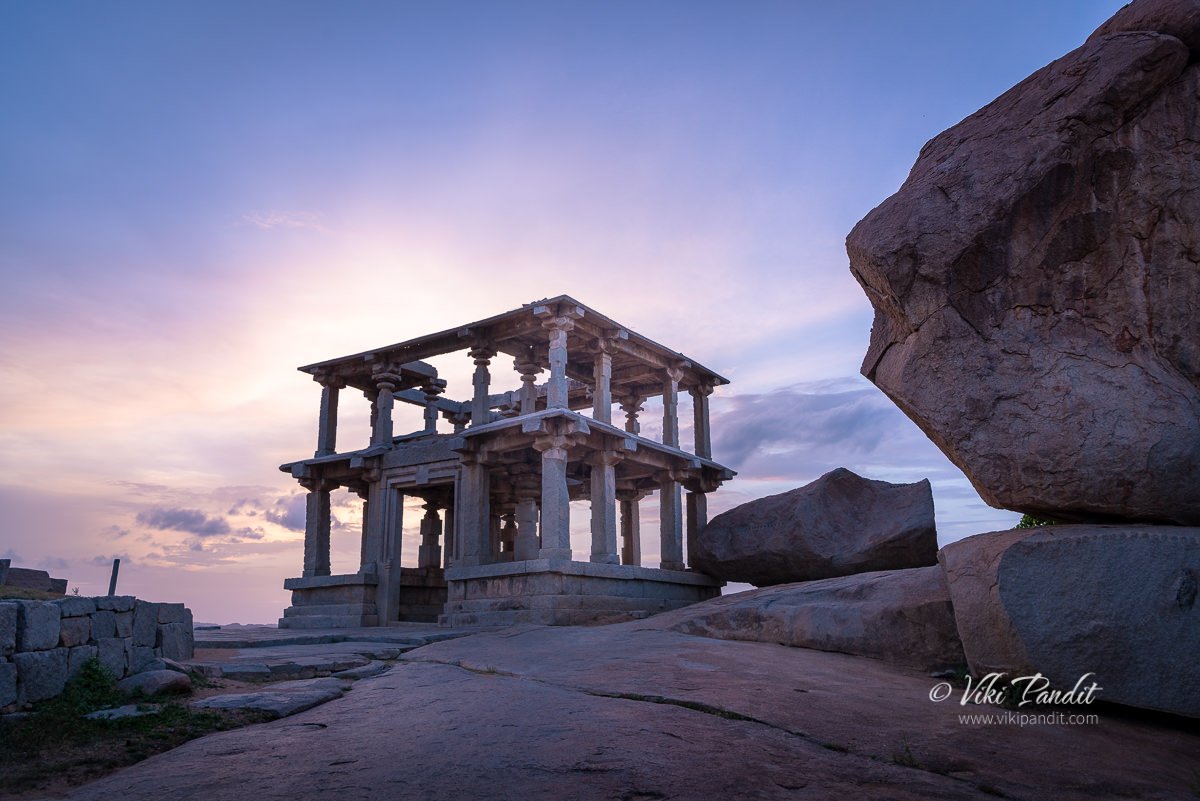
These are the largest and most elaborately decorated temples, situated on the northern side of the hill and face the Virupaksha temple compound. Below is a view from the inside of the temple looking towards the Virupaksha Temple compound.

On the top of the hill lies the Mula Virupaksha Temple, considered by historians to be the original Shiva temple, before the grand Virupaksha temple was built at the base of the hill. Though not as grand as the one built by the Vijayanagara rulers, the Mula Virupaksha Temple represents a style of architecture that was popular before the Vijayanagara style came into being.

There are several other monuments in this area that are built in the pre-Vijayanagara style of architecture.

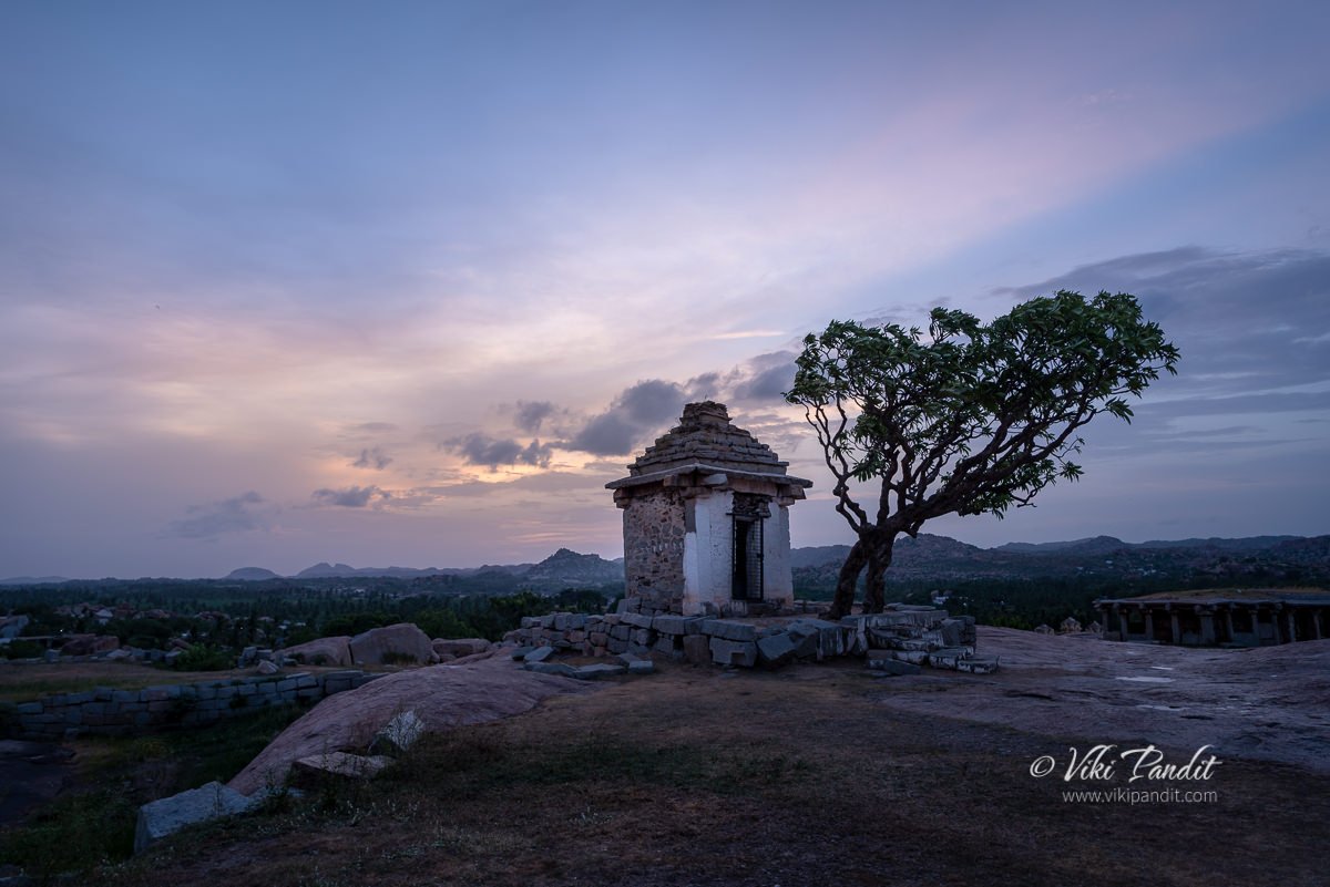
In the ancient times the whole hill was fortified with stone walls and one could enter the area only using the two gates at each end. Once you each the top of the hill you will find it is almost flat providing the perfect base for temples. There is also a natural pond formation making it perfect for the temple.

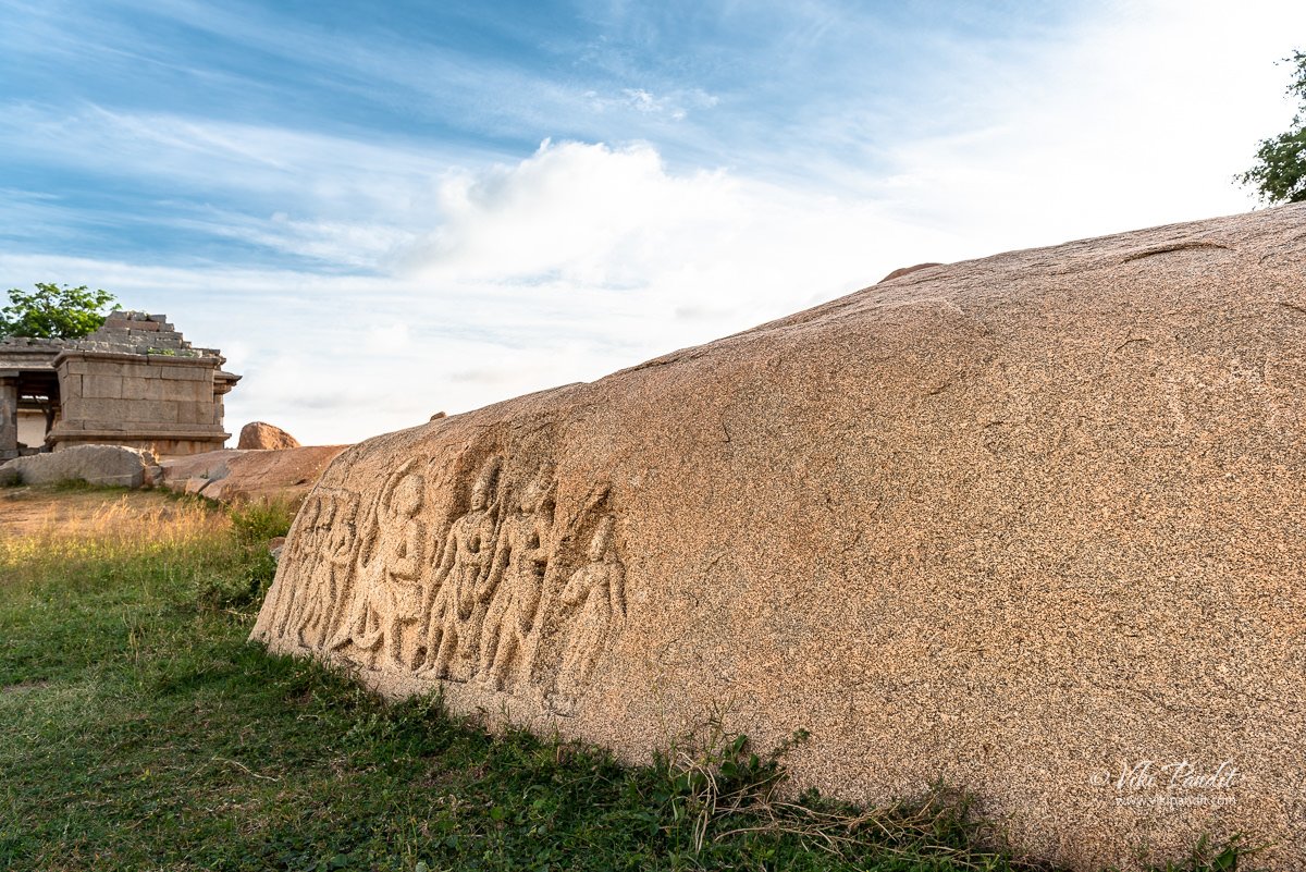
Near the Mula Virupaksha temple lies a granite rock with the carvings of the characters from Ramayana. Ramayana plays an important part in the mythological aspect of Hampi. You can read more about it in my journal on Kishkindha.

Afternoons at Hemkuta Hill

The gentle morning light grew into a bright day. The skies turned a vivid blue. In all my visits to the ancient city, I have never seen it more blue before.

The age old boulders were lit up in the golden Sun and looking for attention.

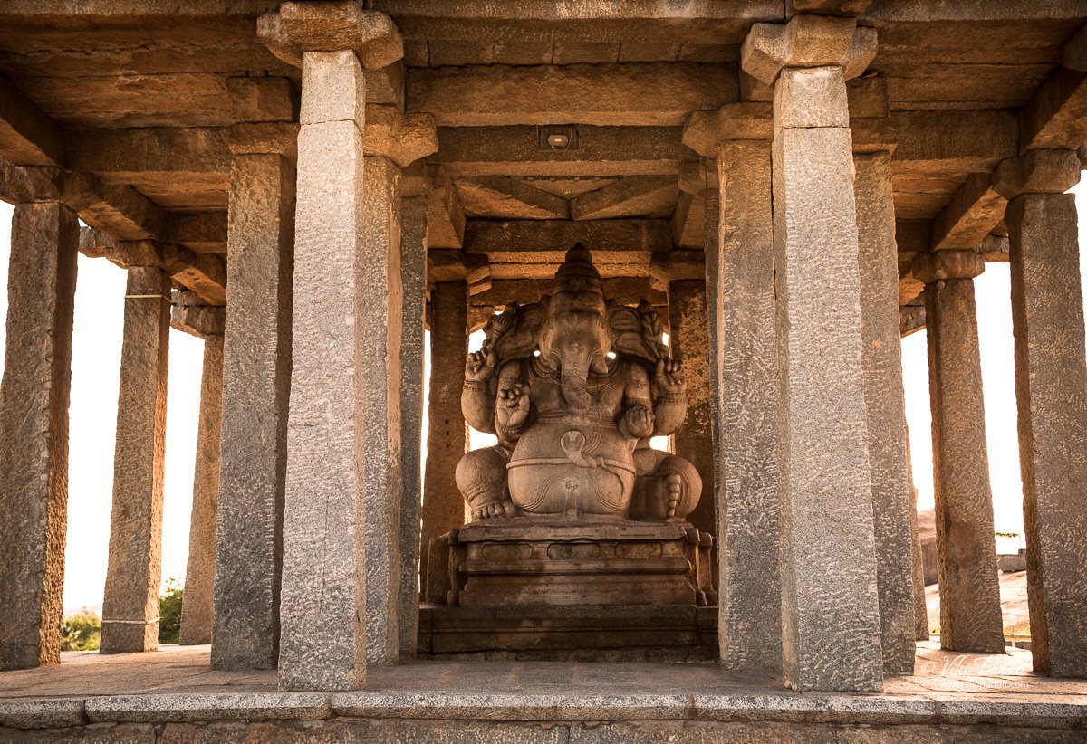
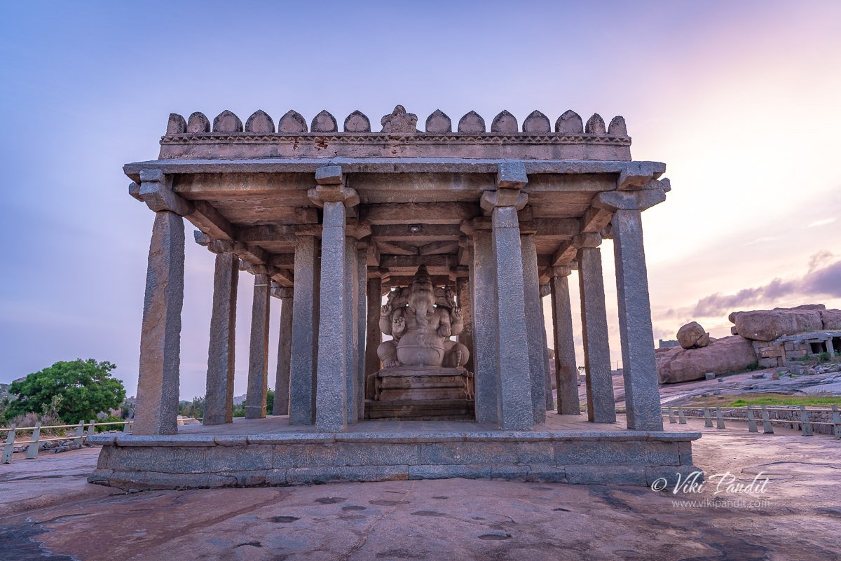
As I hiked down from the other side, I passed by the one of the prominent monuments, that of Sasivekalu Ganesha at the foot of Hemkuta Hill.

It was late in the afternoon. The Sun was harsh, so I left for the hotel.

Evenings at Hemkuta

After a fulfilling lunch at Clark’s Inn, I was back at the hill in the evening. This time I used the entry from Sasivekalu Ganesha side of the hill. Dusk had begun to kick in.

Among the Hemakuta monuments, most are in total ruins. Once home to half a million people, Hampi was ransacked in 1565 by the armies of the Bahamani sultanates. For hundreds of years, the City of Victory lay abandoned until it was rediscovered by the British in the 19th century.

The hike is pretty easy in a few minutes and I was up at the top of the hill.

Some of the temples that had escaped destruction during the Mughal invasions have suffered damage from the wear and tear of weather. I truly appreciate the efforts of The Archaeological Survey of India in its continued efforts to renovate these temples and bring back their lost glory.

The beauty of the ancient temples and the relative calm of the place make it an amazing place to spend some peaceful moments on the hilltop.

We waited at the summit for the sun to set. Hemakuta Hill is one among the best places in Hampi to see the sunset but not as tedious to reach the top when compared to Matanga Hill nearby, which is considered as the best location to watch sunset in Hampi. It was touching 6 pm. The security guard made us promise that we would leave in 10 minutes and went his way.

Today the sprawling beauty, a world heritage site of ancient monuments scattered across a landscape of enormous granite boulders, pulls in hundreds of visitors every year from around the world. After relishing the beautiful sunset we were on our way back to the hotel.

VISITOR INFORMATION

The Hemkuta hill area remains open throughout the day and night. But guards will probably heckle to leave at 6 pm.

No tickets are required to access the site.

Thanks for reading. Please leave me a comment if you liked the post or follow these connected stories of my visit to the mythical monkey kingdom of Kishkindha from the epic tale of Ramayana or take a virtual walk with me to the iconic Vitthala Temple.

Shades of Virupaksha Temple

This was my third visit to Hampi, but the first time that I drove myself to the historical city. Hampi sits on the banks of the Tungabhadra river in the ruins of the ancient city of Vijayanagar, capital of the once flourishing Vijayanagara empire.

The road to Hampi is pretty straightforward. I took the NH48 from Bangalore and then slid into NH50 near Chitradurga. The NH50 is under major repairs but its still faster than any alternative routes.

On the way we passed the Tungabhadra reservoir. The national highway leads directly to the town of Hospet, from where we drove into Kamlapur, where our hotel was located.

Clark’s Inn

We were staying at Clark’s Inn for the duration of our stay in Hampi. Even though we had an amazing time at the Hyatt Hampi in 2014, I reserved this hotel mainly because I wanted to stay closer to the UNESCO site. Staying at Clark’s Inn reduced my travel time to reach the ancient monuments from 40 minutes to just over 10 mins.

Clark’s Inn is a decent place to put up for a few days. The food is nice and the staff hospitable. They also have a small swimming pool. But the parking is a bit of a concern since it lies in the basement and the lane leading to it is quite narrow. On the bright side, they do however have valet services to help out visitors.

History of Virupaksha Temple

Like I mentioned before, I have been to Hampi multiple times but this time I came with the sole purpose of capturing the iconic Virupaksha temple (храм вирупакша) at different times of the day.

While discussing the monuments at Hampi, the first thing that comes to mind is the contribution of the Vijaynagara Empire. However the Virupaksha – Pampa sanctuary existed well before the Vijayanagara capital was located here.

Virupaksha Temple has been a most prominent center of pilgrimage at Hampi for centuries with earliest records dating from 689 CE when it was known as Pampa Tirtha after the local river God Pampa. The temple is fully intact among the surrounding ruins and is the only active temple in all of Hampi. The temple is dedicated to Lord Shiva, known here as Virupaksha.

The shrine dedicated to Shiva was established on the banks of the Pampa (Tungabhadra) river sometime in the 7th century, thus making it older than a thousand years. It is debatable whether the initial temple was actually the structure that is still on top of the Hemkuta Hill known as Mula Virupaksha Temple. By logic it should, since temples are generally created on the top of hills. By the mid 7th century the temple had already become a revered Saiva pilgrimage with the Saivas taking up settlement on the Hemkuta hill just beside the temple.

In those times Hampi was known by the name Pampakshetra. It is not clear when but the growing popularity of the temple might have resulted in the creating of the larger Virupaksha Temple near the banks pf the river Pampa (Tungabhadra).

The mythology surrounding Virupaksha Temple

The Tungabhadra river of today was in ancient times known as the river Pampa. The Skanda Purana mentions Pampakshetra as saktipitha, describing it as the abode of the goddess Pampa otherwise referred to as Parvati. According to local myth, Pampa, the daughter of Brahma, mortified herself here to gain the hand of the Lord Shiva. Multiple references to Pampakshetra can be found in records between the 7th to 14th century, overlooking the banks of the Tungabhadra, which currently include Hampi and Anegundi. Several inscriptions can also be found at the temple itself dating back to the 9th and 10th centuries. 

Time passed and what started as a small shrine grew into a large complex under the Vijayanagara rulers. Domingos Paes (1520–22 AD) whose records provide valuable inputs into life during the Vijaynagara reign mentions that inspite of the numerous temples in the vicinity, Virupaksha temple was the one which the people held most veneration for.

The Vijayanagara rulers, in the middle of the 14th century, initiated the blossoming of native art and culture in the region. Though most of the temple buildings are attributed to the Vijayanagara period, there is ample evidence indicating to additions that were made to the temple in the late Chalukyan and Hoysala periods. When they were defeated by Deccan Sultunate in the 16th century, most of the wonderful decorative structures and creations were systematically destroyed. However they were not able to destroy the religious sect of Virupaksha-Pampa. Even after the anhilation of the city in 1565, worship of Shiva persisted throughout the years and continues even today.

Breaking dawn at Virupaksha Temple

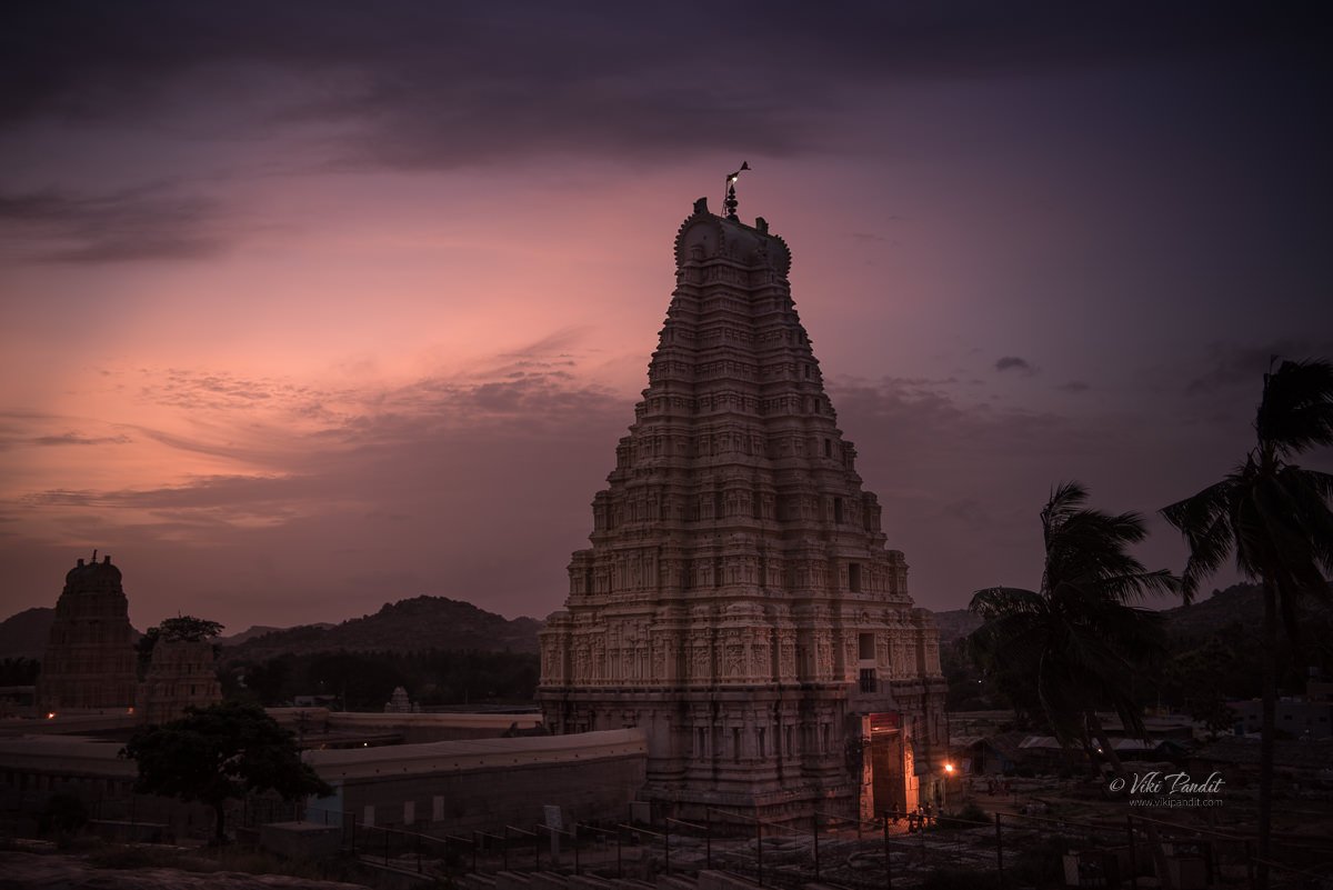
On my first day in Hampi, I woke up at break of dawn and drove down to the temple. By the time I reached the parking lot near the temple the sky was already glowing in blue and the stars were beginning to fade away. The parking was mostly deserted.

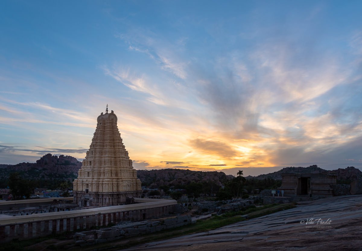
One of the best spots to catch the sunrise is from the Hemkuta Hill. Its an easy hike up towards the western side of the hill. By the time I took my position on the Hemkuta hill, the Sun was ready to cast its blessings on Hampi and I was ready with my tripod to capture its glory.

I set up my composition on the main gopura, which is the most ornate structure of the temple. The main gopura or temple tower is called the hiriyagopura or the chief tower. It has a brick superstructure and a stone base. Supervised by Devaraya’s minister Proluganti Tippa, the nine-tiered eastern gateway is the largest of the gopuras raised by the Vijayanagara kings.

Light changes pretty fast in these moments and within minutes the gopura was flooded with light from the Sun.

Daytime at Virupaksha Temple

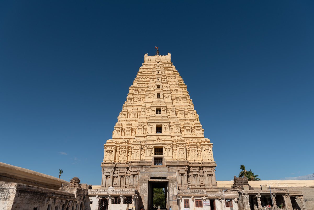
By afternoon the sky had changed to a brilliant blue. The devotees were streaming in. Being a weekday, it was comparatively less than the crowds on weekends.

At present, the main temple consists of a sanctum, three ante chambers, a pillared hall and an open pillared hall. It is decorated with delicately carved pillars. The smaller eastern gateway leads to the inner court with its numerous smaller shrines. The hall of the main temple is believed to have built under the patronage of Saluvamantri, a minister of Sangama Mallikarjuna (1447–1465 AD).

Another gopuram towards north known as the Kanakagiri gopura, leads to a small enclosure with subsidiary shrines and eventually to the river Tungabhadra.

Krishnadevaraya, the most famous kings of the Vijayanagara Empire was a major patron of this temple. The most ornate of all structures in the temple, the central pillared hall is believed to be his addition to this temple. So is the gateway tower giving access to the inner courtyard of the temple.

It is recorded that Krishnadevaraya commissioned the open air hall in 1510 AD to mark his accession. Inscriptions on a stone plaque installed next to the pillared hall explain his contribution to the temple.

Nights at Virupaksha Temple

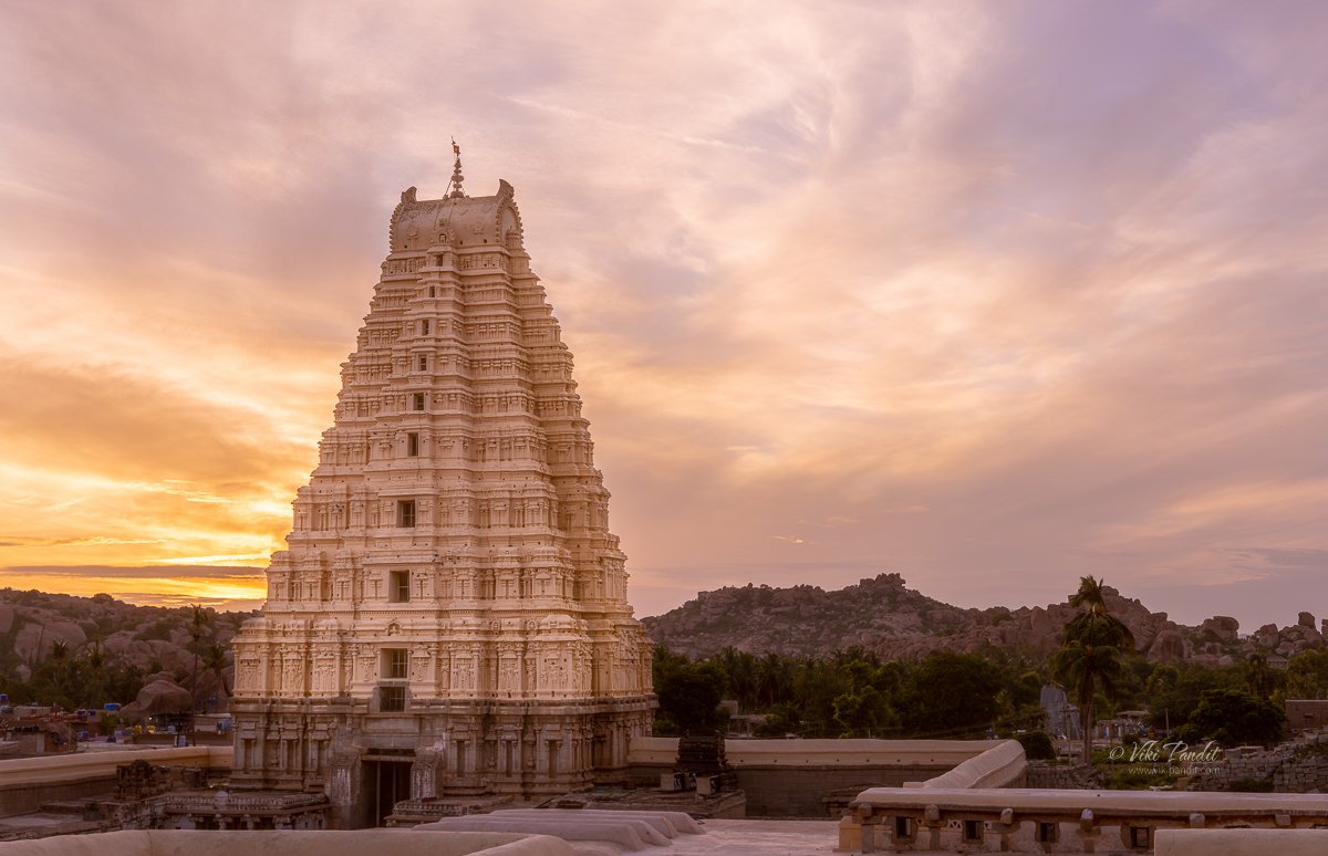
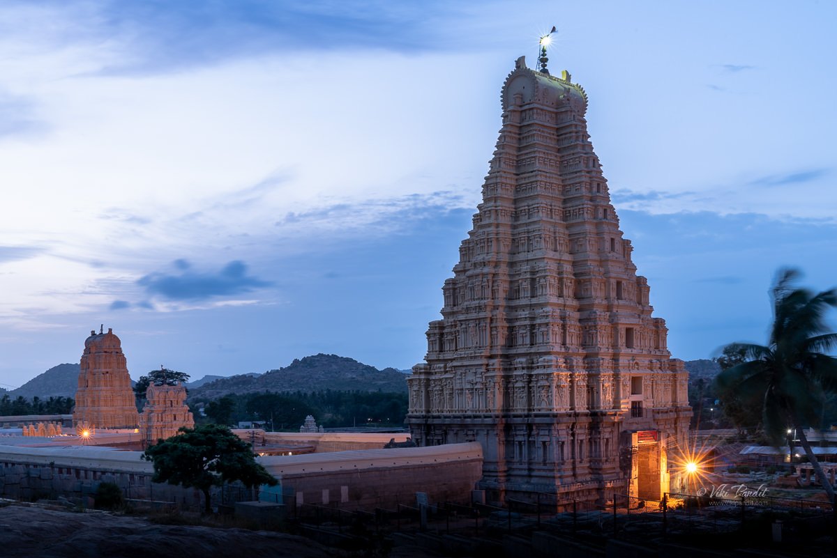
Sun is strong in Hampi. Evenings brought relief to my parched body. It also brought with it a magical glow to the surroundings. The sky went all red for a moment. The guard wouldn’t allow me to set up my tripod so I took this handheld.

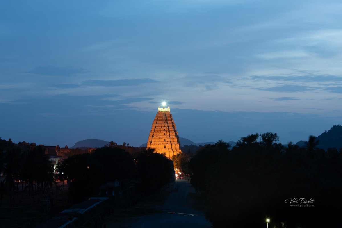
After this we walked out of the fenced area where I set up my tripod to capture the one below. By that time the sun had already set but it left behind a beautiful blue sky.

After catching the temple at sunset, I made my way towards the wide street in front of Virupaksha, situated between the eastern gate of Virupaksha and the northwestern foot of the Matanga hill. Domingos Paes describes it as – a very beautiful street with beautiful houses with balconies and arcades, sheltering pilgrims that come to it, and with houses for the upper classes. He also mentions that the king too had a palatial residence in the same street.

Festivals at Virupaksha

In the month of February the annual chariot festival is celebrated here. Nicolo Conti, the first European visitor to Vijayanagara (1420–1421 AD), refers to two chariots which carried idols through the city. Richly adorned women or courtesans accompanied the procession stinging hymns in praise of the lord. Poet Ahobala, the author of Vasantotsava Champu, also refers to the two chariots: one taken out by the Brahmins and the other by the merchants or shudras.

Interestingly, the Virupaksha chariot festival has been continued ever since it was introduced in the fourteenth century and neither the fall of the empire nor the destruction of the capital in 1565 AD seems to have affected its popularity or practice. To date, the largest gathering at Hampi is witnessed during the chariot festival of Virupaksha held every year in March/April as per the local calendar.

Renovations

There have been major renovations which included painting the towers of the north and east gopura. When I was here a few years back the gopura were in white but I see a beige paint now. It is also heartening to see that ASI has stayed away from applying plasters to stone carvings like they did at Kailashanthar temple in Kanchipuram, which actually makes them look ugly.

I leave you with the last image of the day: Virupaksha captured from the steps of Matanga Hill at night.

Thanks for reading. Please leave me a comment if you liked the post or follow my story as I revisit the monuments on Hemkuta Hill.

Musical Waves of Mahabalipuram Beach

I can hear the sound of waves crashing on the shore. The moist, salty air flays my hair into the air as I walk towards the lovely beach in Mahabalipuram…

Drive to Mahabalipuram 

In the morning, a couple of hours drive is all it took for us to reach the quaint town of Mahabalipuram. The roads from Kanchipuram are a pleasure to drive.

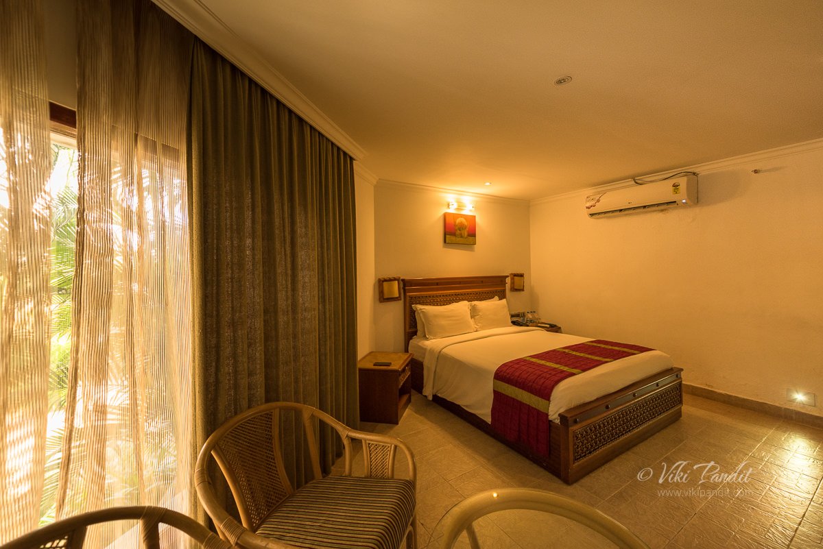
It was easy to find the Chariot Beach Resort, where we would be staying for the duration of our trip in Mahabalipuram. A huge signboard announces the resort to the passersby. The entrance gate leads into a long driveway and unto the resort building where a lady received us with garlands made of seashells.

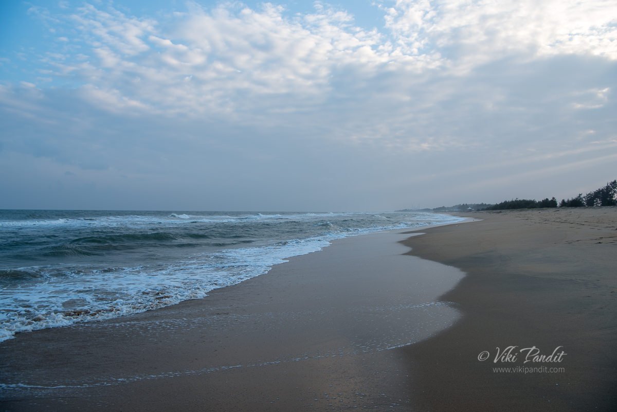
Once we were finished with the formalities of checking in, we had our lunch and headed right away towards the windy beach. Please be aware that I am not talking about the public beach, that experience would be a lot different.

The little town of Mahabalipuram is blessed with a glistening coastline with clean private beaches on the one hand and a plethora of UNESCO World Heritage sites and medieval temples on the other.

Mahabalipuram Beach

Mahabalipuram is a very ancient town, seeped in history & mythology. The town was largely developed by the Pallava king Narasimhavarman I in the 7th century AD. The history of the town however, goes much beyond the Pallava dynasty when it used to be a popular seaport since the 1st century. The town flourished and was brought into limelight in the 7th to 9th century during the Pallava rule which gave them the heritage sites, the primary reason I was there.

The resort is clean and well maintained. Apart from a bar and two restaurants, it also features an inviting swimming pool.

Buggy rides to the beach were available from the reception area, but we chose to walk. As we strolled towards the beach, I realized that the resort also serves independent cottages for visitors looking for more privacy.

We were at the beach in no time. The beach heightens my senses. The music of the waves of the ocean make me forget myself. Mani watched me reluctantly as I was drawn into the cold blue waters. As the waves hit me, I could feel the rough texture of the sand as it deposited itself on my feet.

Once my initial excitement petered out, we found a nice place to sit on the sand. It is hard in such a mystical surrounding to stay in the present. With each wave hitting the shore my mind was already starting to slip away into nothingness.

We lay down on the sand, next to the water’s edge, making a head stand of my camera backpack. Looking at the vast blue sky, I felt so connected to the earth as my body settled into the ground.

As we sat there, gazing out into the horizon, taking in the vastness of the seascape, a young boy in his teens came along looking for casual tourists if they wanted to ride a horse. We didn’t ride it but we did made friends with the handsome creature.

Music of the Waves

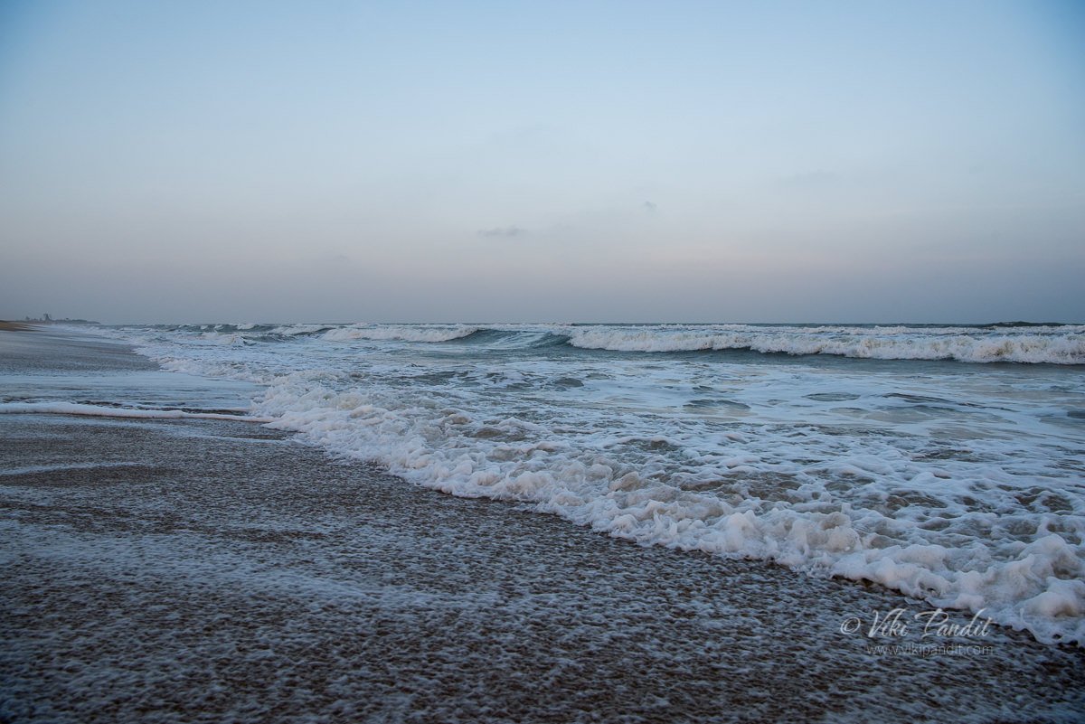
Looking for prospective clients, the boy rode off with the horse and we were back on our makeshift mattress on the sandy beach. I closed my eyes, listening to the consistent ebbing and flowing of the waves crashing on the shore. Just like the sharp sound of clanging bells at the temples, the sound of these waves hammered away, driving out all my tensed thoughts . I could hear nothing… nothingness was good.

On my left, far away into the horizon, I could see a faint silhouette of the pagoda of the Shore temple. We will go there tomorrow, but for now I let my mind wander.

We sat there for a long time, under magical skies, immersed in the music of the strong waves of the Bay of Bengal.

Sunset at Mahabalipuram Beach

Behind us, the Sun had quietly slipped away into oblivion. It was starting to get colder now. The few tourists that were, were starting to leave, leaving us alone with the raging sea.

As the evening drew to a close, we took a last walk along the water’s edge, letting the cool waves gently wash our feet. Mani’s jeans were fully drenched, my cargoes were too.

As evening turned into night, we walked back to the resort. The lights had come on and it looked lovely in the night.

The historical town of Mahabalipuram is an enchanting place to explore age-old stone carvings and century old temples, but in-between the sweaty hikes, one can immerse themselves at the peaceful beaches along the quite town.

Thanks for reading. Please leave me a comment if you liked the post or follow my story as I visit the last remaining pagoda on the shores of Mahabalipuram.

A stroll on Mandvi Beach

I am strolling on Mandvi beach, with the cool waters of the ocean slipping though my toes. The noise of the jeering tourists is drowned by the gentle waves of the Arabian Sea. A wave of black herons fly by as if the dimming sun is prodding them to go back to their homes.

Situated at the border of Diu and Gujarat, Mandvi beach is a 6 km long stretch where the pristine water of the turquoise Arabian Sea adjoins the seashore. It was once a major port of the region and summer retreat for King Maharao of Kutch.

Once we were back from the salt desert of White Rann, we decided to spend an evening at this pristine beach. The reception at Click Hotel helped me obtain a car for the ride to the port city.

Drive from Bhuj to Mandvi

Mandvi is about an hour down the road from Bhuj, a busy little place with a spectacular shipbuilding yard. I was pleasantly surprised as the flat landscape gradually changed into a hilly terrain as we drove farther away from Bhuj. While in Bhuj and during my stay at the Rann Utsav, all I have seen is vast stretches of flat lands.

There isn’t much to see along the highway except tiny huts and a few single floored concrete buildings. Mandvi suffered far less destruction than Bhuj in the 2001 earthquake and the heart of town, around Mochi Bazar doesn’t show much damage as I witnessed at Chattardi in Bhuj. The buildings along the colorful town are decorated in faded pastel hues.

History of Mandvi

Located right on the Gulf of Kutch, with the Rukmavati River flowing on the east, the town of Mandvi has a rich history. A fortress was established here in the late 16th century and the town itself was a bustling sea port and trading center. Its landmark temples that drew people from all over the kingdom of Kutch. Today it is a slower, calmer place known for its golden sand beaches and migratory birds.

Mandvi Beach

Our driver dropped us off at the parking area. The beach is just a minutes walk away. Before I reach the turquoise green waters of the sea, huge wind mills on my right draw my attention away. The Wind Farms Beach and Wind-mills, which line the horizon of Mandvi, offer a spectacular view from the beach. The Wind mills projects running here is Asia’s first Wind-Mills Projects, started way back in 1983.

The noise grows louder as we walk further towards the wide sea. It was like a carnival out there. People are busy with swimming, surfing and speed boat trips. Some of the more daredevils are trying their hand at parasailing.

We walk away from the crowd and find ourselves are quiet spot in the sun. A few kilometers away from here lies Vijay Vilas Palace. Built as a summer resort in the 1920s by the then Maharao of Kutch, Vijay Vilas Palace is a beautiful red sandstone structure fusing Rajput architecture with colonial elements. Unfortunately we wont have time to explore it today.

As we sat, chatting away, camels keep running by, carrying shrieking tourists on their back. Apart from swims and walks; one can also avail of these camel rides available at the beach.

But I am here just for a leisurely walk on the beach. The beach is a curving stretch of golden sand fringed by blue-green waters, with windmills on one side, the breakwater on the other, and an uninterrupted view of the Arabian sea in front.

As the hot Sun began to make us uncomfortable, we walked towards what appeared to be a breakwater. Some people were sitting precariously at the edge enjoying the gentle breeze. We couldn’t find any way onto the platform, from our side of the beach, so we resigned ourselves to this side of the sandy beach.

Time flies when you are having fun. I didn’t realize, how quickly evening was upon us. The crowd had thinned and many of the people ferrying camels were casually moving around trying to find interested clients. We don’t ride animals, but I called up to one of the camel owners to ask if I could use his tattooed pet to take some pictures. His pet camel called Saagar, was friendly. He stood there calmly as I took a few photos.

The guy also offered to click a photo of us with the handsome beast.

Sunset on Mandvi Beach

We waited at the edge of the shore, even as the tide slowly receded, revealing more and more of the golden sands. Occasionally someone would disturb the peace with the vrooming of the engines of the monster sand bikes gliding over soft beach sand.

Luckily I was carrying my 80-400mm lens. With the Gitzo tripod holding the beast of a lens, I managed to get a zoomed shot of the lone star in our solar system.

Due to the strong haze, the sun started to disappear a lot before even touching base with the ocean. We said our final goodbyes to the lovely beach on Mandvi and headed back towards the parking lot.

Mandvi beach is one of the finest beach of Gujarat and a historic port town of the Maharao of Kutch. Embraced with golden sands and fishing villages, Mandvi is an idyllic location for a relaxed evening. It is beautifully besieged by windmills on the one hand and green waters on the other. Though not as famous as its northern neighbor Bhuj, Mandvi remains a great place to soak in history and enjoy Kutchi hospitality, all at a leisurely pace.

Thanks for reading. Please leave me a comment if you liked the post or follow my travels on instagram.

Interesting places around Mandvi

[mapsmarker layer=”8″]