Monuments of Mahabalipuram
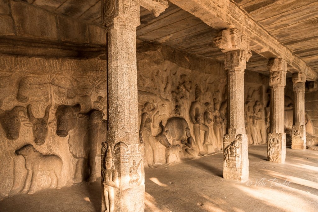
Today we go on a tour of the monuments of Mahabalipuram. The city of Mamalla, named after the title of Pallava ruler Narasimhavarman-I, was a sea-port during the time of Periplus and Ptolemy. Today it is a town studded with rock-cut caves, monolithic shrines, cave sanctuaries and structural temples. The open-air museum also includes the largest open-air rock relief in the world. The group of monuments at Mahabalipuram, were accorded the status of a UNESCO World Heritage Site in the year 1984.