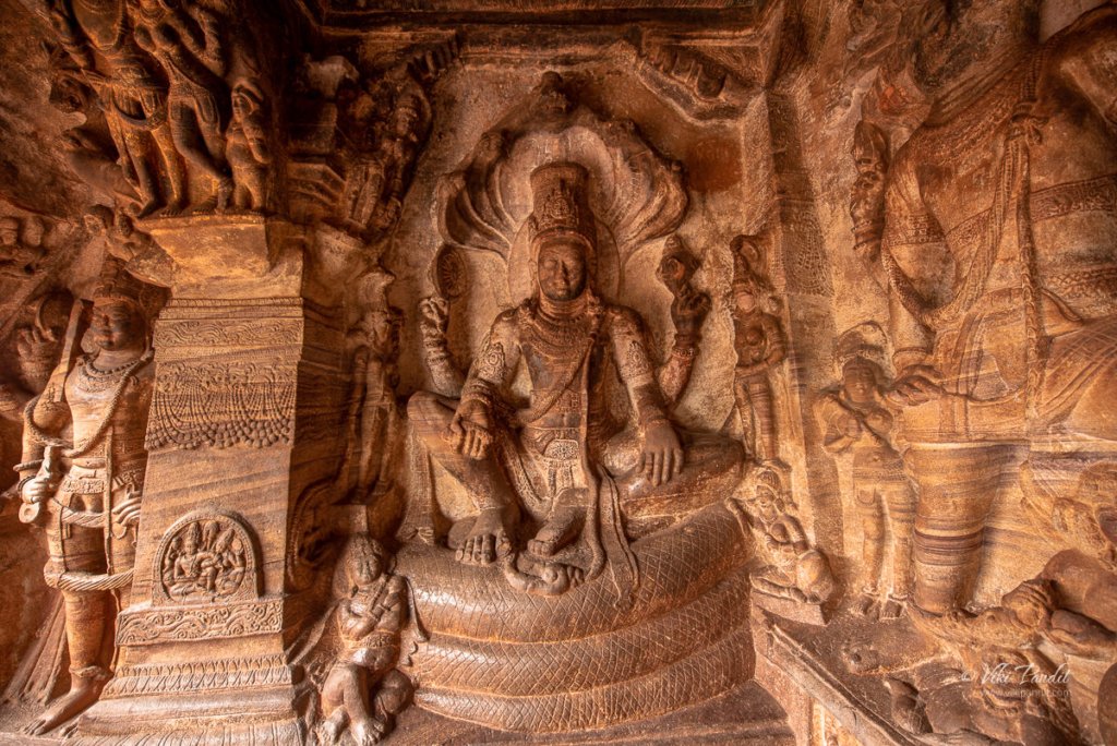
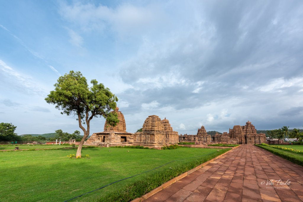
Group of Monuments at Pattadakal

Pattadakal, also called Paṭṭadakallu, is a collection of temples from 7th and 8th century CE Hindu and Jain temples in northern Karnataka. Declared as a UNESCO World Heritage site, it is a historically significant cultural center and religious site to witness the structural tastes during the times of the Chalukya dynasty.

We were staying in Badami, which is just about 23 km from Pattadakal. The drive to Pattadakal is beautiful. Surrounding by empty vastness along a beautifully paved road, you will find the ride very satisfying.

The heritage site falls on the main road and very easy to find using Google Maps. The temple complex lies on the left banks of Malprabha river represents the greatest achievement of the Early Chalukya sculptures. Unfortunately the site does not have a proper parking zone, so we had to park the Brezza just outside the complex.

The admission booth is on the left near the entrance. It costs us Rs. 25 per head. Camera charges apply extra at Rs. 25 per camera. It is a small area compared to Hampi, about the size of about a cricket field.

Monuments at Pattadakal

Pattadakal translates to “place of coronation”. As its name implies, it was used during the Chalukya dynasty for coronation ceremonies, such as that of Vinayaditya in the 7th century CE. Over the years the town has been known by various names like – Kisuvolal meaning “valley of red soil”, Raktapura meaning “city of blood”, and Pattada-Kisuvolal meaning “red soil valley for coronation”.

The rule of the Gupta Empire during the 5th century brought about a period of political stability, during which Aihole became a locus of scholarship. The experimentations in architecture extended into Badami over the course of the next two centuries. This culture of learning encompassed Pattadakal in the 7th century which became a nexus where ideas from northern and southern India fused.

After the fall of the Chalukya Empire, the region was annexed by the Rashtrakuta kingdom, who would rule over the region into the 10th century. Between the 11th to 12th century, the region came under the rule of the Late Chalukyas. Although the area was not a capital region, nor in proximity to one, numerous sources such as inscriptions, contemporaneous texts and the architectural style indicate that, from the 9th to 12th centuries, new Hindu, Jain and Buddhist temples and monasteries continued to be built in the Pattadakal region.

Throughout the 13th century, Pattadakal, the Malprabha valley, as well as much of the nearby Deccan region, was subject to raids and plunder by the Delhi Sultanate armies that devastated the region. This period ended with the rise of the Hindu Vijayanagara Empire. It was responsible for the construction of forts for the protection of the monuments, as evidenced by inscriptions in the fort at Badami. Post Vijayanagara Empire the region fell into ruins before ASI took up the protection of these heritage monuments.

The monuments at Pattadakal are evidence of the existence, and the history, of interaction between the early northern and southern styles of Hindu arts. The Hindu temples are generally dedicated to Shiva. The friezes in the Hindu temples display various Vedic and Puranic concepts, depict stories from the Ramayana, the Mahabharata, the Bhagavata Purana, as well as elements of other Hindu texts, such as the Panchatantra and the Kirātārjunīya.

There are ten major temples at Pattadakal, nine Hindu and one Jain, along with numerous small shrines and plinths. The complex has now been cleared of the village houses that encroached onto the temples, with the monuments standing in the middle of a landscaped lawn.

Kadasidhdeshwara Temple in Pattadakal

The first temple we reached was the Kadasidhdeshwara Temple. It is a relatively small temple dating back to around the mid 7th century CE. The temple faces east and is built around a square garbha griha (sacrum sanctum). It houses a linga on a pitha (platform), and the Nandi bull faces it from outside.

There is a mandapa around the sacrum center. Another mandapa provides a circumambulation path in an expanded axial layout. The outer walls of the Kada Siddheshwara sanctum feature images of Ardhanarishvara (half Shiva, half Parvati) on its north, Harihara (half Shiva, half Vishnu) to its west and Lakulisha to the south. Mounted on a lintel at the sanctum entrance is Shiva and Parvati flanked by Brahma and Vishnu on either side. The steps at the sanctum entrance are flanked by the river goddesses Ganga and Yamuna, with attendants.

Much of the temple has been eroded or was damaged in the following centuries. Its a small temple but I really loved the shikhara of this temple. Here is another view of the same from the back.

Jambulinga Temple in Pattadakal

This almost similar looking temple just beside the Kadasidhdeshwara Temple is the Jambulinga Temple. This temple also dates to around mid 7th century. The temple is built around a square garbha griha (sacrum sanctum) The temple faces east, greeting the sunrise. The Nandi too is provided with a raised platform which is in ruins and the Nandi image shows signs of erosion.

Even thought the shikhara of this temple is not so detailed, the dancing Shiva Nataraja with Parvati and Nandi by his side on the frontal arch sukanasa is beautifully presented.

Galagalantha Temple in Pattadakal

A few paces ahead towards east, lies the Galagalantha Temple. This temple is estimatedto be from the mid 8th century. The sanctum has a covered circumambulatory path (pradakshina patha), indicating that this Hindu tradition was well established by 7th to 8th century. Various mandapas exist in this temple, such as a social or community hall (sabha mandapa), used for ceremonial functions, and a mukha mandapa, of which only the foundation remains. The entrance to the mandapa is flanked by the river goddesses Ganga and Yamuna.

It is one of the more majestic temple in the grounds. The basement of the eastern moulding is notable for depicting friezes of Panchatantra fables. I went around the temple, clicking pictures as I went around the back. Inspite of its incomplete condition, the Galaganatha temple has a remarkably well preserved tower of the curved Nagara type, with all its precisely carved details intact. The tower is surmounted by an amalaka finial rising to almost 15 meters.

The Galagatha temple is mostly in ruins, except for the southern part which contains a carved slab showing an eight-armed Shiva killing the demon Andhaka, while wearing a garland of skulls as a yajnopavita (sacred thread across the chest).

Making a full circle of the temple.

Sangameshwara Temple in Pattadakal

The next temple we explored was the Sangameshwara Temple. It is probably the one with the largest area. Sangameshwara temple, also called the Vijayeshvara temple, is a large, Dravida style east facing temple located on the south side of the Chandrashekhara temple. Inscription on a monolithic stone at the site records that this temple was erected on the orders of Vijayaditya and dedicated to Shiva.

Below we have a side of the Sangameshwara Temple. Inscriptions at the temple, and other evidence, date it to between 720 CE and 733 CE. The death of its patron king, Vijayaditya, in 734 CE resulted in the temple being left unfinished, although work continued intermittently in later centuries during the time of the Rashtrakutas.

The outer walls of the sanctuary and the tower are fully preserved. Raised on a moulded basement with a frieze of elephant, yali and makara torsos, the walls are divided into four projections.

Although the temple is not the largest among those at Pattadakal it is nonetheless of imposing proportions. The temple has a square layout, with an east facing sanctum. The sanctum, surrounded by a covered pradakshina patha (circumambulatory path) lit by three carved windows.

The vimana superstructure above the temple and the outer walls of the temple are well preserved. The temple is built on a raised moulded base, with decorative friezes of elephants, yali and makara mythical creatures.

Excavations into the foundations of its ruined hall, in 1969 and 1971, revealed the archaeologically significant discovery of a brick temple structure beneath the hall. This discovery led to the proposal that Sangameshwara had been built over an older temple, possibly dating to the 3rd century CE. The next set of temples appeared to be in a clump.

Chandrashekhara Temple in Pattadakal

Chandrashekhara Temple is the first structure in this area of the heritage site. It is a small east facing temple without a tower. It is situated on the south side of the Galaganatha temple. The temple has a garbha griha with a Shiva linga and a closed hall; a Nandi sits on a platform to the east facing the linga.

This temple is said to be the only structure that postdates the Early Chalukyan era. You can clearly observe the difference between it and the other structures on the premises. This one contains no carved ornamentation except for pairs of makaras sitting on the pilasters of the walls.

Kashivishveshar Shiva Temple in Pattadakal

Just beside the Chandrashekhara Temple you can find the Kashivishveshar Shiva Temple. Also known as Kashivishweswara, the Kashi Vishwanatha temple is another of the smaller temples at Pattadakal. The temple has been variously dated to the late 7th century, early 8th century or the mid-8th century.

Much like the other temples, the core of the Kashi Vishwanatha temple is the square garbha griha (sanctum), which houses a linga. The kapota (cornice) are decorated with motifs and carved with ganas (playful dwarfs) carrying garlands; brackets show flying couples and kirtimukhas.

In front of the Kashivishveshar Shiva Temple garbha griha is the moulded platform of a Nandi-mandapa where sits a beautifully carved statue of Nandi.

Monolithic Stone Pillar at Pattadakal

Beside the Nandi, you can find a monolithic stone pillar bearing inscription in Sanskrit. Set up by Kirttivarman II, the last of the Early Chalukya rulers, the octagonal column indicates that the temples at Pattadakal were conceived as commemorative monuments, suggesting that the site may have served as a coronation place for the Early Chalukyas.

Here is a close-up of the monolithic pillar. The inscriptions on the pillar explains that the temples now known as Virupaksha and Mallikarjuna were commissioned by two sister queens of Vikramaditya II to commemorate their husband’s successful raids on the Pallava capital at Kanchipuram.

Mallikarjuna Temple in Pattadakal

On the left of the molithic pillar, you will find the most decorated temple at the site – Mallikarjuna Temple. Mallikarjuna temple, also called the Trailokeswara Maha Saila Prasada in a local inscription, is a mid 8th-century Shiva temple sponsored by queen Trailokyamahadevi. The temple was built about the same time as the Virupaksha temple, with a similar design and layout, but is somewhat smaller and has a few important differences.

The temple reflects a fully developed South Indian vimana style architecture.

The Shiva temple also has a small area designated for Nandi.

Inside the temple, in the dark corridor, you can find a lone Shivalinga. Its garbha griya (sanctum) has a Shiva linga, and features a circumambulatory path (pradakshina patha).

The pillars inside the temple are exquisitely carved. Unlike figures, they depict stories. The use of stone carvings for storytelling is prevalent throughout the temple. The legends of Hindu epics and the Puranas are depicted on the temple pillars in the community hall.

Pillars Carvings inside Mallikarjuna Temple in Pattadakal

Image 1 of 2

Pillars Carvings inside Mallikarjuna Temple in Pattadakal

The outside is even more interesting. On the left side of the temple the side gates are beautifully designed.

The pillars are are also beautifully carved. Like other Hindu temples, the friezes of the Mallikarjuna temple show kama and mithuna scenes of amorous couples.

Another pillar of the Mallikarjuna Temple

After capturing the side, I walked towards the back of the temple, which also has interesting carving all along the back wall of the temple.

The Virupaksha temple, located to the immediate south of the Mallikarjuna temple, is the largest and most sophisticated of the monuments at Pattadakal.

Covering the full circle of the temple I found myself at the last structure inside the complex. This is the Virupaksha Temple. This is the only active temple on the premises. Originally known as the Lokeshwara, after queen Lokamahadevi, the Virupaksha temple marks a significant advance on the earlier Sangamaheshwara in terms of building design, scale and construction techniques.

In inscriptions, it is referred to as “Shri Lokeshvara Mahasila Prasada”, after its sponsor Queen Lokmahadevi, and is dated to about 740 CE.The temple is notable for its range, and quality, of construction exemplifying a well developed Dravidian architectural style, as well as the inscribed names of the artists beneath the panels they worked on.

As is common with other temples at Pattadakal, the Virupaksha temple was built facing east centred around a square garbha griya (sanctum), with a Shiva Linga, surrounded by a covered circumabulatory path (pradakshina patha).

After capturing all the temples we made our way back to the car, but not before catching a last glimpse of the heritage site.

On the way back, we passed many interesting shaped boulders. This one specifically caught my eye and I stopped to get a shot of this in the setting sun.

Thanks for reading. Please leave me a comment if you liked the post or follow my story as I visit the group of monuments in Aihole.

Hiking to the Shivalayas of Badami

Today we hike to the Shivalayas of Badami. These shivalayas dedicated to the Hindu deity Shiva are surprisingly located inside a fort protected with canons et al. However the most intriguing thing that I saw were some uniquely dome-shaped stone granaries, never seen before in my travels across India.

Badami was the regal capital of the Badami Chalukyas from 540 to 757 CE. It is located in a ravine at the foot of a rugged, red sandstone outcrop that surrounds a man-made Agastya lake.

The road to the ASI protected hill goes through a massive slum area. I was naive to take my Brezza up that path, where there not even space for two cars to pass through. I would also not recommend walking to it as it goes through some really dingy areas. Hiring a local tuktuk would be the best option.

Once you breach the ASI gates, you will be transferred into a much cleaner and peaceful place. The Shivalayas are located up a hill which also used to double up as a fortress.

Near the entrance you ca see the remnants of the walls of the fortress in some places.

The walls extend towards the back of the hill.

There is no parking lot in front of the entrance to the hill, so we just left it in front of the Gate. This part of the hill does not require any admission tickets. Just beside the path up the hill lies a small museum that exhibits some of the idols and carvings that needed to be protected. The museum requires a ticket to enter. Outside the museum many stone artifacts are lying out in the open.

This is the first gate we encountered. This gate stays open from 6 am to 6 pm.

From here a series of stone steps take up up the hill into an open space. The massive boulders surrounding you will make you feel overwhelmed.

We gradually made our way towards the boulders. The red patterns on the rock faces make them even more interesting.

Beyond the boulders we found ourselves in front of a small gate. Sandwiched between two huge boulders, the doors has some carvings on it.

Below is an image of the back side of the same gate, which is quite bland.

Beyond the door the path forks into two. One the left lies the Lower Shivalaya and on the right a path that takes you to Upper Shivalaya. At the fork, there lies a ruined rubble structure that looks like some kind of hall consisting of two long chambers, created out of small rocks bound together by something resembling cement. Most likely these chambers were used as an armory or a store.

We took the left towards Lower Shivalaya. The boulders gave way to an open area where at the edge lay a small temple. Inside the temple lies a Shivalinga. There are no ventilation in the temple and the Shivalinga lies in darkness.

Going across to the other side, I found an age-old cannon bearing an engraved date of 1550, pointing towards the city. The cannon reminded me that this hill also used to be a fort.

Only the towered sanctuary of the temple exists today; its outer walls have been dismantled. The sanctuary was originally surrounded by a passageway on three sides, possibly with a mandapa extension to the east which can be predicted by observing the broken roof slabs set into its walls and the stumps of beans with friezes of ganas.

The temple’s doorway is framed by bands of lotus ornament. An unusual, elliptical shaped pedestal is seen within which happens to be empty now. The outer walls have flat pilasters but there are no signs of projections or sculptures niche. The roof is an octagon to dome topped by a tiny amalaka finial. It is framed by corner model elements topped by kuta roofs containing miniature nidhis.

From here if you look north, you can view the upper Shivalaya in a distance.

After taking a short break at the Lower Shivalaya, we started on our hike to the Upper Shivalaya. Along the way you can find many interesting boulders like this.

In a few minutes we were at the third gate. Unlike the second gate, this does not feature any artistic figures.

From the gate a series to steep stairs took up up the hill.

Unlike the Cave Temple in Badami, this part of the hill is mostly desolate. We kept making our way to wards the top. In a few minutes we found ourselves at another fork in the path.

We took the left stairs that well a little bit downhill. It led us into an opening with a cylindrical structure. This used to be a Bastion of the old Fort, jutting out over the edge of the cliff. The bastion is bounded by finished walls with angled ramparts provided with apertures for cannons.

After spending a few minutes inside the Bastion, we moved on towards summit. The boulders in this area are so close to each other that the passage becomes very narrow.

Eventually it narrows down so much that only one person can pass thru it at a time.

After some time we reached the fourth and final gate.

The narrow path continues beyond the gate.

In a few minutes along this narrow path we entered a clearing containing two oval shaped structures beside a ruined third. These structures we used as granaries in ancient time. Built on finely finished bases with a small single doorway, the rubble walls have projecting stone pieces that serve as steps to the summit.

The small door must have been used to take out the grains. On the sides of the oval building, the projected rocks must have been used to fill the granary from the top. My late grandmother used to have a mud granary in her house in the village and this was how it used to work.

The ruined granary provides a better view of how the base features on the inside.

From here we moved towards Upper Shivalaya.

We were finally at the summit of the North Fort. The hike took us around a couple of hours at a leisurely pace. At the summit the first structure we saw was a building in ruins. This ruined building with a spacious court surrounded by a number of chambers was most likely used as residential quarters for a garrison.

Just beyond the ruins, lay the Upper Shivalaya. The temple faces east and is the highest point of the fort.

In front of the Upper Shivalaya, you can find a small natural pond. Its prominent location and rudimentary Dravida style of it architecture suggests that it is one of the earliest structures in Badami.

The Upper Shivalaya rests on the edge of the summit. Like the lower Shivalaya, the Upper Shivalaya also looks to be partly demolished. While the sanctuary and the tower have survived, parts of the mandapa are altogether missing.

The outer walls of the temple create a rectangle containing a sanctuary with a passageway on three sides, opens into a columned mandapa on the east, missing all its internal columns. The walls are built on a basement with a central recessed course containing foliate ornament and narrative scenes.

I captured some close up shots of the outer walls of the temple. On the south face, Ramayana episodes are pictured, like, waking of Kumbhakarna, Rama fighting with forest enemies. Panels on the west face depict the birth and childhood of Lord Krishna, including Krishna sucking Putana’s breasts.

A front shot of the Upper Shivalaya. The central pilastered projections have panels depicting Krishna lifting Mount Govardhana (south), Narasimha disemboweling his victim

From the edge of the temple you can also see the lower Shivalaya.

We spent some time admiring the beautiful view from the summit as a huge cloud surrounded the area.

I took a last shot of the Upper Shivalaya before we started on our way down the hill. Both these appear to have partly dismantled mostly by conquering pallava forces; and maybe they have been pillaged for building blocks to strengthen north fort by later occupiers.

Thanks for reading. I look forward to your comments and questions. If you are looking to explore more of the Badami region, follow my story as I visit the UNESCO site of Group of Monuments in Pattadakal.

Cave Temples of Badami

Today we hike up a small hill in the quaint town of Badami, in northern Karnataka. Along the hike, we will be exploring four rock-cut cave temples dating back to the 6th century. These temples were primarily commissioned during the times of Chalukya reign (543 CE – 757 CE), and they provide a deep insight into an emerging architecture that influenced the next generation of sculpturing style in the surrounding regions of southern India.

I and my wife, Mani, were staying at Clark’s Inn, which in my opinion is the best hotel in this area. It is also a good base if you have the nearby hotspots like Aihole and Pattadakal planned in your itinerary. Both heritage sites are located within an hour’s drive from Badami.

Historically, Badami has been known by many names. During the reign of Early Chalukyas, it was known as Vatapi. With the passing of time, it came to be referred to as Vatapipura, Vatapinagari, and also Agastya Tirtha. The city lies at the exit point of a ravine between two steep mountain cliffs. The cave temples that we will explore today, lie on the southern cliff.

The road leading to the entrance of the ASI protected site is filthy with dirty slums and pigs loitering around. But once you enter the parking lot, it gets a lot cleaner. The parking lot is located at the base of the hill that hosts all of the 4 Cave temples, each at a different height.

The Badami cave temples represent some of the earliest known examples of Hindu temples in the Deccan region. The temples are numbered 1 to 4 in the order of their ascedency. It is universally agreed that these ancient creations, along with the temples in Aihole, transformed the Malaprabha River valley into a cradle of temple architecture that influenced the components of later Hindu temples in southern India. The Badami Caves complex is part of a UNESCO-designated World Heritage Site candidate. I believe the only thing keeping it waiting to get the official nod is the unhealthy encroaching settlement that surrounds the heritage site.

As usual, I would advise tourists, not to pick a weekend to visit this place as it gets overcrowded. Guides are available near the ticket counter on all days. Tickets costs 25 per head for adults. There is an additional camera charge of 25 for cameras. Even though it is a nominal charge, I find it amusing that ASI is charging for cameras separately but not charging people using phones to take the same pictures.

Cave Temple 1, Badami

Today’s exploration begins from Cave Temple 1, which lies just a few steps up from the parking lot, on an elevated platform. It is about 60ft above ground level on the north-west part of the hill. The Badami cave temples are carved out of soft Badami sandstone. If you have been to Hampi, you can clearly tell that the color of these temples is comparatively much more reddish.

The Badami cave temples are carved out of soft Badami sandstone on a hill cliff.

A ticket checker stands guard at the base. You might also spot a few monkeys near him. Once you climb the first series of steps, you will find yourself on a flat area with another set of stone steps that take you up to the first cave platform. The wall beside the stairs depicts carvings of dwarfish ganas in different postures as if holding the cave floor.

Cave Temple 1 is dedicated to the Hindu God Shiva. This is immediately apparent from the 18-armed carving of the Tandava-dancing Shiva as Nataraja on the right wall even before you enter the cave. Elaborately portrayed with the arms in various poses, the image expresses the dynamic posture of Shiva in his cosmic dance. The image, about 5ft tall, has 18 arms in a form that expresses the dance positions arranged in a geometric pattern depicting the cosmic wheel.

The eighteen arms express Natya mudras (symbolic hand gestures), with some holding objects such as drums, a flame torch, a serpent, a trident, and an axe. The image of Shiva, has his son Ganesha and the bull Nandi by his side.

The verandah of the cave has five columns sculpted with reliefs of flower garlands, foliage, and jewelry. On the opposite side, to my left, standing just outside the entrance of the cave lies a two-handed Shaiva dvarapala (guard) who holds a trident. Below the guard, carved into the wall is a bull-elephant fused image where the creatures share the head. Seen from left it looks like an elephant and from right the same appears to be a bull.

As you enter the cave temple, beside the dvarpala you can find a carved sculpture of Harihara. The 7.75ft high sculpture is portrayed as a single figure where the left half is depicted to be Hindu god Shiva and the right half is Vishnu. He is shown with goddess Parvati on the left side and goddess Lakshmi on the right side. Thus both the halves are with their respective consorts. A closer look will also reveal that the two halves are also with their vahan(vehicles) Nandi , the bull in a human form on the left, and Garuda, again in human form on the right.

Also known as Shankaranarayana (“Shankara” is Shiva, and “Narayana” is Vishnu), Harihara is revered by both Vaishnavites and Shaivites as a form of Supreme God.

Interestingly the early rulers of the Chalukya dynasty were Vaishnavites. In later years they began to worship Shiva. Yet here in a cave dedicated to Shiva, they have commissioned a sculpture of Harihara. Was this figure invented in order to end the controversy between the Vaishnavites and the Shaivites as to whose god was greater?

The first line of pillars in the front of the cave is richly decorated. Inside this cave, the sons of Shiva, Ganesha, and Kartikeya, the god of war and family deity of the Chalukya dynasty, are seen in one of the carved sculptures on the walls of the cave, with Kartikeya riding a peacock.

The roof of the cave has five carved panels with the central panel depicting the Nagaraja, with flying couples on both sides. In the center lies a beautifully carved image of Nagaraja, with a coiled serpent body around a human torso. The head and bust are well-formed and project from the center of the coil.

On either side of the Nagaraja, you can find images of the Vidyadhara couples as well as couples in courtship, some of them in erotic poses. In Hindu epics, Vidyadharas are described as spirits of the air. They are considered Upadevas, or demi-gods. All the figures are adorned with carved ornaments and surrounded by borders with reliefs of animals and birds.

What is most amazing here is that the artisans who carved these beautifully detailed images must have spent years, day in and day out, lying on their back while creating these.

The inner sanctum contains a Shivaling. Facing the Shivaling, in the center of the mandapa lies a headless, seated Nandi facing the garbha ghriya (sacrum sanctum). The light inside the cave is not very good, so I suggest you come during the afternoons when the light is properly able to reach the interiors. Lack of sunlight means the caves are smelly from centuries of dampness.

From the first cave temple, a fleet of stone stairs lead up to the 2nd Cave Temple. There are about 64 steps to the second cave. It’s like baby steps compared to Kuon-ji Temple in Yamanashi, where I did 287 steps, or the Yamadera Temple that took me about 1,015 steps.

Cave Temple 2, Badami

The 2nd Cave Temple is consecrated to Lord Vishnu. It faces towards the north and is comparatively smaller than the first and might I add: less refined. It is believed to have been commissioned in the late 6th or early 7th century. It has been sculpted from a boulder that is almost double in height of the first cave temple. The cave entrance is divided by four square pillars, all carved out of the monolithic stone face. Similar to the first temple, this too sits on an elevated plinth, decorated with a frieze of ganas.

On the extremes of either side of the entrance are standing dvarapalas (guards) holding flowers, not weapons. The pillars here are rather simple in design with reliefs of flowers and jewelry. The pillars also feature amorous couples towards the top.

The roof contains a complex combination of four Vishnu images surrounded by a maze of Swastikas, somewhat similar to what I noticed in the Ramalingeshwara Temple in Avani.

Though the pillars fail to generate much enthusiasm, the two sides have wonderfully sculpted images of the incarnations of Vishnu. On the left, you will find a beautiful relief depicting the legend of Vishnu in his Varaha (boar) avatar rescuing goddess Earth (Bhudevi) from the depths of the cosmic ocean, with a penitent multi-headed Naga (snake) below. Inside the temple are friezes showing stories from Hindu texts such as the Bhagavata Purana.

On the opposite side, we have an equally beautifully sculpted image of Vishnu in the avatar of the Vamana. This relief in Cave Temple 2, depicts the legend of Vishnu in his Trivikrama form, taking one of the three steps. Below the raised step is a frieze showing the legend of Vamana (dwarf) avatar of Vishnu, before he morphs into the Trivikrama form.

After exploring the 2nd Cave Temple, we ascended towards the next cave. You may find a number of monkeys leisurely sitting here. Do not engage with them or they might attack you or snatch your bags away. To my surprise, one of them even knows how to open bag zippers.

Midway to the third cave temple, molded by the force of winds, lies a natural cave. I small stairs hidden from view takes you up to the cave.

From this cave, one can get a good view of the wide Agastya Lake at the base of the mountain. It is said to have been formed in the 5th century and many believe that its water has curative properties.

This cave does not feature any prominent sculptures. You can barely make out some figures on the side walls as if something was planned and started but was abandoned midway. A mutilated figure of Padmapani can be found deep inside in this natural cavern.

Steep steps from here ascend to the ramparts that constitute the citadel at the summit of the North Fort. Yes, this hill was at one time upgraded into a fort because of regular raids from the Mughal Sultanate. A small doorway that fits not more than two people at a time leads to a broad paved terrace.

Before you enter the doorway, to the right, lies a tiny building, sandwiched inside the crevasse of what looks like a split in the boulder.

Cave Temple 3, Badami

Facing north, Cave Temple 3 is about 60 steps from Cave 2 and at a higher level. It seems to the most decorated among the three we had already explored. It features Vishnu-related mythology and is also in my opinion the most intricately carved cave on the entire hill. At the entrance wall of Cave 3, there is an inscription in the ancient Kannada language that mentioned that Chalukya ruler Mangalesha son of Pulikesh-I was the founder of these cave temples during circa 578 CE.

Cave 3 is said to be the earliest dated Hindu temple in the Deccan region. It is dedicated to Vishnu. It has intricately carved friezes and giant figures of Trivikrama, Anantasayana, Vasudeva, Varaha, Harihara, and Narasimha. The cave stands raised on a plinth divided by seven columns. The cave’s primary theme is Vaishnavite, though it also shows Harihara on its southern wall. The cave is about 15ft high and supported by 3 rows of six pillars. Each of the pillars contains magnificent pieces of art. These columns randomly feature ganas and amorous couples. The cave shows many Kama scenes in pillar brackets, where a woman and a man are in courtship or mithuna (erotic) embrace.

The temple has been sculpted 48ft deep into the mountain; an added square shrine at the end extends the cave 12ft further inside. The verandah itself is 7ft wide and has four free-standing, carved pillars separating it from the hall. Cave 3 also shows fresco paintings on the ceiling, some of which are faded and broken. You can still see the color green used in these paintings. These are among the earliest known surviving evidence of fresco painting in Indian art. The Hindu god Brahma is seen on Hansa vahana in one of the murals. The wedding of Shiva and Parvati, attended by various Hindu deities is the theme of another.

The columns on the inside of the cave temple are much simpler.

On the left of the entrance, we have a lovely image of Vishnu sitting as Vaikuntha over the coils of Sesha. The multi-hoods of the Sesha shelter the crowned head of Vishnu. To its left is another image of Varaha (man-boar avatar) rescuing earth, just like we saw at the previous cave.

On the right side of the entrance lies an image of the Trivikrama-Vamana. He was known as Trivikrama because he is the one who has conquered the three worlds, Earth, Heaven, and the netherworld. There is an interesting story about this avatar of the Hindu god Vishnu. Vamana was the fifth avatar of Vishnu, He was born as the son of Sage Kashyapa and his wife Aditi. In this avatar, Vishnu was known as Vamana because he was a dwarf.

Indian mythology has long stories about tussles between the Asuras (demons) and Devas (heavenly beings). Bali, an asura, was killed by Indra, the king of the Devas, in the battle. He was brought back to life by Sage Shukra. In his reincarnated life he practiced several sacrifices, becoming powerful with each. He became so mighty that he conquered all the three worlds, driving away the devas from the heavens. As usual, they turned to Lord Vishnu for help. Vishnu in the avatar of the Vamana, went to King Bali and asks for three steps of land measured by his foot as a charity.

When Maha Bali completed the ritual process of donating the land, Lord Vamana assumed his cosmic form (Trivikrama), measured the entire Earth including the nether world by his first step. With his second step, he measured the entire heaven.

When the entire Universe was conquered by just two paces of Vishnu (Vamana) there was no space left in the Universe to keep Vamana’s third pace. When Lord Vamana asked Maha Bali the space to keep his third step, all the pride and vanity of Maha Bali vanished and he had no hesitation in surrendering before Vishnu. He readily offered his own head to keep the Vishnu’s third step. The Vamana immediately placed his third step on the head of Bali and sent him to the nether world.

The image of Trivikrama is accompanied by another two carvings of incarnations of Vishnu – The Narasimha and the Harihara. Might I add, in all my travels to Indian temples, I have never seen Narashimha smiling so cutely.

Cave Temple 4, Badami

From here, separated by a series of small steps, but on a lower height lies the last of the Cave temples. Located immediately next to and east of Cave 3, Cave 4 floor is situated about 10 feet lower and is the smallest of the four. It is the only one dedicated to Tirthankaras, the revered figures of Jainism. It is believed to be constructed after the first three, sponsored by Hindu kings in the latter part of the 7th-century.

Like the other caves, Cave 4 features detailed carvings and a diverse range of motifs. The cave has a five-bayed entrance with four square columns.

Inside the temple, behind a narrow door sits a carving of the Buddha. At each corner you will find carvings of Bahubali, Parshvanatha and Mahavira with symbolic display of other Tirthankaras.

Buddha is enshrined as the main deity. Because of the narrow door and no other light source, it was tough to capture it in the darkness.

To the left, right at the entrance, you can find Bahubali, standing in Kayotsarga meditating posture with vines wrapped around his leg, his classic iconography. Bahubali was a prince who attained the stature of a perfected being (siddha). Although never admitted to the pantheon of twenty-four tirthankaras, he nonetheless attained jina-like status. The legend of Bahubali tells of a prince who renounces violence after coming close to slaying his brother Bharata in a battle of succession and then renounces pride and its expression – violence to other living creatures. Embracing ahimsa (nonviolence), he meditates in the “body-abandonment” posture in a forest, where he is entwined by vines and hosts birds that nest in his hair until he attains moksha.

On the right, just opposite the Bahubali image, you will find a detailed image of Parshavanata, with a multi-hooded cobra rising over its head.

The carvings on the pillars are different here from the other cave temples. The first row features floral motifs along with circular carvings of amorous couples. If you look closely, it seems that some of the more erotic carvings on the pillars have been scooped out.

The second row of pillars features detailed carvings of Mahavira embedded into a surrounding carving depicting a gate of sorts. This divergence of design leads to much speculation about the time of the creation of this temple.

After exploring the cave, we took a small breather at the top. From the podium in front of the 4th Cave temple, you can get some lovely shots of the expanse that surrounds Badami.

Other than the numbered caves, Badami is home to many other cave monuments and medieval era temples. On the other side of the lake, near the Bhutanatha temple, is a 7th-8th century Chalukya period cave of small dimensions. You can visit Badami all round the year except mid-Summer when it gets extremely hot. I would recommend going just after monsoon when the Agastya lake is brimming with crystal clear water and adds a nice charm to the heritage site

Please note, you will find many monkeys along the hike. Do not carry food and make sure your bags are tightly wrapped as they will try to snatch it and run away.

Just beneath the Cave temple complex, the man-made Agastya teertha or lake is situated which looks like a ravine of crystal clear water surrounded by the greenery and hills of yellow sandstone.

Thanks for reading. I look forward to your comments and questions. If you are looking to explore more of the Badami region, follow my story as I hike to the ruins of the Shivalayas of Badami. If you are in Karnataka do not miss these interesting heritage sites around Bangalore.

When was Badami Cave Temples built?

The Badami Cave Temples were built in the 6th century.

Who created the Badami Cave Temples?

The Badami Cave Temples were commissioned by the Chalukya kings

What is the admission price for Badami Cave Temples?

The entry fees of Badami Cave Temples is 25 per person for Indian Nationals and 100 per person for Foreigners.

Photowalk along Osanbashi Pier

Today we dropped by at one of the most photographed areas in YokohamaOsanbashi Pier(大さん橋) . The pier was originally built in 1894, but was reconstructed in 2002 as a passenger terminal. Its bold new design incorporates floor boards, with no stairs, beams or posts making it a unique experience with great views of the city.

We were in the Kanto region for a few days. The weather had been a big disappointment. We spent the early part of the day inside malls surrounding Shin-Osaka Station. We found a Book-off store nearby. Its a great place to find old series that are not in publication anymore and, I may add.. in pretty good condition.

The weather didn’t improve much over the afternoon, but Osanbashi Pier was one of the places I badly wanted to see. It is one of Yokohama’s best spots for a walk, with unobstructed views of the Minato Mirai skyline especially in the evening.

How to get to Osanbashi Pier from Shin-Yokohama

After lunch we dropped off our shopping bags back at the hotel and left for the pier. We took the Blue line from Shin-Yokohama Station and got down at Kannai Station. From there it is a 15 minute walk to the pier. JR Passes are not valid on the Blue line. It cost us 270 Yen each for the one way ride. You can also buy one-day passes for the subway.

Osanbashi Pier

Osanbashi Pier is located between Minato Mirai and Yamashita Park. Since all three attractions are connected by a pleasant waterfront promenade, Osanbashi Pier is most conveniently accessed by foot from either of the other two sites.

It was already dark by the time we reached the pier. The beautiful lights had come on and it appeared quite romantic except for the drizzle that was still trying to dampen my spirits. I was almost ready give up but Mani egged me on.

It was cold. We walked over to the pier and found us a bench. Luckily we found a vending machines alongside and grabbed us some very welcome warm coffee. The drizzle eventually went away by the time we finished our coffee

Yokohama Night Skyline

I set up my tripod on the left side of the pier from where I was able to capture some lovely images of the Yokohama skyline.

Osanbashi pier has a unique design. Its “roof top” is a huge wood deck with steps, slopes, and benches. It is open to the public. Generally, families and couples visit there and have relaxing time with fresh sea breeze. However very few people had braved the wet weather to be at the pier.

Brief history of Osanbashi Pier

The Port of Yokohama was opened in 1859 as a direct result of the Treaty of Kanagawa, signed by Commodore Matthew Perry of the United States and the Tokugawa Shogunate of Japan. At the time, 2 wharfs were built in place of the present day Osanbashi. The wharfs were too shallow for the ships to dock, and so barges were used to carry passengers and freight to and from the ships.

In 1889, during the Meiji Era, the City of Yokohama was incorporated. The Osanbashi Pier was constructed between 1889 and 1896. Between that time and today it has been damaged many a times.

In 1923, the port was badly damaged by the Great Kanto Earthquake, and had to be rebuilt. During World War II, the port was again badly damaged, this time by air raids.

In 1964, another reconstruction of Osanbashi Passenger Terminal was undertaken to jazz it up before the Tokyo Olympics that year.

Far out one can also see the iconic red brick warehouse at the base of the Minato Mirai skyline. We would be heading there later in the evening.

After taking a few pictures, we walked over to the eastern side of the pier. The wet wood was still glistening from being wet.

As we stood admiring the wide open bay, a Royal Wing Bay Cruise ship came along making its rounds in the bay. One of the best way to feel this Bay City’s charm is by joining this cruising tour. The ship serves a variety of dishes, and follows it up with amazing views of the bay area.

Osanbashi Kokusai Kyakusen Terminal

We didn’t want to stay for long in the anticipation that the rain would be back. As we walked back we found ourselves in front of the gate of the passenger terminal. Most of this area was constructed between 1987 and 2002, to meet the modern demands of the port.

This newly reconstructed passenger terminal is named the Osanbashi Kokusai Kyakusen Terminal. It can accommodate up to four 30,000-ton class ships or two 70,000-ton class ships at the same time. The pier has a terminal building which houses checking counters for passengers, customs, immigration, souvenir shops, coffee shop, information counters and a restaurant.

Once I was done taking pictures of the Yokohama skyline, we made our way towards the dazzling lights of Minai Mirato across the Zo No Hana Park. In this park there is a new installation of a series of vertical light panels in a curved line that gradually increase in size.

On the left one can see the Yamashita Lingang Port Promenade. It is a boardwalk that connects the New Port District of Yokohama City Naka Ward directly with Yamashita Park. Yamashita park was just behind us but it was too late to head there. One really does need a full day to explore the area. Anyways, we walked briskly towards the Red Brick Warehouse.

Yokohama Red Brick Warehouse

The Red Brick Warehouse (Aka Renga Soko) is a pair of landmark buildings, with an artsy shopping center, banquet hall, and event grounds. It is located right next to the port in the Minato Mirai district of Yokohama.

The bold vibe of the Red Brick Warehouse is quite unique in nature to anything I have seen in Japan. The are two buildings running parallel to each other, with an open courtyard-like area in between. It is a good place for souvenir shopping. For those looking for a more substantial dining plan, there are also some larger, sit-down restaurants.

The two buildings were constructed in 1911 and 1913 meant to be used as customs buildings for the nearby harbor. They survived the Great Kanto Earthquake of 1923, requiring just some basic repair and restoration. The buildings were requisitioned by the Americans during WWII, but were returned to their original use after the war, and continued serving as customs houses until 1989.

In 2002, they were repurposed into a shopping mall. Each building, as well as individual shops, operate on their own hours and holidays, so there is no universal schedule. Most shops open between 10-11:00 am and close by 7 – 8:00 pm.

Walk back to Kannai Station

It was 9 pm. We started our walk back to Kannai Station. We were tired from walking all day. On the way I got this last incredible close-up shot of the Landmark Plaza. I can certainly say that the more I roam around this area, the more angles I can get. But this would be enough for today.

Yokohama bay area is like a feast for the photographers. I would love to come back some time during the day to capture other parts of the area.

Thanks for reading. Please leave me a comment if you liked the post or follow my story as I visit the lovely Kiyosu Castle.

The great Senso-ji Temple

Sensō-ji is an ancient Buddhist temple located in Asakusa district of Tokyo, Japan. It is Tokyo’s oldest temple, and one of its most significant. It is a very busy place during daytime so I decided to escape the crowd by visiting early at dawn and then returning back late at night.

We were staying at APA Hotel Asakusa-Kuramae. It is just a couple of minutes walk away from the Kuramae Station on the Toei Oedo Subway Line. I had intentionally reserved this hotel as it is at a walk-able distance from the historic temple. I left the hotel at around 6:30 am. The skies were a saddening, dull gray as I made my way along the quiet alleys.

Because the hotel was near the Sumida river, I choose to walk along the banks towards the heritage temple. Along the way, helping myself to some pictures. The picture below is a shot of the Azuma Bridge with the Asahi Beer Headquarter Building in the background.

You can cross the Azuma bridge from above, but I chose to go under a small dark tunnel. This tunnel is mainly used by joggers, so they don’t have to climb the stairs to cross over to the other side of the road above.

Across the tunnel, I found myself in the Sumida Park area. On the right there is a small dock for ferries. On your left, you can find the Tokyo Cruise Ship Asakusa office. If you are looking for a cruise around Tokyo on the Sumida River, this would be the place to go.

From here I took a left turn towards Senso-ji. From the Azuma bridge you can directly head for the temple, that is the more correct way, that leads directly to the temple main gate and then the temple, but I love to wander about a little.

The Nitenmon Gate

Coming from the river side, the first structure I encountered was the Nitenmon Gate, located on the east side of the Main Hall. Nitenmon in Japanese means “the gate of two ten”. It is named so because of the two protective Buddhist deities (known as ten) that can be seen on its left and right side.

The deities are called Zochoten and Jikokuten respectively. The original statues were destroyed in 19th century. Since then, substitute statues from the Ueno Kaneiji stands there. This gate leads directly to main altar of Senso-ji. It was originally built in 1618 CE and has been named an Important Cultural Property.

Asakusa Shrine

From the gate, towards my right I could see the Asakusa Shrine. I went in and paid my respects. The Asakusa jinja is a Shinto shrine also referred to as Sanja-sama (Shrine of the Three gods). It’s modest appearance belies its historical and cultural significance. The shrine honors the spirits (kami) of the three men – the Hinokuma brothers and Chief Hajino, who founded Sensō-ji.

After taking a few pictures, I made my way towards the main hall of the Senso-ji.

History of Senso-ji

According to legend, Senso-ji Temple was said to have been created when a statuette of Kannon was fished out of the nearby Sumida River by two local fishermen brothers – Hinokuma Hamanari and Hinokuma Takenari in the year 628 CE. It is a mystery as to who carved the statue, or how it had come to be floating in the waters of Sumida, but everyone considered the discovery of the statue to be a miraculous event.

News was sent to the then capital of Japan, which was in Nara, a city to the south of Kyoto. Nara was at that time under the reign of Empress Suiko. She was a very devout Buddhist and is credited with establishing many of the oldest temples and monasteries in Nara. When she heard the story of the two fishermen and the statue of Kannon, she ordered that a temple be built to house the statue.

For those who don’t know, Tokyo was just a small village at that time. The chief of the village, Hajino Nakamoto was greatly moved by the presence of the idol and he decided to remodel his own house into a small temple where the villagers could worship the goddess of mercy. The statue was consecrated during the Kamakura period, around the year 645 CE, which makes the temple the oldest temple in the capital.

Centuries later, Senso-ji became associated with the Tendai school of Buddhism. This Mahayana Buddhist tradition brought over from China in the 8th century became the dominant form of Buddhism among Japan’s upper classes for many centuries.

Although most of the original temple buildings were destroyed by US bombs during World War II, the structures was rebuilt soon afterwards in 1950.

Actually, Senso-ji’s full name is “Kinryū-zan Sensō-ji” , Kinryu-zan meaning “The mountain of the golden Dragon .

The Main Temple Compound

It was quiet early but a steady stream of visitors were already coming in to pay their respects. The Main hall is the largest structure in the complex. In front of the main hall lies a large incense cauldron. You can light some incense sticks there if you prefer. Before entering the hall you can also indulge in some harmless fun by buying the Omikuji (paper fortunes) that costs 100 yen. But even if you unfortunately draw bad luck, don’t be discouraged, just tie them around a designated place nearby and hope for a better one next time, fingers crossed 🙂 A lot of Omikuji will already be hanging nearby like white flowers, so you can’t miss it.

The Hondo (Main Hall)

The Hondo or Main Hall houses the Kannon statue. The statue is kept deep inside the hall to keep it safe from pollutant degradation. The Hondo Hall is a national treasure and was originally built in 942 CE. It was later rebuilt by the third Shogun, Tokugawa Iemitsu. The current building dates from 1958. Photography is not allowed inside the hall.

Inside of the hall was rather cold, presumably because of lack of any sunlight inside. I paid my respects and walked back out. From the top of the stairs I took this photo of the Hozomon Gate.

I wandered around the main hall taking a few shots. With the thick cloud cover, the day was photogenically extremely boring. I have tried to spruce them up in Lightroom to bring some energy into them.

Five Storey Pagoda

While walking around the Hondo, I strayed into a small rock garden. From here I got a better shot of the Pagoda.

The Five Story Pagoda (Goju-no-Tou), which is said to contain some of the ashes of Buddha. The Pagoda is approximately 53 meters high and is especially picturesque at night when all lit up. The original structure was built in 942 CE. It was later reconstructed in 1973. It is a national treasure and the second highest pagoda in Japan.

In the garden on the right of the Hondo, there is a small landscaped garden. In the garden you can find a hexagonal temple. I am not too sure about its history but the small wooden structure tucked away in the north-west corner of the temple grounds was built way back in 1618.

It was originally built on top of a well, but was slightly moved from its original location in 1994. The inner structure follows an umbrella-like wooden structure called ougitaruki. The Higiri Jizō-son is enshrined in the small wooden structure, which translates as “Time-bound Ksitigarbha-bodhisattva.”

Directly opposite to the hexagonal temple lies a seated bronze Buddha. Talking of seated Buddha’s, if you are touring Japan, you must not miss these four:

The Hozomon Gate

After leaving the garden, I walked towards the Hozomon Gate. The Hozomon Gate is the gateway to the inner complex of Senso-ji Temple and the temple’s inner gate. The second floor of the Hozomon Gate houses many of Senso-ji’s treasures, including a copy of the Lotus Sutra, and the Issai-kyo scriptures.

When you are standing with your back towards the main hall, you will see the two large straw sandals hanging on the left and right of the gate. They are called waraji. These huge sandals were crafted by villagers in northern Yamagata Prefecture, and are meant to symbolize the Buddha’s power. It is believed that evil spirits will be scared off by the giant sandals. The Hozomon Gate was originally built in 942 CE. After it was destroyed during World War II, when the temple was bombed during the 10 March air raid on Tokyo, it was rebuilt in 1964.

In the same gate, from the other side you will find two statues located on either side. They are Nio Guardians, the guardian deity of Buddha, and the gate was originally known as the Niomon. You can find the pictures of the Nio guardians further down the article.

Nakamise-dōri

From the Hozomon Gate, I walked towards the main entrance gate. The two gates are connected by a long narrow corridor known as the Nakamise-dōri. It is said to have come about in the early 18th century, when neighbors of Sensō-ji were granted permission to set up shops on the approach to the temple.

In those times it was like flea market. So in May 1885 the government of Tokyo ordered all shop owners to leave to rebuild the area in an orderly fashion. In December of that same year the area was reconstructed in Western-style brick and the shop owners were allowed to come back to resume their business.

During the 1923 Great Kantō earthquake many of the shops were destroyed, then rebuilt in 1925 using concrete, only to be destroyed again during the bombings of World War II. The length of the street is approximately 250 meters and contains around 89 shops.

The Kaminarimon Gate

The Kaminarimon or Thunder Gate serves as the entrance to the Senso-ji Temple precinct. It was originally built in 942 CE by military commander Taira no Kinmasa. The gate has two protector deities, Fujin, the god of wind is on the right, and Raijin, the god of thunder is on the left.

The structure features a massive red and black paper lantern, dramatically painted to suggest thunderclouds and lightening and hence the name. The traditional lantern called chochin in Japanese is 3.9 meters high, 3.3 meters in diameter and almost 700 kg in weight. The original lantern burned down along with the Kaminarimon in the late Edo Period. It was rebuilt in 1960 and is renewed every decade with the current lantern created in November 2013.

My photo-walk of Senso-ji was done. Small crowds of tourists were beginning coming in. I spent the day casing out book stores around Tokyo. Mani needed some language books. I needed some Manga. We went to Maruzen Marunouchi Main Store, one of the biggest book store in Tokyo. It was just incredible, the sheer variety of the books they carry.

Time flies away on wings when I am surrounded by brand new books. It was late in the evening by the time we reluctantly came out of the building. By 8 pm I was back at the hotel, ready to return to the heritage site.

Night out at Senso-ji

I went down the same path as in the morning. On the way I took this shot of the bridge over the Sumida river. You can see the Skytree and the iconic Asahi Beer building in the background.

Before reaching Senso-ji, I stopped a couple of times near the Sumida river to catch the lovely Skytree. I haven’t been to the Skytree yet , but it sure is in my bucket-list.

It was late and the shops along the approach to Senso-ji were all closed. Though I couldn’t shop for souvenirs, it also meant I was not surrounded by hundreds of tourists. There are 54 shops in East side, 35 shops in West side; 89 shops in total. It gets really noisy here during daytime.

The Hozomon Gate at Night

I was at the temple by 9 pm. Even though it was late, there was a good stream of people still coming in. I waited for my moment to capture this shot of the Hozomon Gate. This is without any doubt, the most beautiful photo of Senso-ji that I have taken.

According to Oei Engi, a chronicle written around the 15th or 16th century and the only source describing the establishment of Senso-ji, Hozomon Gate (known as the Niomon Gate when it was first erected), was built in 942 by military commander Taira no Kinmasa.

Here is a close-up of the ornate lantern adorning the Hozomon Gate. The central lantern has the characters 小舟町 (Kobunacho), written on it, because this is the name of the Tokyo district that donated the lantern in 2014.

The Hōzōmon houses two guardian statues that are located on either side of the gate’s south face. These are fierce-looking protectors of the temple. In the past the gate was called the Niomon after these statues, before being renamed the Hozomon.

If you want to read more about the Nio Guardians, please read this in-depth article on the history of Nio Guardians in Japanese temples.

Red Pagoda at Night

The illuminated pagoda looked amazing in the night. Even though I was extremely tired, I was glad I decided to come back again at night.

Senso-ji Temple at Night

I was truly surprised that even at 11 pm, people were still streaming in to see the temple. I wasted many shots as people would stroll into them. What I thought would be an hours job, was taking up way too much time.

By midnight I was really frustrated as people were still coming in. I took this last shot of the temple and made my way back to the hotel.

My thoughts on Senso-ji

Japan’s most visited Buddhist temple is not one of the peaceful temples. In-fact, the temple located in Tokyo’s lively Asakusa district, holds a record of welcoming about 30 million visitors annually. I had seen pictures of the temple and that is why I chose to come during the times when I can truly enjoy it in peace.

If you visit during the day, the atmosphere of this temple is certainly not one of serenity. With its crowds, noise, and enticing shops, Senso-ji, in its own way, entertains the residents and visitors alike, offering a lively alternative to the tranquility of a Zen temple.

The reconstructions have been true to their authentic designs and the complex resembles an Edo-period site, with several imposing gates, giant lanterns, and a five-story pagoda. At the heart of the complex the main worship hall you can witness one of the oldest statue of Kannon, and if you visit in these awkward times, as I did you can see the strong faith of the local people residing nearby as they start dropping in from 5 am in the morning. In all it was a good day. Although it started quiet dull with gray clouds et al, I was able to snap some nice photos for my journal.

Thanks for reading. I look forward to your reviews and questions. If you are looking to explore more of the Kanto region, follow my story as I visit the Osanbashi Pier in Yokohama .

When was Senso-ji built?

645 CE

Who built Senso-ji?

Kaishō

How to reach Senso-ji?

Sensoji Temple in Asakusa is just a 15-minute train ride from Tokyo Station

To which deity is Senso-ji dedicated to?

Senso-ji was built to honor Kannon, the goddess of mercy.

Aomori Bay

Aomori is mainly known for producing apples. But it was not always so…

The first apple saplings were imported in Japan around the year 1871. In the spring of 1875, the Department of Industry Promotion from the Home Ministry sent three apple saplings to Aomori prefecture. The apples that were grown on the grounds of the Aomori Prefectural Office were the beginnings of Aomori’s apples.

Since then Aomori apples have come a long way. Today most of the shops in the city will inevitably offer numerous kinds of apple-based culinary delights. Today however I am going to talk about one of the most photogenic spots in Aomori – the Aomori Bay.

When I was here a couple of years back, I was floored by the most incredible sunsets I have ever seen. Since then Aomori enjoys a special place in my heart. What I love the most the about it is that is just perfect for romantic walks by the sea. You can roam around the Sin-machi Dori, enjoy traditional artifacts at the WaRasse Museum or if you are lucky enough, you might also experience a most beautiful sunset like I did.

At the end of the day, you can just go up the ASPAM building, which is the tallest building in Aomori and enjoy the beautiful city at night while sipping on a warm cup of coffee. In this journal I will talk about a day I spent wandering around the beautiful bay and the incredible spots surrounding it.

Aomori Bay at Dawn

I woke up at dawn, packed my camera gear and left for the bay. I was staying at APA Aomori. The APA Hotel is located at a walk-able distance from the Aomori bay. I have stayed at this hotel before and really liked it. Its perfectly placed, equidistant from the Aomori Bay, Wa Rasse Museum and the Aomori Station.

It was still dark as I made my way towards the Bay. I reached the ASPAM building in few minutes. The Aoiumi Park in front of the ASPAM building was desolate and not a soul was around. As I set up my tripod, the morning glow was just beginning to spread over the city,

Far away towards the east, the Sun was starting to rise. As the Sun was just about to show itself, a long mass of cloud moved in from the south-eastern side and blocked the view. With every passing minute it floated more and more towards the sunrise and that was it. Even though I couldn’t capture the sunrise, the scene was still amazing to look at.

I slowly made my way along the central pier, towards the West Lighthouse. I have some amazing memories of the place from a few years back. Unfortunately the entrance to the lighthouse was locked. I am not really sure at what times they open it or its been closed for a while.

By that time the clouds had totally engulfed the sky, shattering all hopes of catching the rising sun.

However, it was not a total loss as as towards the west the sky was painted in a plethora of vivid colors in the sky. Far on the right you can see the yellow colored ship – Hakkoda-Maru. The ship which used to connect Aomori to Hakodate, was the longest Seikan ferry in operation and is now on exhibition as a memorial ferry.

I spent a few minutes near the bay enjoying the peaceful moment, before morning joggers gradually started showing up. Even though it was a cloudy day, the bay still looked incredible.

Aomori Bay in Daytime

After the peaceful morning at the Bay, I went back to the Hotel to catch up on some breakfast. After a light meal, I walked towards the Aomori Station. This time Mani was with me. It was pleasant surprise to see wild apples growing on the trees on the side-walk.

The day was dull but the queue of lovely Gingko trees near the station brought about a feeling of happiness. The broad, fan-shaped ginkgo leaves turn a brilliant yellow and can be stunning to watch during this time of the year.

We were on our way to the Seir-yu ji Temple in the suburbs of Aomori. If you want something closer you can always enjoy the amazing Nebuta Floats at the Aomori WaRasse Museum.

The Nebuta Museum WA-RASSE is a facility that introduces the history and charms of the Aomori Nebuta Festival. At the museum you can experience every aspect of the festival. On display are life-sized floats that participated in the festival in August, and Nebuta Faces that show the individuality of their respective creators

Just beside the WaRasse Museum you can find the Hakkoda Maru. The now retired ship used to ferry passengers between Aomori and Hakodate from 1964 to 1988 and is now a permanently moored floating museum.

If you take a small detour along the shore, you will pass under the lovely Aomori Bay Bridge. With the Sinmachi Dori nearby, you can find some nice restaurants in the most chirpy area of Aomori.

After lunch I would recommend a leisurely walk at Aoiumi Park along the bay. The park is decorated with some Momiji as well as Gingko trees.

Aomori Bay at Sunset

Because of its strategic location of the city, you get some really beautiful sunsets at Aomori. Click here to see my pictures of one of the most beautiful sunsets at Aomori.

For us it was not meant to be. The clouds had gathered up strongly but if you want to see what a glorious sunset looks like at Aomori bay, click the button below to read my story on the most memorable sunset I have ever been witness to.

Aomori Bay at Night

Finally, If you are willing to slug it out through the evening, the ASPAM building is the place to be. It is the perfect place to crown a lovely evening. Admire the unusual pyramid building that houses the Aomori Prefecture Tourist Center, ASPAM. Its platform on the twelfth floor offers a beautiful panoramic view of the Aomori bay and the city. I specially love the way you can capture the iconic Bay Bridge along with Aomori’s skyline.

It was still raining incessantly so we stayed at the coffee shop for a little longer. For photo enthusiasts. using a tripod is allowed inside. I would recommend using a lens skirt to take photos from inside the tower, so the reflections wont damage the photos.

Once the rain relented, we walked down to the Aomori Bay Bridge which looked so beautiful from the top of the ASPAM building. You don’t have to go all the way to where the flyover touches base. The bridge can be accessed from the pier by stairs. Just before you alight onto the main bridge you can see some beautiful designed street lamps. This shot was taken handheld using my Samsung S9+ device. It does surprise me more often that not.

We walked a bit further along the cable-stayed bridge overlooking the bay.
It’s the second longest bridge in Aomori Prefecture after the Hachinohe Ōhashi Bridge.

On the other side the ASPAM building was looking incredible lit up in changing colors.

So, there it is. I was certainly tired from the long day. But I was excited to post the pictures I shot. Even though the day was dull with cloud hanging over at all times, the pictures did come out interestingly well.

Aomori Bay is a nice and relaxing place to hang out. It is a major tourism attraction with many popular sights of historical, cultural, and local festivals. Even though it was my second visit to the city, I still haven’t had enough of it. Thanks for reading. I look forward to your questions or comments. Please leave me a star rating if you liked the post or continue to read the story of my visit to Showa Daibutsu in the suburbs of Aomori.

Photowalk to Vijaya Vittala Temple

While in Hampi, it is discourteous not to visit the Vijay Vittala Temple. This was my third visit to the UNESCO world heritage temple grounds and I was not sure what to capture. I have gone over the temple grounds pillar by pillar with my camera.

Anyways I left for the Temple early at dawn. This time I drove from Bangalore, so I had my car available to me at all times during the visit. It makes life a hell lot convenient having your own ride in a place like Hampi which spreads over acres of land.

I had booked my lodgings at Clark’s Inn, which is a pretty good deal considering the other available options. The small hotel also provided free parking facilities.

Now there are two routes to Vijay Vittala Temple from the nearby town. You can either park your car near the allotted parking space near Virupaksha Temple and take a 15 minute walk along the Tungabhadra. This is the scenic route and you will pass many other points of interest along the way. The other route is a bit desolate but takes you right to the parking space of Vittala Temple from where buggy rides are available up to the temple.

The Sun had just risen as I set on the road. The heavy clouds though made the skies quite murky. The first structure I came across was the Talarigatta Gate. This gate is the entrance to the lost city of Hampi. It stands alone, with no surrounding structures. During its heyday, there would be queues to get into the city.

After parking my Brezza, I made my way towards the Temple on foot. From the temple it takes about 10 minutes on foot to reach the temple grounds. Buggy rides are available from the Parking lot, but not this early in the morning. On either side of the mud road, you can find various other small temples and other structures in ruins.

To the North, West and east of the Vijaya Vitthala temple were rows of galleries of which only few survive now. The most impressive of these galleries were the ones facing the main gopura of the temple. The eastern Bazaar of the Chariot Street is about 40m wide and a kilometer long. The galleries served as ships, residential quarters, rest houses and camping centers for pilgrims.

The ticket counter had not opened yet, so I loitered round the complex taking some shots of the surrounding areas. The most prominently visible location is the Anjanadri Hill, across the Tungabhadra, just behind the Vittala Temple.

The marked white route goes all the way to the top where a temple lies dedicated to monkey god Hanuman. For some reason or the other, I have always somehow not been able to go to this hill.

The landscape outside the Vittala Temple is very shabby and not at all maintained. You can see rubbish and thorny bushes everywhere. This section used to be a market.

The corridors on either side of the wide road used to sell items relating to prayers at the temple. I moved towards the Shivalayam at the end of the road.

The Gopuram of the Shivalaya looked to have been abandoned midway through construction.

Inside the structure you can still see some boulders lying around that were meant to be sculpted to be a part of this temple dedicated to Shiva.

After exporing the Shivalaya, I walked back towards the Vittala Temple. The admission booth had still not opened, so I walked towards the back on the compound. On the Nothern side lies one of the smaller gates to the temple. These gates remain locked at all times.

Towards the back of the compound you can find two abandoned structures. The nearest one is an open air pavilion, which may have been left uncompleted.

The other structure is quite popular but again not very properly maintained is the King’s Balance.

From the King’s balance, I made my back towards the entrance. On the way I spotted another small temple known as the Nammalvar Temple. I am not very familiar with its main deity.

Just opposite to the Nammalvar Temple, lies the South Gate of Vittala Temple. Just like the North Gate, this gate too remains closed at all times.

Once I reached the front gate, I was glad to see the admission booth was finally opened. Tickets costs ₹30 for Indian citizens and ₹500 for foreign nationals. I do not understand why foreigners have to pay such an enormous amount, it is the Indians who do more damage to these heritage structures than foreigners, and so they should be dissuaded with higher fees to enter these magnificent works of art.

Once inside the temple grounds, I focused first on the Stone Chariot that welcomes the visitors inside the complex.

On all of my earlier visits, I have never been able to capture this beauty without hoards of selfie-takers getting in the way. The stupid thing about selfies is what does it matter if they take the photo in front of the chariot or anywhere else, their face covers 70% of the image anyways.

I took some other side snaps of the Stone Chariot. If you are a photo enthusiast, do take my advice and go in the mornings when there are almost no visitors to disturb your peace.

The Maha Mandap lies in the center of the Temple grounds. Visitors are prohibited from entering as they kept banging the pillars to hear the musical notes eminating from them. I have written in detail about the Maha Mandap in an earlier journal.

To the left of the Maha Mandap lies a flowering tree which is said to be very very old.

To the right of the Maha Mandap lies one of the two Kalyan Mandaps. These mandaps were generally reserved for marriages.

Incidentally I had also missed capturing the beautiful pillars of this mandap, so I went over each of the pillars capturing the beautiful sculptures one by one.

The outer pillars of the Kalyan Mandap have Yali scupltures.

This pillar clearly depicts Hindu God Vishnu in the avatar of Krishna playing his flute.

Below is another pillar with a carving of Hanuman

This one appears to be Lord Rama hunting the deer during his exile.

I am not really sure about this. The others above depict avatars of Vishnu. This could be the woman avatar that Vishnu took to steal away the Amrit from the Asuras.

After capturing the pillars of the Kalyan Mandap. I loitered around the premises. This is a shot of the South Gate again, but this time from the inside.

On the other side, there is a small corridor fallen into ruins.

People were now staring to come in steadily. Mani took a shot of me with the Stone Chariot.

After catching a last shot of the Stone Chariot, we were on our way back to the city.

While driving back to the hotel, I stopped at the fortified gateway known as the ‘Talarighat Gate,’ a ruined three storeyed gateway set into fortified walls. The two upper, arched sections have carved surface detail and a parapet. Two assistants are posed near the entrance and another seated in an archway above.

Identified by an inscription as the ‘hunter’s gate’, this gateway is found on the northeast road leading to Talarighat and the Vitthala temple complex. The gateway has a merloned parapet and pointed arches with rosettes in the spandrels. The walls in the foreground suggest a barbican enclosure (which no longer exists), forcing a number of turns in the approach to the gateway.

Thanks for reading.

Monuments on Hemkuta Hill

India is a country, rich in cultural heritage with hundreds of ancient archaeological sites – each with its own mythical stories. The monuments on Hemakuta Hill in Hampi is one such cluster of ancient temples, archways and pavilions with local folklore spread over centuries.

Hampi’s claim to fame began when it became the capital of the Vijayanagara empire. However these temples on the Hemakuta Hill are among the oldest cluster of shrines in Hampi, preceding even the Vijayanagara reign.

The hill is located on the southern side of the Virupaksha temple, identified quite easily by the slopes dotted with a number of abandoned monuments. When the revered Virupaksha temple was still in its infancy, this hill used to be occupied by Shaivas, devotees of Shiva, who would come from far away parts of South India to pay respects.

You can access the hill via two opposite routes. The first path is just beside the Virupaksha temple’s main entrance. From there, if you are facing Virupaksha, take the left alley up the hill. I chose this route since it was closer to the parking lot.

Otherwise if you already near the Balkrishna Temple, you can take the series of steps up the hill, through the twin storied archway located near the Sasivekalu Ganesha shrine.

History of the monuments on Hemkuta Hill

There are more than 30 structures on the Hemakuta hill that belong to both, pre-Vijayanagara as well as Vijayanagara periods. Celebrated in history, rooted in myths and now a tumbled mass of magnificent residues of an empire, Hampi is probably the most renowned medieval Hindu metropolis in the history of the Deccan plateau. As the capital city of the Vijayanagara Empire, from the 14th to 16th century, it was unparalleled in wealth as well in culture in its time.

The monuments spread across the face of the hill are centuries old and represent a historical era of art and culture. The hill also contains as many boulders as temples.

These boulders date back to more than 3 billion years and are believed to be the earliest solidified rock on the planet. From where I stood, the hill appears to be a canvas of stones.

Mythology associated with Hemakuta Hill

Most of the Hemakuta monuments are dedicated to Lord Shiva. According to local folklore, Pampa, a local girl, performed intense penance on Hemakuta Hill, aspiring to marry Lord Shiva. The Stala Purana and the Pampa Mahatme both support this myth. Seeing her intense devotion, Shiva eventually consented to marry her. People say it rained gold on the hill thereafter. Since then this hill came to be known as Hemakuta which loosely translates into the “hill of gold”.

With time, Hemakuta Hill came to be deeply associated with Lord Shiva and many temples were built on the hill to worship this fascinating deity of the Hindu Trinity.

Architecture of Monuments on Hemakuta Hill

The architecture of the temples on the Hemakuta Hill is quite different from the typical Vijayanagara style of architecture found in many other temples in Hampi. The Hemakuta group of temples have a distinct style of their own.

The first marked difference you will see is the lack of carvings on the pillars. If you have been to Vitthala or any other temple commissioned by the Vijayanagar kings, you cannot miss the intricate Yali carvings and decorations on the columns that support the roof. None of the monuments on Hemkuta carry this trademark style.

The early 14th century temples on Hemakuta hill built during the rule of Harihara Raya I, incorporates the distinctive stepped Kadamba style.

These are the largest and most elaborately decorated temples, situated on the northern side of the hill and face the Virupaksha temple compound. Below is a view from the inside of the temple looking towards the Virupaksha Temple compound.

On the top of the hill lies the Mula Virupaksha Temple, considered by historians to be the original Shiva temple, before the grand Virupaksha temple was built at the base of the hill. Though not as grand as the one built by the Vijayanagara rulers, the Mula Virupaksha Temple represents a style of architecture that was popular before the Vijayanagara style came into being.

There are several other monuments in this area that are built in the pre-Vijayanagara style of architecture.

In the ancient times the whole hill was fortified with stone walls and one could enter the area only using the two gates at each end. Once you each the top of the hill you will find it is almost flat providing the perfect base for temples. There is also a natural pond formation making it perfect for the temple.

Near the Mula Virupaksha temple lies a granite rock with the carvings of the characters from Ramayana. Ramayana plays an important part in the mythological aspect of Hampi. You can read more about it in my journal on Kishkindha.

Afternoons at Hemkuta Hill

The gentle morning light grew into a bright day. The skies turned a vivid blue. In all my visits to the ancient city, I have never seen it more blue before.

The age old boulders were lit up in the golden Sun and looking for attention.

As I hiked down from the other side, I passed by the one of the prominent monuments, that of Sasivekalu Ganesha at the foot of Hemkuta Hill.

It was late in the afternoon. The Sun was harsh, so I left for the hotel.

Evenings at Hemkuta

After a fulfilling lunch at Clark’s Inn, I was back at the hill in the evening. This time I used the entry from Sasivekalu Ganesha side of the hill. Dusk had begun to kick in.

Among the Hemakuta monuments, most are in total ruins. Once home to half a million people, Hampi was ransacked in 1565 by the armies of the Bahamani sultanates. For hundreds of years, the City of Victory lay abandoned until it was rediscovered by the British in the 19th century.

The hike is pretty easy in a few minutes and I was up at the top of the hill.

Some of the temples that had escaped destruction during the Mughal invasions have suffered damage from the wear and tear of weather. I truly appreciate the efforts of The Archaeological Survey of India in its continued efforts to renovate these temples and bring back their lost glory.

The beauty of the ancient temples and the relative calm of the place make it an amazing place to spend some peaceful moments on the hilltop.

We waited at the summit for the sun to set. Hemakuta Hill is one among the best places in Hampi to see the sunset but not as tedious to reach the top when compared to Matanga Hill nearby, which is considered as the best location to watch sunset in Hampi. It was touching 6 pm. The security guard made us promise that we would leave in 10 minutes and went his way.

Today the sprawling beauty, a world heritage site of ancient monuments scattered across a landscape of enormous granite boulders, pulls in hundreds of visitors every year from around the world. After relishing the beautiful sunset we were on our way back to the hotel.

VISITOR INFORMATION

The Hemkuta hill area remains open throughout the day and night. But guards will probably heckle to leave at 6 pm.

No tickets are required to access the site.

Thanks for reading. Please leave me a comment if you liked the post or follow these connected stories of my visit to the mythical monkey kingdom of Kishkindha from the epic tale of Ramayana or take a virtual walk with me to the iconic Vitthala Temple.

Shades of Virupaksha Temple

This was my third visit to Hampi, but the first time that I drove myself to the historical city. Hampi sits on the banks of the Tungabhadra river in the ruins of the ancient city of Vijayanagar, capital of the once flourishing Vijayanagara empire.

The road to Hampi is pretty straightforward. I took the NH48 from Bangalore and then slid into NH50 near Chitradurga. The NH50 is under major repairs but its still faster than any alternative routes.

On the way we passed the Tungabhadra reservoir. The national highway leads directly to the town of Hospet, from where we drove into Kamlapur, where our hotel was located.

Clark’s Inn

We were staying at Clark’s Inn for the duration of our stay in Hampi. Even though we had an amazing time at the Hyatt Hampi in 2014, I reserved this hotel mainly because I wanted to stay closer to the UNESCO site. Staying at Clark’s Inn reduced my travel time to reach the ancient monuments from 40 minutes to just over 10 mins.

Clark’s Inn is a decent place to put up for a few days. The food is nice and the staff hospitable. They also have a small swimming pool. But the parking is a bit of a concern since it lies in the basement and the lane leading to it is quite narrow. On the bright side, they do however have valet services to help out visitors.

History of Virupaksha Temple

Like I mentioned before, I have been to Hampi multiple times but this time I came with the sole purpose of capturing the iconic Virupaksha temple (храм вирупакша) at different times of the day.

While discussing the monuments at Hampi, the first thing that comes to mind is the contribution of the Vijaynagara Empire. However the Virupaksha – Pampa sanctuary existed well before the Vijayanagara capital was located here.

Virupaksha Temple has been a most prominent center of pilgrimage at Hampi for centuries with earliest records dating from 689 CE when it was known as Pampa Tirtha after the local river God Pampa. The temple is fully intact among the surrounding ruins and is the only active temple in all of Hampi. The temple is dedicated to Lord Shiva, known here as Virupaksha.

The shrine dedicated to Shiva was established on the banks of the Pampa (Tungabhadra) river sometime in the 7th century, thus making it older than a thousand years. It is debatable whether the initial temple was actually the structure that is still on top of the Hemkuta Hill known as Mula Virupaksha Temple. By logic it should, since temples are generally created on the top of hills. By the mid 7th century the temple had already become a revered Saiva pilgrimage with the Saivas taking up settlement on the Hemkuta hill just beside the temple.

In those times Hampi was known by the name Pampakshetra. It is not clear when but the growing popularity of the temple might have resulted in the creating of the larger Virupaksha Temple near the banks pf the river Pampa (Tungabhadra).

The mythology surrounding Virupaksha Temple

The Tungabhadra river of today was in ancient times known as the river Pampa. The Skanda Purana mentions Pampakshetra as saktipitha, describing it as the abode of the goddess Pampa otherwise referred to as Parvati. According to local myth, Pampa, the daughter of Brahma, mortified herself here to gain the hand of the Lord Shiva. Multiple references to Pampakshetra can be found in records between the 7th to 14th century, overlooking the banks of the Tungabhadra, which currently include Hampi and Anegundi. Several inscriptions can also be found at the temple itself dating back to the 9th and 10th centuries. 

Time passed and what started as a small shrine grew into a large complex under the Vijayanagara rulers. Domingos Paes (1520–22 AD) whose records provide valuable inputs into life during the Vijaynagara reign mentions that inspite of the numerous temples in the vicinity, Virupaksha temple was the one which the people held most veneration for.

The Vijayanagara rulers, in the middle of the 14th century, initiated the blossoming of native art and culture in the region. Though most of the temple buildings are attributed to the Vijayanagara period, there is ample evidence indicating to additions that were made to the temple in the late Chalukyan and Hoysala periods. When they were defeated by Deccan Sultunate in the 16th century, most of the wonderful decorative structures and creations were systematically destroyed. However they were not able to destroy the religious sect of Virupaksha-Pampa. Even after the anhilation of the city in 1565, worship of Shiva persisted throughout the years and continues even today.

Breaking dawn at Virupaksha Temple

On my first day in Hampi, I woke up at break of dawn and drove down to the temple. By the time I reached the parking lot near the temple the sky was already glowing in blue and the stars were beginning to fade away. The parking was mostly deserted.

One of the best spots to catch the sunrise is from the Hemkuta Hill. Its an easy hike up towards the western side of the hill. By the time I took my position on the Hemkuta hill, the Sun was ready to cast its blessings on Hampi and I was ready with my tripod to capture its glory.

I set up my composition on the main gopura, which is the most ornate structure of the temple. The main gopura or temple tower is called the hiriyagopura or the chief tower. It has a brick superstructure and a stone base. Supervised by Devaraya’s minister Proluganti Tippa, the nine-tiered eastern gateway is the largest of the gopuras raised by the Vijayanagara kings.

Light changes pretty fast in these moments and within minutes the gopura was flooded with light from the Sun.

Daytime at Virupaksha Temple

By afternoon the sky had changed to a brilliant blue. The devotees were streaming in. Being a weekday, it was comparatively less than the crowds on weekends.

At present, the main temple consists of a sanctum, three ante chambers, a pillared hall and an open pillared hall. It is decorated with delicately carved pillars. The smaller eastern gateway leads to the inner court with its numerous smaller shrines. The hall of the main temple is believed to have built under the patronage of Saluvamantri, a minister of Sangama Mallikarjuna (1447–1465 AD).

Another gopuram towards north known as the Kanakagiri gopura, leads to a small enclosure with subsidiary shrines and eventually to the river Tungabhadra.

Krishnadevaraya, the most famous kings of the Vijayanagara Empire was a major patron of this temple. The most ornate of all structures in the temple, the central pillared hall is believed to be his addition to this temple. So is the gateway tower giving access to the inner courtyard of the temple.

It is recorded that Krishnadevaraya commissioned the open air hall in 1510 AD to mark his accession. Inscriptions on a stone plaque installed next to the pillared hall explain his contribution to the temple.

Nights at Virupaksha Temple

Sun is strong in Hampi. Evenings brought relief to my parched body. It also brought with it a magical glow to the surroundings. The sky went all red for a moment. The guard wouldn’t allow me to set up my tripod so I took this handheld.

After this we walked out of the fenced area where I set up my tripod to capture the one below. By that time the sun had already set but it left behind a beautiful blue sky.

After catching the temple at sunset, I made my way towards the wide street in front of Virupaksha, situated between the eastern gate of Virupaksha and the northwestern foot of the Matanga hill. Domingos Paes describes it as – a very beautiful street with beautiful houses with balconies and arcades, sheltering pilgrims that come to it, and with houses for the upper classes. He also mentions that the king too had a palatial residence in the same street.

Festivals at Virupaksha

In the month of February the annual chariot festival is celebrated here. Nicolo Conti, the first European visitor to Vijayanagara (1420–1421 AD), refers to two chariots which carried idols through the city. Richly adorned women or courtesans accompanied the procession stinging hymns in praise of the lord. Poet Ahobala, the author of Vasantotsava Champu, also refers to the two chariots: one taken out by the Brahmins and the other by the merchants or shudras.

Interestingly, the Virupaksha chariot festival has been continued ever since it was introduced in the fourteenth century and neither the fall of the empire nor the destruction of the capital in 1565 AD seems to have affected its popularity or practice. To date, the largest gathering at Hampi is witnessed during the chariot festival of Virupaksha held every year in March/April as per the local calendar.

Renovations

There have been major renovations which included painting the towers of the north and east gopura. When I was here a few years back the gopura were in white but I see a beige paint now. It is also heartening to see that ASI has stayed away from applying plasters to stone carvings like they did at Kailashanthar temple in Kanchipuram, which actually makes them look ugly.

I leave you with the last image of the day: Virupaksha captured from the steps of Matanga Hill at night.

Thanks for reading. Please leave me a comment if you liked the post or follow my story as I revisit the monuments on Hemkuta Hill.