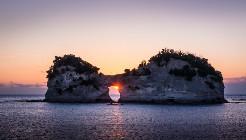
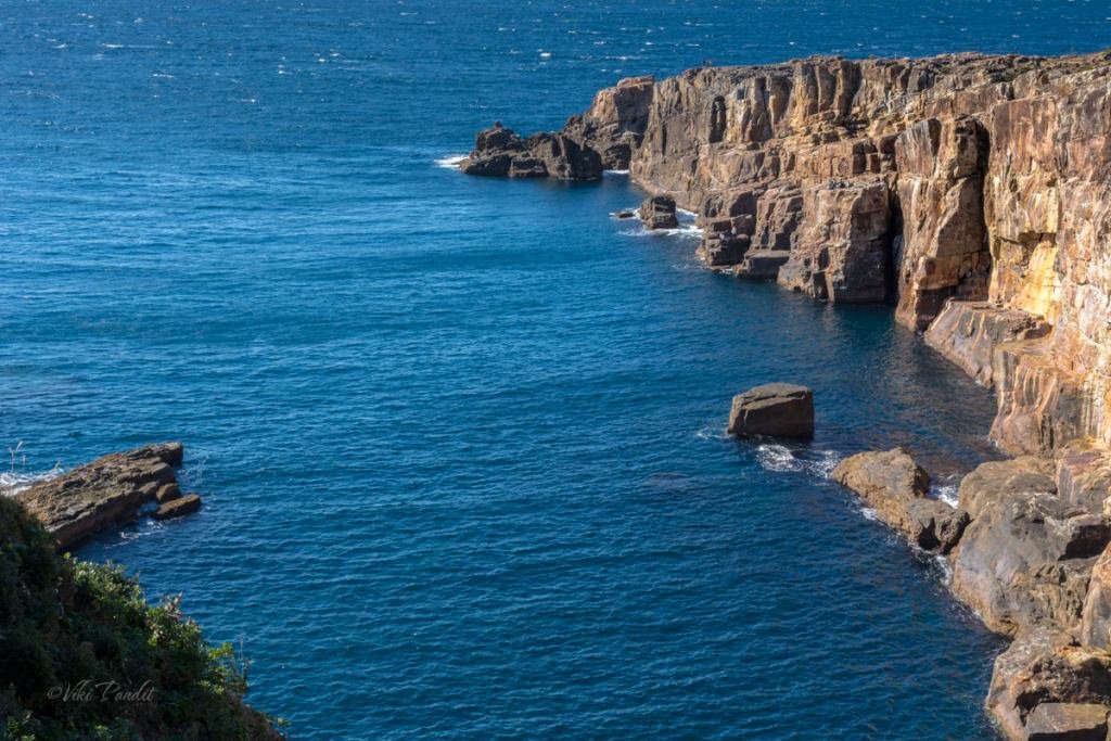
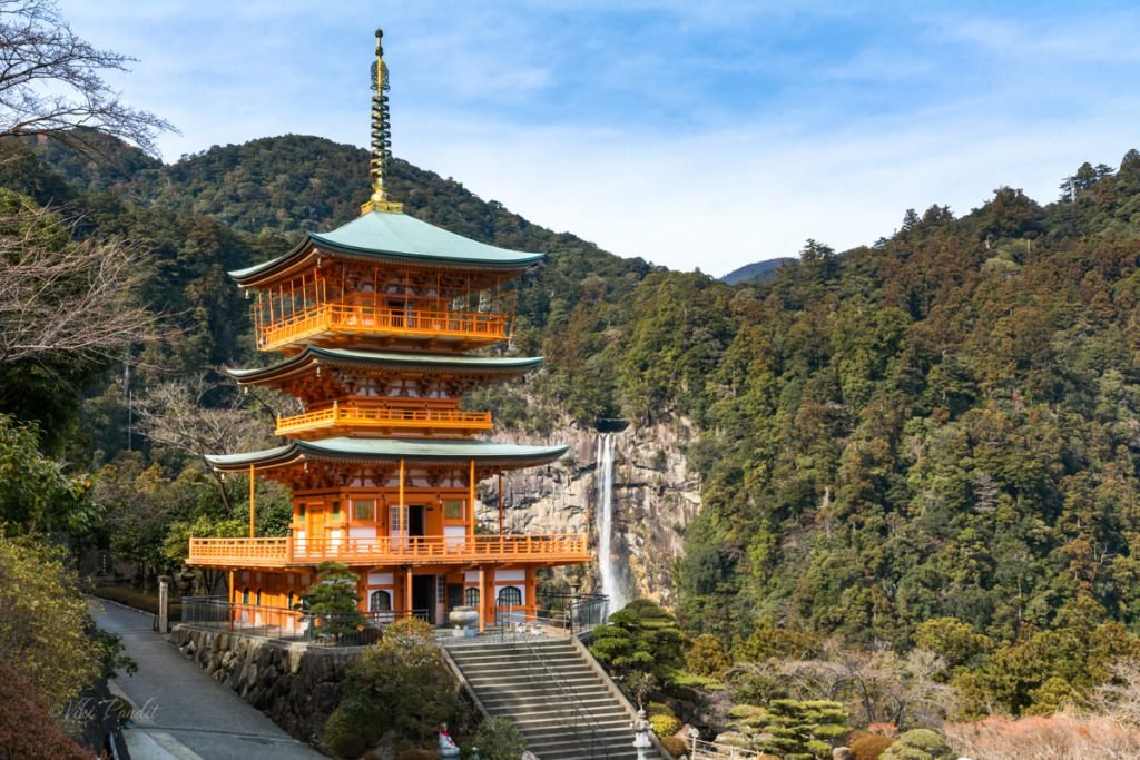
Hike to Nachi Falls

Today I went back to Wakayama to explore Nachisan and capture the iconic view of Sanjudo Pagoda in front of the Nachi Falls or Nachi-no-taki as it is known locally. After the exploits of my first outing on my own to Shirahama, I was much more confident today. Shirahama was an amazing experience with the thrilling Sandanbeki Cliffs, the lovely Shirahama Beach, and the most stunning sunset at Engetsu.

Nachi Falls ([那智の滝) in Nachikatsuura, Wakayama is one of the best-known waterfalls in Japan. It is said to be the highest single-drop waterfall in the country at 133 m. The mountain is also popular for Kumano Nachi Taisha, Seiganto-ji Temple, Sanjudo Pagoda, and the Hiryu-jinja Shrine all of which can be found in the vicinity of the waterfall.

How to get to Nachi Falls from Nara/Osaka

I used the same approach as the day before while visiting Shirahama. I started a bit earlier at about 6 am. Since Nachi is further away, I wanted to have some cushion so I would have more time on hand to roam around the temple grounds.

I reached JR Nara Station at about 6.30 am and caught the next available train to Tennoji. From Tennoji I took the 7.79 am Kuroshio Limited Express, bound for Kii-Katsuura Station. If you are traveling from Osaka, you can catch the same train from JR Osaka Station.

The Kuroshio Limited Express is the fastest way to reach Nachi from Osaka

The train was mostly empty. I found myself a window seat. If you have the option, choose the window seats on the right. The view is amazing as the train travels along the pacific coast for the better part of the ride. The interiors of the train are luxurious and the big clear windows make for a lovely experience for those who love to watch the scenery as the train goes.

The Kuroshio Express passes through some beautiful countryside. After crossing the Wakayama Station, the train line moves almost parallel to the coast, going past rocky cliffs along the blue sea. The cliffs near Kushimoto Station, located on the southern tip of the Kii Peninsula are especially interesting – shaped like a natural bridge going into the ocean.

Bus to Nachi Falls

After a long ride of three and a half hours, I reached Kii Katsuura Station at 11.33 am. It is one of those quaint little stations you see in the rural areas of Japan.

The tourist information booth is located inside the station premises. The lady at the counter provided me a printed map. She was pleasantly surprised when she came to know that I was from India as not many foreigners come all the way down there.

She plotted out for me a “Nachisan Excursion Course”. The course would start from Daimon Zaka Slope and go up to Nachi Falls, via the Kumano Grand Shrine, Nachisan Seiganto-ji Temple, and the Sanjudo Pagoda. She also informed me that it would take me about 2 hours to complete the hike to Nachi Falls. Once she had provided me all the information, she directed me towards the bus stop nearby from where I was supposed to catch the bus to Nachi Falls.

Outside the station, I found a vending machine serving hot french fries amongst other fast food items. I wasn’t sure if I would find a proper eatery on the Nachi mountain, so I got one for myself and put it in my backpack for later.

There are a number of restaurants and shops near the station. The shops were mostly empty at this time of the day, with very few people around. The next bus to Nachi Falls was scheduled for 12.30 pm, so I wandered around the area looking for some souvenirs.

A small group had gathered near the bus stop by the scheduled time. Most of them were Japanese couples. I didn’t notice any foreigners among them. This bus also makes a stop at Nachi Station too, in case you are arriving via Mie.

As the bus drove through the town, one can see many abandoned broken-down buildings in the area. The typhoon Talas that struck in 2011 had been quite severe on the town of Nachikatsuura. Once the bus moved into the outskirts of the city and entered the mountains, it was a much more serene view.

It takes about 20 minutes to reach Daimon Zaka Bus stop from the Kii Katsuura Station. The ride costs me ¥420. A young couple also got down with me. The bus continued on with the rest of the tourists to Nachisan.

I could have gone directly to Nachi-san but I wanted to hike through the primeval forest. What is the fun of coming to this beautiful countryside if one doesn’t experience the unique landscape of Kumano’s spiritual forest?

Kumano Kodo Daimon Zaka slope

Daimon-zaka means “large gate” referring to a gate that once stood at the entrance to the slope. I was not really sure which way to go, so I followed a narrow path going towards high ground, hoping it was the right trail.

Meoto Sugi

The path leads up to two huge cedar trees, standing on either side, which serves as a beginning to the Daimon-zaka Slope. These two almost 800-year-old cedar trees are known as Meoto Sugi (Married Couple) Trees. For centuries these trees have been standing together welcoming pilgrims and tourists – making their way up the hill. In 2000, the locals came together and performed a wedding ceremony between them. It is believed that couples marrying between these trees will find eternal love.

Beyond the married cedar trees, the path gives way to an ancient cobblestone staircase called Kumano Kodo trail which runs from the base of the valley all the way to the parking lot near Nachi San.

Kumano Kodo Trail in Nachi

The Kumano Kodo (Ancient road of Kumano) is a network of pilgrimage roads that link all three major sacred sites in the Kii Mountain range. Japan’s Kumano Kodo trail is one of only two pilgrimages in the world with UNESCO World Heritage status – the other being Spain’s Camino de Santiago. During the Heian period, people used to make the pilgrimage from Kyoto to Kumano Taisha using this trail. The trail, however, is not limited to Nachi. Its total length is about 300 km extending across the prefectures of Wakayama, Nara, and Mie. In July 2004, the Kumano Kodo, pilgrimage routes were registered as UNESCO World Heritage as part of the “Sacred Sites and Pilgrimage Routes in the Kii Mountain Range

A fleet of rocky steps took me up the Daimon Zaka slope. The massive cedar trees surrounding the trail create a divine atmosphere in the primeval forest. The Kumano Kodo’s rugged, forested mountains, quiet rural valleys, rivers, and waterfalls provide a spectacular backdrop for hikers.

At a point in the trail, the forest opens up beside the road. From the road, though very far away, I could see the top of Sanjudo Pagoda.

The trail is properly maintained and easy to climb. Mani, my wife, was here in December when it had rained profusely and the slopes were a bit slippery. So, fellas, keep an eye out for the weather before you embark on this hike.

I reached the parking lot in about half an hour and about 270 steps. The hike is not very tough and I saw several aged Japanese making their way down, as I was hiking up the hill.

Kumano Nachi Grand Shrine

Once I came out of the Daimon Zaka slope, there is a series of long steep stairs to get to Kumano Nachi Grand Shrine. Kumano Nachi Taisha (熊野那智大社) is a Shinto shrine and part of the UNESCO-designated World Heritage Sacred Sites and Pilgrimage Routes in the Kii Mountain Range. Its main deity is Izanami no Mikoto, who is a deity of unity. Along these stairs, you can find numerous shops selling black stone souvenirs.

Climbing up, I reached a fork on the stairs. The left one with a big red Torii led to Kumano Nachi Taisha. I decided to skip the Shrine for now and if time permitted return back to see it.

Kanzeon Bosatsu

To the right, just at the fork in the stairs, one can find a small wooden temple with a statue of Kanzeon Bosatsu, merciful hermaphrodite Goddess (観世音菩薩) is one of the five great Bodhisattva who administers mercy and compassion. A stone pillar in front says “For World Peace.

Kanzeon (観世音) can be broken down into three words – the one who constantly surveys (kan 観) the world (ze 世) listening for the sounds (on 音) of suffering. Kanzeon and Kannon is used in Japanese with the same meaning. You might think why these sound almost similar. Well… Kanzeon was shortened by removing the ze(世) to make it Kannon.

Seiganto-ji Temple

A few paces later, I found myself in front of the Seiganto-ji Temple. I lit some incense sticks at the altar. Seiganto-ji is the first temple that is visited in the Saikoku 33 Kannon Pilgrimage. It is said that Seiganto-ji was established by an Indian monk, Ragyo-shonin, who happened to travel to the Nachisan area and practiced ascetic Buddhism at the base of Nachi Falls in the 4th century. As such, the original build of the Seiganto-ji qualifies to be the oldest temple in the Kumano area.

The original buildings were destroyed during the Japan unification war. What we see currently was re-built in 1590 AD on the orders of Hideyoshi Toyotomi (who was the Military General and a friend of Oda Nobunaga). Seiganto-ji was designated as a World Heritage Site in 2004. The main worshiped deity here is Kanzeon Bosatsu (also known as Bodhisattva Kannon).

From the temple grounds, on the other side, one can get a full view of the Kii mountain range. I didn’t spend too much time in this area – given my rush to capture the iconic Sanjudo Pagoda in front of Nachi Falls.

Sanjudo Pagoda

After walking down a fleet of stairs I finally found myself in front of the vermilion pagoda juxtaposed with the cliff-diving Nachi Waterfall. It is hard to explain in words the majestic view of the waterfall in the backdrop, with the vermilion pagoda standing against it. I can only imagine how this view might have influenced the spirituality of the residents in the temples and shrines here. This is definitely the most beautiful photo of Nachi Falls that I have captured.

Religious Significance of Nachisan

Since ancient times people have considered this area to be a pilgrimage. For centuries people have visited these lands believing in the mystic powers of the mountains of Kumano. One of these beliefs is that if a worshiper prays at the Three Grand Shrines, he or she can attain salvation. The shrines thus attract many pilgrims ranging from members of the Japanese Imperial Family to the common folks.

I took a few more photos of the stunning pagoda with the Nachi-no-taki together. If you have time do not miss going up to the top balcony of the Pagoda.

The hike had made me hungry. I dug into the french fries I had obtained from the vending machine at the Kii-Katsuura station. I was also carrying a couple of shrimp Onigiri with me. After the quick lunch, I just laid down on one of the seats in front of the pagoda, mesmerized by the amazing view.

Nachi Waterfall

It was 2.30 pm already. After the quick rest, I walked downhill along the road towards Nachi Falls. A few meters downhill there is a narrow stone path cutting through the forest, towards the Nachi Falls.

One can also take the road if you don’t want to cut through the forested trail.

After walking for about 15 minutes I was at the gates of Hirou Shrine, one of the three Kumano Grand Shrines. It was also a relief to see the bus stop just nearby.

Hirou-jinja

Hirou Shrine’s gate marks the entrance to the Nachi Falls. I went through the Torii to a wide stone stairway that goes directly to the base of the waterfall. The cedar trees are much more massive here than anywhere on the trail.

At the base, I took a breather in front of the cascading waterfall. Flowing between the peaks of the Kumano Nachi mountain, the Nachi River creates over 48 waterfalls. Nachi Falls, also known as Nachi-no-taki, is the largest of them.

If one wants a closer look at the waterfall, one can enter the shrine and take the stairs up towards a wooden deck. It costs ¥200 to enter the shrine. From the vermilion deck, you can get the best view of Nachi falls as the water falls from the incredible height, hits the rocks below, and transforms into a small stream at the foot of the waterfall.

While coming down there is a small reservoir with natural spring flowing through the mouth of a stone-carved dragon head. Drinking spring water is supposed to give one good health. I filled my bottle with some to take back home for my wife.

It gets dark early in these mountains. It was only 4 pm but the light had begun to fade. I went back to the bus stand and waited anxiously for the next bus to show up. Anxious, because the last train to Osaka was at 6.10 pm and I didn’t want to miss it. Missing that last train would have left me stranded in Nachi. Thankfully, the Japanese are very punctual and the bus arrived exactly at 4.25 pm and I reached Kii Katsuura station by 4.50 pm.

Waiting at the platform it was hard not to be still lost in those memorable moments that I spent at the stunning Nachi Falls. I had a wonderful time in the mountains of Nachi. Though the pilgrimage has been in operation since ancient times, it still remains quite off the map for most tourists. That inadvertently resulted in a richer experience for people like me who love silence. If you are planning a day trip to Nachi Falls, I would advise visitors to stay back for a night in Nachi so you can start the tour early in the morning. I missed out on exploring the Kumano Nachi Taisha because of lack of time.

Train from Nachi to Osaka

Nachi is a journey into the realm of nature that brings purification to the soul. For centuries Japanese pilgrims have walked the Kumano Kodo, a more than 1,200-year-old network of trails that pass cedar forests, cascading waterfalls, and picturesque villages in the Kii Mountains.

Nachi being the terminal station, the train pulled into the station about 20 minutes early. I got myself a bag of peanuts and took my seat on the train. It was a near 4-hour journey back to Tennoji. The hike had taken a toll on me. I turned on my music playlist thinking of the charming elevated temple with the lovely view of Nachi Falls. I spent nearly 8 hours traveling for that one memory of the magnificent vermillion three-story pagoda and I will tell you that it was worth it.

Stretching across the Kii Peninsula on the island of Honshu, the pilgrimage takes us off the beaten track into a world of stunning scenery, soothing hot springs, delicious food. This journey through southern Wakayama and the Kumano Kodo will prove to be one of the most exceptional experiences you will have during your trip.

Thanks for reading. Leave me a comment if you liked the post or follow my story as I visit the illuminated Kenrokuen Garden in Kanazawa.

What are the hike challenges?

The Kumano Kodo is a mountain trek with waterfalls and shrines and physically demanding. Set mostly in the deep forest, there are a number of steep ascents and descents along the trail. I would highly recommend walking poles.

Kumano Kodo trail Information

I only covered a fraction of the Kumano Kodo trail. For the full route, please allow 7 days in total, including rest days.

Admission fees

Most of the areas I visited were free. To enter the shrine at the base of Nachi Falls it cost ¥200 per person.

Bus Schedules – Nachi Falls

Provided below are the bus time tables between Kii Katsura Station and Nachi Falls. Please note Nachi Falls is not the terminal stop. There another stop that goes all the way up to Nachisan mountain.
Updated March 17th 2018
Timings & fares are subject to change

Bus fare from Kii Katsura Station (Adult / One Way)
Daimonzaka: ¥420
Nachisan / Nachi-no-Taki-mae( Falls): ¥620

Kii-Katsuura Station to Nachi Falls

Nachi Falls to Kii-Katsuura Station

Eye of Engetsu

This is a three-part story which began at dawn, with me traveling all the way from Nara to Wakayama. In Wakayama, Sandanbaki Cliffs wes the first place I visited. After spending a couple of hours at the cliffs I walked down to the lovely Shirahama beach.

The bright morning had grown into a lovely afternoon. I was in the mood for a long walk, so I left the white sands of Shirahama Beach and started my walk towards Engetsu Island.

Engetsu Island is a small white sandstone island just off Shirahama’s coast in Wakayama Prefecture. From the beach, it took me about 30 minutes on foot to reach the Engetsu viewpoint. Buses are available, but they run at long intervals, so you have to time yourself perfectly or you will end up losing a lot of time waiting.

Engetsu Island

The rock island’s formal name is Takashima, but it is widely known as Engetsuto, which is literally translated to “round moon island”. This is due to the round-shaped arch in the center of the island. Along the coast there are several points where stairs lead down into the rock formations. It was still early so I walked past the sunset viewpoint towards the end of the coastline.

Engetsu Island is also a place of historical significance, as it was the site of a major battle between the Taira and Minamoto clans during the Genpei War in the 12th century.

On the way I passed an aquarium and a Glass boat ride. The rides on the glass boat are scheduled at hourly intervals. I had a free ticket to the glass boat from my all day pass but I was more in anticipation of seeing the thrilling sunset.

As I walked past the dock, I saw a cave at the edge of the coast. I had some 30 minutes on my clock so I went inside. It’s a small cave that opens up towards the sea.

I was thirsty after the long walk. After grabbing a Coke from a nearby vending machine, I started my walk back to the sunset viewpoint.

Sunset at Engetsu Island

The tide was low and the rocky banks were a perfect place to sit and gaze at this marvel of nature. I went down and sat at one of the boulders nearest to the sunset point. At times the tide goes so low that people can even walk to the island, but it is forbidden because the island is not very stable and sea urchins lying on the sea-bottom can cause injuries.

The island’s sandstone rocks have become less stable throughout the years The arch was artificially repaired in 2011 to make it earthquake-proof. I sat there for some time, lost in the stunning beauty amidst the sea.

As the sun slowly descended, I went up the stairs to the viewpoint. A small crowd had gathered, mostly locals. The sun was almost ready to show itself inside the hollow arch, so I quickly set up my gear and got ready for the iconic shot. Some thick clouds on the horizon did not allow the sun to stay for long.It came and went away so fast, but I got my shot!

This shot was taken handheld as a huge crowd had gathered to witness the amazing sun as it passed within the arch of Engetsu

After the sunset I walked back towards the beach. Buses are rare this side of the town and I hoped to have better luck getting one from near Shirahama beach. However on reaching the bus stop, I figured it was best if I walked back all the way to the station rather than wait half an hour for the next bus to come along.

Because I walked to most of the places, I didn’t use the bus pass to its full extent. The train arrived on time and I was on my way back home.

Engetsu Island is a unique blend of natural beauty and human history. The island’s unique shape, picturesque scenery and the lighthouse are some of the main attractions that draw visitors to the island. The island is also a popular spot for photography, with its beautiful landscapes, sunsets and sunrises. A day trip from Osaka to Wakayama can be easily done and if you start early you can visit all the three interesting spots that I was able to cover. After the day tour, the sunset at Engetsu is like a cherry topping. If you are in Shirahama, it a must visit place. An all day bus pass costs 1100 Yen. It covers all the major attractions in Shirahama including the thrilling Sandanbeki cliffs.

Thanks for reading. Please do leave me a comment if you liked the post follow my story as I come back to Wakayama in a couple of days to visit the magnificent Nachi Falls.

White Sands of Shirahama Beach

From the thrilling cliffs of Sandanbeki, I walked down the road towards Shirahama Beach. Buses are available at regular intervals but the intervals are spread out during the afternoon. The next one was not scheduled to come soon, so, I decided to walk down to the beach. We had passed it while coming down from the station and it didn’t feel very far away.

Shirahama in Wakayama is known for its Onsen resorts and the beautiful white sand beach. It is not very far from Osaka and makes for a nice day trip. There are other places in Japan called “Shirahama” which can easily lead to confusion. The Shirahama beach in Izu Peninsula in Shizuoka Prefecture is also very popular and easily confused with.

I was the lone person walking on the road. After a few minutes I reached the Under Sea Observation Tower. I hadn’t planned on visiting it since my main goal was to get to Engetsu Island to capture the iconic sunset.

The road goes downhill towards the beach. As I walked past the Observation Tower, I noticed some fishing boats moored to the pier. Near the pier there is a fisherman’s market stocked with unlimited marine delicacies. I am sure Mani would have gone crazy seeing the delicious spread.

I rested for a bit at the market and the n started back on the road towards the beach. Within a few minutes I was at the lovely beach.

Shirahama Beach is located in Kanayama Bay. The left side of the beach has been landscaped with some rocks possibly to keep the waves in check. The white powdery sands were like none I have witnessed before. I hear they have been imported from Australia. The wind was not strong, but As I walked, my footsteps were blown away in the light sand.

The beach itself is not very huge and there weren’t many tourists around. A group of kids were on the beach, possibly on a tour from their school. I walked along the crescent-shaped beach thinking of Mani. It was so beautiful out there.

The sparkling transparent waters were inviting me to take a dip, but I had come unprepared.

The beach is quite small and I was at the other end in just a few minutes. On the other side of the beach there’s a small shrine. I wandered around for some time going to the edge of the beach where some boulders were lying on the path. They keep falling from the edge of the sandstone cliffs so I didn’t go further.

It was 3 pm when I brought myself to leave the enchanting beach for Engetsu. Time flows quickly in these beautiful places. Buses are relatively scarce along this route, so I had to walk down the coastline.

Shirahama Beach in Wakayama is one of the most beautiful beaches I have seen. The soft white sands and the blue green waters are enchanting. I would love to come back to Shirahama with my lovely wife someday.

Thanks for reading. Leave me a comment if you like the post or follow my story as I hurry towards Engetsu Island to capture the iconic sunset that makes Shirahama a photographers delight.

The towering Sandanbeki Cliffs

Today I ride out of Nara on my own for the first time. I am headed for the beautiful town of Shirahama in Wakayama Prefecture.

I woke up early and walked down to the JR Nara station at 7 am. In the early morning, the streets were devoid of people. Walking past the closed stores, it took me about half an hour to reach the JR Station. I activated my 21 day JR Pass at the ticket counter and walked down to the platform. The JR Pass allows me access to unlimited rides on all JR Trains across Japan. I have a long list of amazing places on my bucket list that I hope to visit over the next 21 days.

Nara to Shirahama

Google Maps is a great help for looking up train schedules in Japan. To go to Wakayama I had to first catch a local to Tennoji and from there change to an express train to Shirahama. The next train was scheduled after a few minutes. I grabbed a melon bread from a 7-Eleven store at the station and waited for the train. The wait wasn’t long and the train arrived in a few minutes. The local train chugged on to the platform, and luckily it was pretty empty. I grabbed a window seat. The ride to Tennoji is about 40 minutes. As the train sped along, I finished off the melon bread, watching the lovely countryside.

At Tennoji it took a bit of hunting around to find the correct platform for the train bound for Shirahama. Without the knowledge of Japanese, it can be tough finding the correct platforms but Mani had taught me well.

I caught the 9:21 am Kuroshio Limited Express to Shingu. There are no Shinkansen lines on this route and limited express trains are the fastest way to travel. The Kuroshio Limited Express does not stop anywhere before Wakayama Station. Thereafter it stops at a few important ones, before reaching Shirahama in about 2 hours.

It was a lovely sunny day with blue skies and I passed through some beautiful countryside. After passing through Wakayama Station, the train runs almost parallel to the coastline and the it passed by numerous cliffs.

I reached Shirahama at 11.28 am. I had done my research and walked directly to the tourist information center. At the center, I explained to the lady sitting at the counter in English that I needed the full day bus pass. I also told her about the places I wished to go to. She fished out a map and drew me a route that was best for me to follow. She also pointed me towards the bus ticket office which is just outside to the left of the Shirahama Station.

The bus pass cost me ¥1100. There are times when I am not able to fully utilize the cost of these passes, but it gives me a sense of relief in case I make any mistake anywhere, the pass saves me the blushes. The bus to Sandanbeki Cliffs was leaving in a few minutes. I went forward and boarded the bus. A handful of chirpy Chinese tourists were also on the bus.

We reached Sandanbeki Cliffs in half an hour. On the way we passed the exquisite Shirahama beach. The bus dropped us off at the Sandanbeki Cliffs stop.

Sandanbeki Cliffs

From the bus stop one has to walk for a few minutes towards the ocean to reach the towering cliffs. In the beautiful weather, a fat cat was lazing in the soft sun as I walked towards the ocean. At the end of the street was a narrow gravel path. 

After a 10 minute walk I was at the rocky cliffs overlooking the vast blue Pacific. Sandanbeki translates to Three Step Cliff. There are 3 protruding rocks in the shape of a dinosaurs claws. The face of the 50 meter high cliffs extend up to 2 km from south to north near the town of Sandan.

Sitting down on the rocks I gazed at one of nature’s spectacular marvels – the ocean’s blue current unleashing wave after wave and sending them crashing up against the breath-taking cliffs.

The cliffs are made up of tertiary rocks and there is no danger of them collapsing down into the ocean. The rocks are very similar in nature to the ones I came across at Hampi in South India. So I went forth towards the edge to have a better view over the ocean. These were enormous cliffs and it was dizzying standing at the edge. Some people had made their way down towards the lower cliffs. Not sure how they got there but I was alone and wasn’t going to try any heroism on that day. The rocks are inviting but also deadly if you fall in. I found a nice viewpoint and took some pictures. The waves were relatively calm on the day. I have seen pictures of the cliffs, whence on stormy days, the waves would lash into the top of the cliffs.

Sandanbeki Doukutsu and the legend of the Kumano Pirates

Hidden at the bottom of one of these three cliffs is Sandanbeki Doukutsu, a cave where Kumano pirates of the Heian Era (794-1185) once hid their boats. The story goes that in the second half of the 8th century, during the reign of Kanmu-tenno, the sea was raided by a pirate called Tagamaru. His bunch of pirates would appear out of the blue, raid a ship and then disappear mysteriously into the sea. They were referred to as kaizoku, which literally means “sea robbers.” However they were not merely robbers and played an important role during the conflicts between the Taira and Minamoto clans in the late Heian Era. They used to operate around Kumano Onigashiro and the cave at Sandanbeki was suspected to be one of their hideouts. However looking at it, I seriously doubt a boat can make its way safely near those jagged rocks on a stormy day.

Nearby there is an underground limestone cave, which is said to have been the hideaway for the pirate ships. The cave is located at sea level and can entered via an elevator. The elevator will take you 36 m below ground to the pirate’s hiding spot. The cave also features a museum. While the museum is more or less a presentation of legends and Medieval weaponry, the cave itself makes for a unique experience. But I was short on time and I had to miss out.

I walked down to the other side of the cliffs. There is a safer viewpoint here, surrounded by a wooden fence. A number of seats are placed for the visitors where one can sit and watch the towering cliffs, created by the erosion of the waves. The view of the tide hitting the surface of the rock face makes one admire the strength of the cliffs that have withstood the brunt of those raging waves all these years and still stand tall to this day.

Beneath the platform or viewpoint there are some bushes and trees growing on the rocks. The much higher cliffs were to my right. From here I could feel how dangerously I had been standing a few minutes before on the edge of the cliff.

It was afternoon by the time I had my fill of the place. My next stop was the Shirahama Beach  so I walked down to the bus stop. Unfortunately, the bus was not scheduled to come around before an hour, so I started walking down towards the beach. The bus had passed it on the way up and it didn’t feel very far away.

The two kilometers of steep cliffs and the raging waves striking the cliffs are certainly exciting and memorable. Photographs can never tell the emotions I felt standing on the steep cliff. I hope they can inspire some of you to reach out and witness what I have. If you have the chance to tour Wakayama, do not miss this unique experience.

Thanks for reading. Leave me a comment or follow my story as I walk down to the white sands of Shirahama Beach.