Hike to Nachi Falls

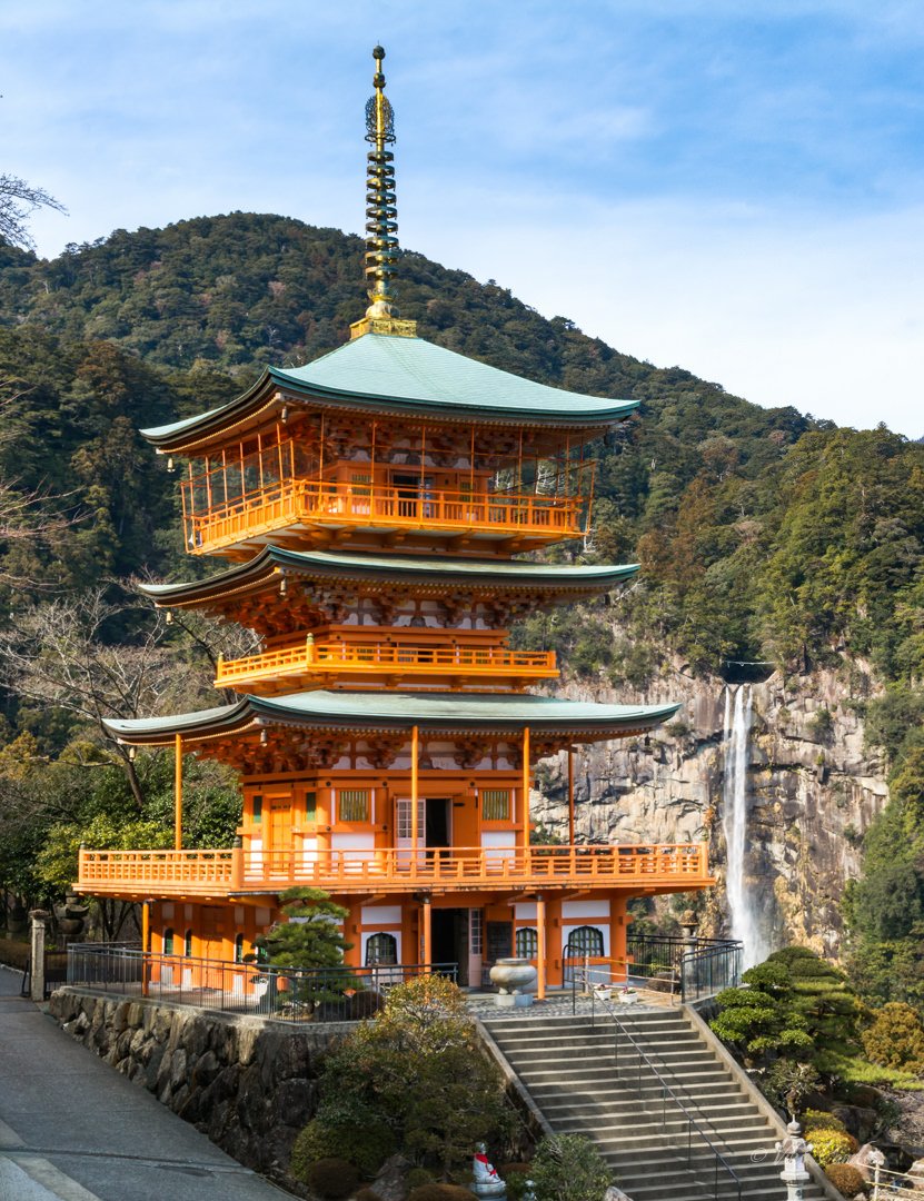
Today I went back to Wakayama to explore Nachisan and capture the iconic view of Sanjudo Pagoda in front of the Nachi Falls or Nachi-no-taki as it is known locally. After the exploits of my first outing on my own to Shirahama, I was much more confident today. Shirahama was an amazing experience with the thrilling Sandanbeki Cliffs, the lovely Shirahama Beach, and the most stunning sunset at Engetsu.

Nachi Falls ([那智の滝) in Nachikatsuura, Wakayama is one of the best-known waterfalls in Japan. It is said to be the highest single-drop waterfall in the country at 133 m. The mountain is also popular for Kumano Nachi Taisha, Seiganto-ji Temple, Sanjudo Pagoda, and the Hiryu-jinja Shrine all of which can be found in the vicinity of the waterfall.

How to get to Nachi Falls from Nara/Osaka

I used the same approach as the day before while visiting Shirahama. I started a bit earlier at about 6 am. Since Nachi is further away, I wanted to have some cushion so I would have more time on hand to roam around the temple grounds.

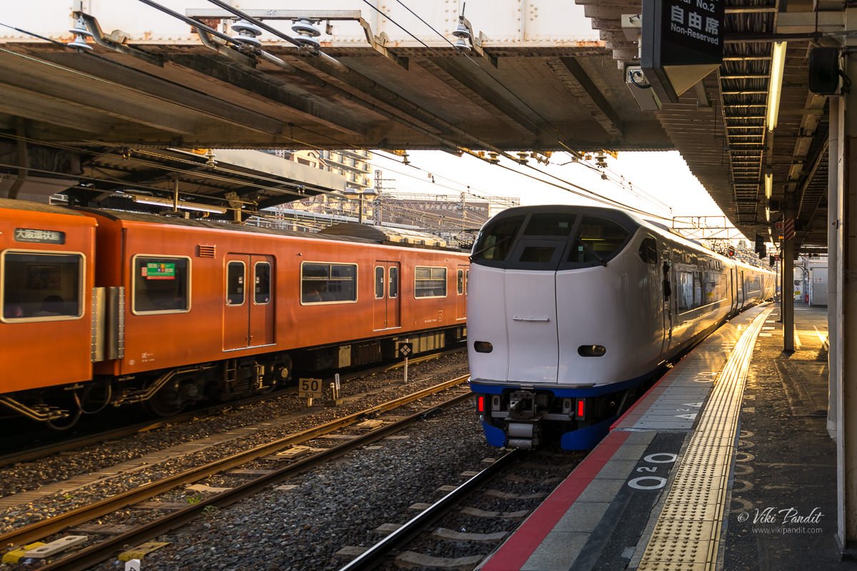
I reached JR Nara Station at about 6.30 am and caught the next available train to Tennoji. From Tennoji I took the 7.79 am Kuroshio Limited Express, bound for Kii-Katsuura Station. If you are traveling from Osaka, you can catch the same train from JR Osaka Station.

The Kuroshio Limited Express is the fastest way to reach Nachi from Osaka

The train was mostly empty. I found myself a window seat. If you have the option, choose the window seats on the right. The view is amazing as the train travels along the pacific coast for the better part of the ride. The interiors of the train are luxurious and the big clear windows make for a lovely experience for those who love to watch the scenery as the train goes.

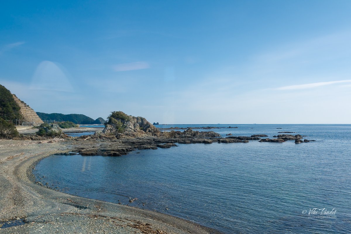
The Kuroshio Express passes through some beautiful countryside. After crossing the Wakayama Station, the train line moves almost parallel to the coast, going past rocky cliffs along the blue sea. The cliffs near Kushimoto Station, located on the southern tip of the Kii Peninsula are especially interesting – shaped like a natural bridge going into the ocean.

Bus to Nachi Falls

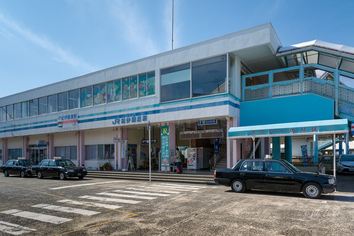
After a long ride of three and a half hours, I reached Kii Katsuura Station at 11.33 am. It is one of those quaint little stations you see in the rural areas of Japan.

The tourist information booth is located inside the station premises. The lady at the counter provided me a printed map. She was pleasantly surprised when she came to know that I was from India as not many foreigners come all the way down there.

She plotted out for me a “Nachisan Excursion Course”. The course would start from Daimon Zaka Slope and go up to Nachi Falls, via the Kumano Grand Shrine, Nachisan Seiganto-ji Temple, and the Sanjudo Pagoda. She also informed me that it would take me about 2 hours to complete the hike to Nachi Falls. Once she had provided me all the information, she directed me towards the bus stop nearby from where I was supposed to catch the bus to Nachi Falls.

Outside the station, I found a vending machine serving hot french fries amongst other fast food items. I wasn’t sure if I would find a proper eatery on the Nachi mountain, so I got one for myself and put it in my backpack for later.

There are a number of restaurants and shops near the station. The shops were mostly empty at this time of the day, with very few people around. The next bus to Nachi Falls was scheduled for 12.30 pm, so I wandered around the area looking for some souvenirs.

A small group had gathered near the bus stop by the scheduled time. Most of them were Japanese couples. I didn’t notice any foreigners among them. This bus also makes a stop at Nachi Station too, in case you are arriving via Mie.

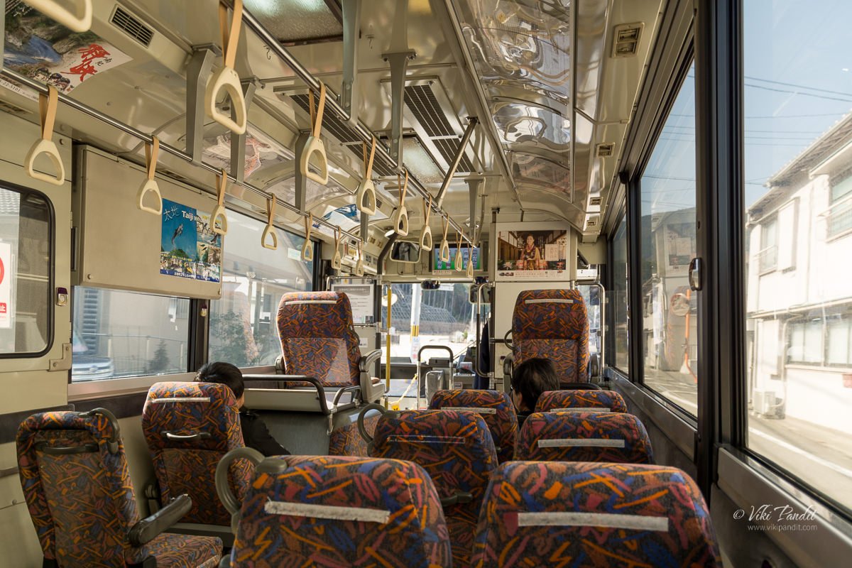
As the bus drove through the town, one can see many abandoned broken-down buildings in the area. The typhoon Talas that struck in 2011 had been quite severe on the town of Nachikatsuura. Once the bus moved into the outskirts of the city and entered the mountains, it was a much more serene view.

It takes about 20 minutes to reach Daimon Zaka Bus stop from the Kii Katsuura Station. The ride costs me ¥420. A young couple also got down with me. The bus continued on with the rest of the tourists to Nachisan.

I could have gone directly to Nachi-san but I wanted to hike through the primeval forest. What is the fun of coming to this beautiful countryside if one doesn’t experience the unique landscape of Kumano’s spiritual forest?

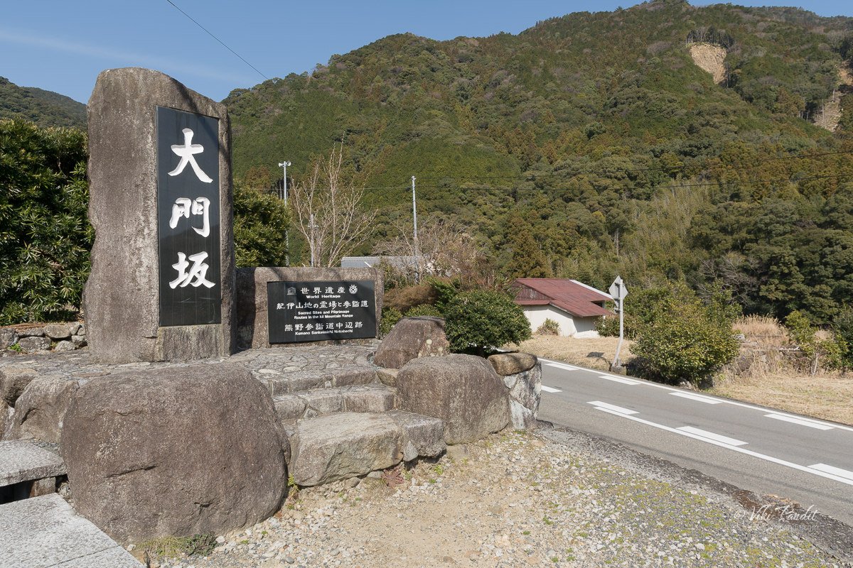
Kumano Kodo Daimon Zaka slope

Daimon-zaka means “large gate” referring to a gate that once stood at the entrance to the slope. I was not really sure which way to go, so I followed a narrow path going towards high ground, hoping it was the right trail.

Meoto Sugi

The path leads up to two huge cedar trees, standing on either side, which serves as a beginning to the Daimon-zaka Slope. These two almost 800-year-old cedar trees are known as Meoto Sugi (Married Couple) Trees. For centuries these trees have been standing together welcoming pilgrims and tourists – making their way up the hill. In 2000, the locals came together and performed a wedding ceremony between them. It is believed that couples marrying between these trees will find eternal love.

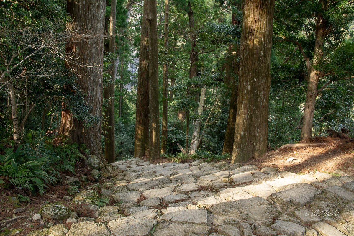
Beyond the married cedar trees, the path gives way to an ancient cobblestone staircase called Kumano Kodo trail which runs from the base of the valley all the way to the parking lot near Nachi San.

Kumano Kodo Trail in Nachi

The Kumano Kodo (Ancient road of Kumano) is a network of pilgrimage roads that link all three major sacred sites in the Kii Mountain range. Japan’s Kumano Kodo trail is one of only two pilgrimages in the world with UNESCO World Heritage status – the other being Spain’s Camino de Santiago. During the Heian period, people used to make the pilgrimage from Kyoto to Kumano Taisha using this trail. The trail, however, is not limited to Nachi. Its total length is about 300 km extending across the prefectures of Wakayama, Nara, and Mie. In July 2004, the Kumano Kodo, pilgrimage routes were registered as UNESCO World Heritage as part of the “Sacred Sites and Pilgrimage Routes in the Kii Mountain Range

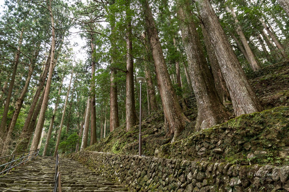
A fleet of rocky steps took me up the Daimon Zaka slope. The massive cedar trees surrounding the trail create a divine atmosphere in the primeval forest. The Kumano Kodo’s rugged, forested mountains, quiet rural valleys, rivers, and waterfalls provide a spectacular backdrop for hikers.

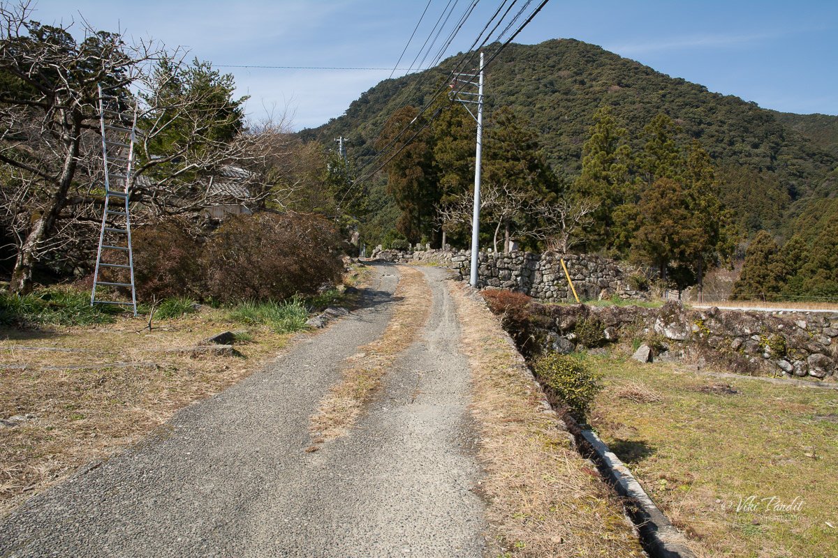
At a point in the trail, the forest opens up beside the road. From the road, though very far away, I could see the top of Sanjudo Pagoda.

The trail is properly maintained and easy to climb. Mani, my wife, was here in December when it had rained profusely and the slopes were a bit slippery. So, fellas, keep an eye out for the weather before you embark on this hike.

I reached the parking lot in about half an hour and about 270 steps. The hike is not very tough and I saw several aged Japanese making their way down, as I was hiking up the hill.

Kumano Nachi Grand Shrine

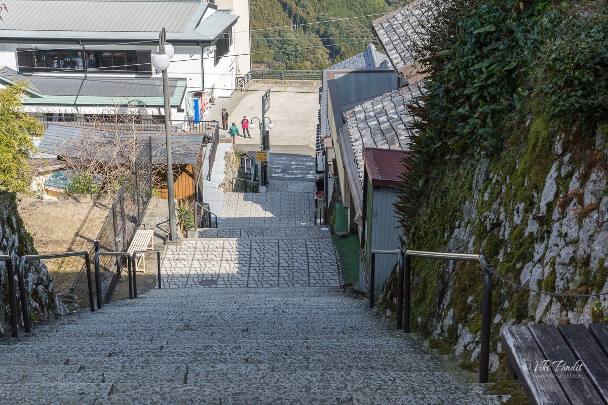
Once I came out of the Daimon Zaka slope, there is a series of long steep stairs to get to Kumano Nachi Grand Shrine. Kumano Nachi Taisha (熊野那智大社) is a Shinto shrine and part of the UNESCO-designated World Heritage Sacred Sites and Pilgrimage Routes in the Kii Mountain Range. Its main deity is Izanami no Mikoto, who is a deity of unity. Along these stairs, you can find numerous shops selling black stone souvenirs.

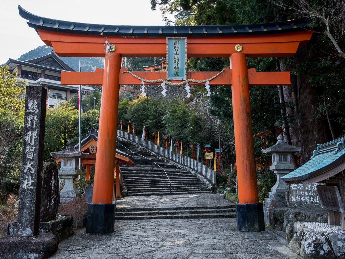
Climbing up, I reached a fork on the stairs. The left one with a big red Torii led to Kumano Nachi Taisha. I decided to skip the Shrine for now and if time permitted return back to see it.

Kanzeon Bosatsu

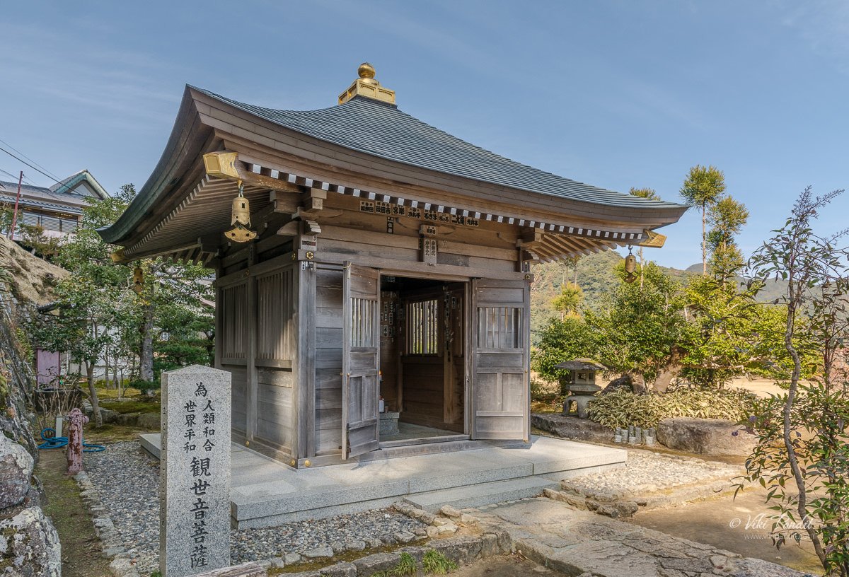
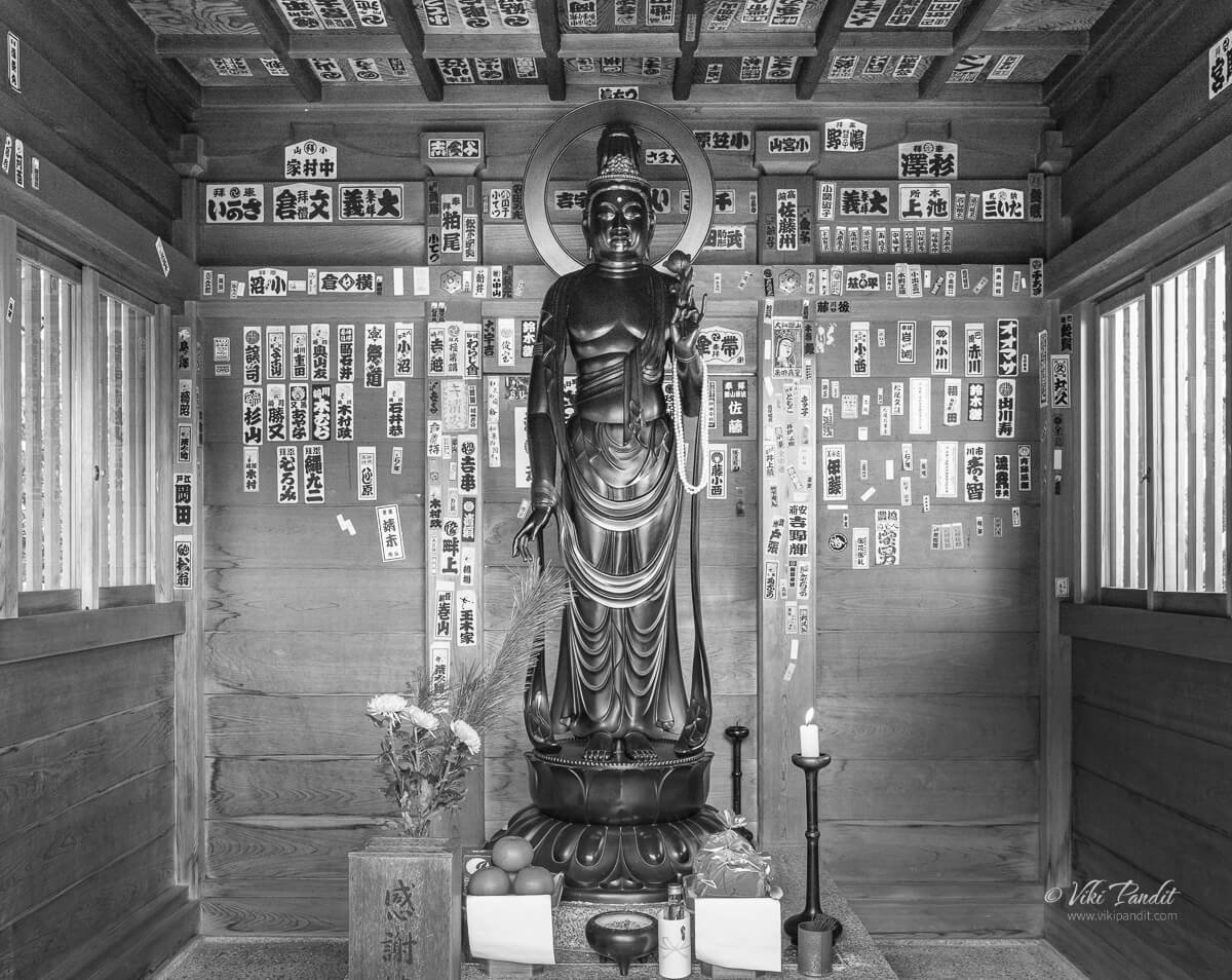
To the right, just at the fork in the stairs, one can find a small wooden temple with a statue of Kanzeon Bosatsu, merciful hermaphrodite Goddess (観世音菩薩) is one of the five great Bodhisattva who administers mercy and compassion. A stone pillar in front says “For World Peace.

Kanzeon (観世音) can be broken down into three words – the one who constantly surveys (kan 観) the world (ze 世) listening for the sounds (on 音) of suffering. Kanzeon and Kannon is used in Japanese with the same meaning. You might think why these sound almost similar. Well… Kanzeon was shortened by removing the ze(世) to make it Kannon.

Seiganto-ji Temple

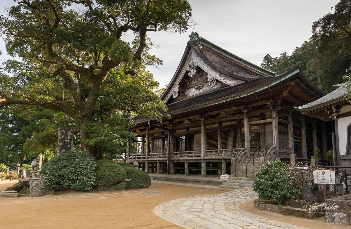
A few paces later, I found myself in front of the Seiganto-ji Temple. I lit some incense sticks at the altar. Seiganto-ji is the first temple that is visited in the Saikoku 33 Kannon Pilgrimage. It is said that Seiganto-ji was established by an Indian monk, Ragyo-shonin, who happened to travel to the Nachisan area and practiced ascetic Buddhism at the base of Nachi Falls in the 4th century. As such, the original build of the Seiganto-ji qualifies to be the oldest temple in the Kumano area.

The original buildings were destroyed during the Japan unification war. What we see currently was re-built in 1590 AD on the orders of Hideyoshi Toyotomi (who was the Military General and a friend of Oda Nobunaga). Seiganto-ji was designated as a World Heritage Site in 2004. The main worshiped deity here is Kanzeon Bosatsu (also known as Bodhisattva Kannon).

From the temple grounds, on the other side, one can get a full view of the Kii mountain range. I didn’t spend too much time in this area – given my rush to capture the iconic Sanjudo Pagoda in front of Nachi Falls.

Sanjudo Pagoda

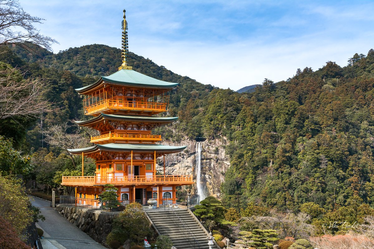
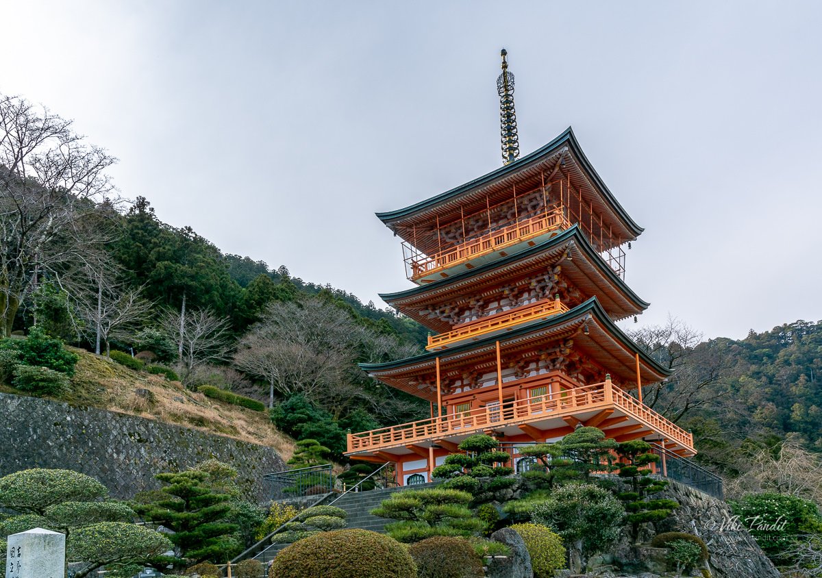
After walking down a fleet of stairs I finally found myself in front of the vermilion pagoda juxtaposed with the cliff-diving Nachi Waterfall. It is hard to explain in words the majestic view of the waterfall in the backdrop, with the vermilion pagoda standing against it. I can only imagine how this view might have influenced the spirituality of the residents in the temples and shrines here. This is definitely the most beautiful photo of Nachi Falls that I have captured.

Religious Significance of Nachisan

Since ancient times people have considered this area to be a pilgrimage. For centuries people have visited these lands believing in the mystic powers of the mountains of Kumano. One of these beliefs is that if a worshiper prays at the Three Grand Shrines, he or she can attain salvation. The shrines thus attract many pilgrims ranging from members of the Japanese Imperial Family to the common folks.

I took a few more photos of the stunning pagoda with the Nachi-no-taki together. If you have time do not miss going up to the top balcony of the Pagoda.

The hike had made me hungry. I dug into the french fries I had obtained from the vending machine at the Kii-Katsuura station. I was also carrying a couple of shrimp Onigiri with me. After the quick lunch, I just laid down on one of the seats in front of the pagoda, mesmerized by the amazing view.

Nachi Waterfall

It was 2.30 pm already. After the quick rest, I walked downhill along the road towards Nachi Falls. A few meters downhill there is a narrow stone path cutting through the forest, towards the Nachi Falls.

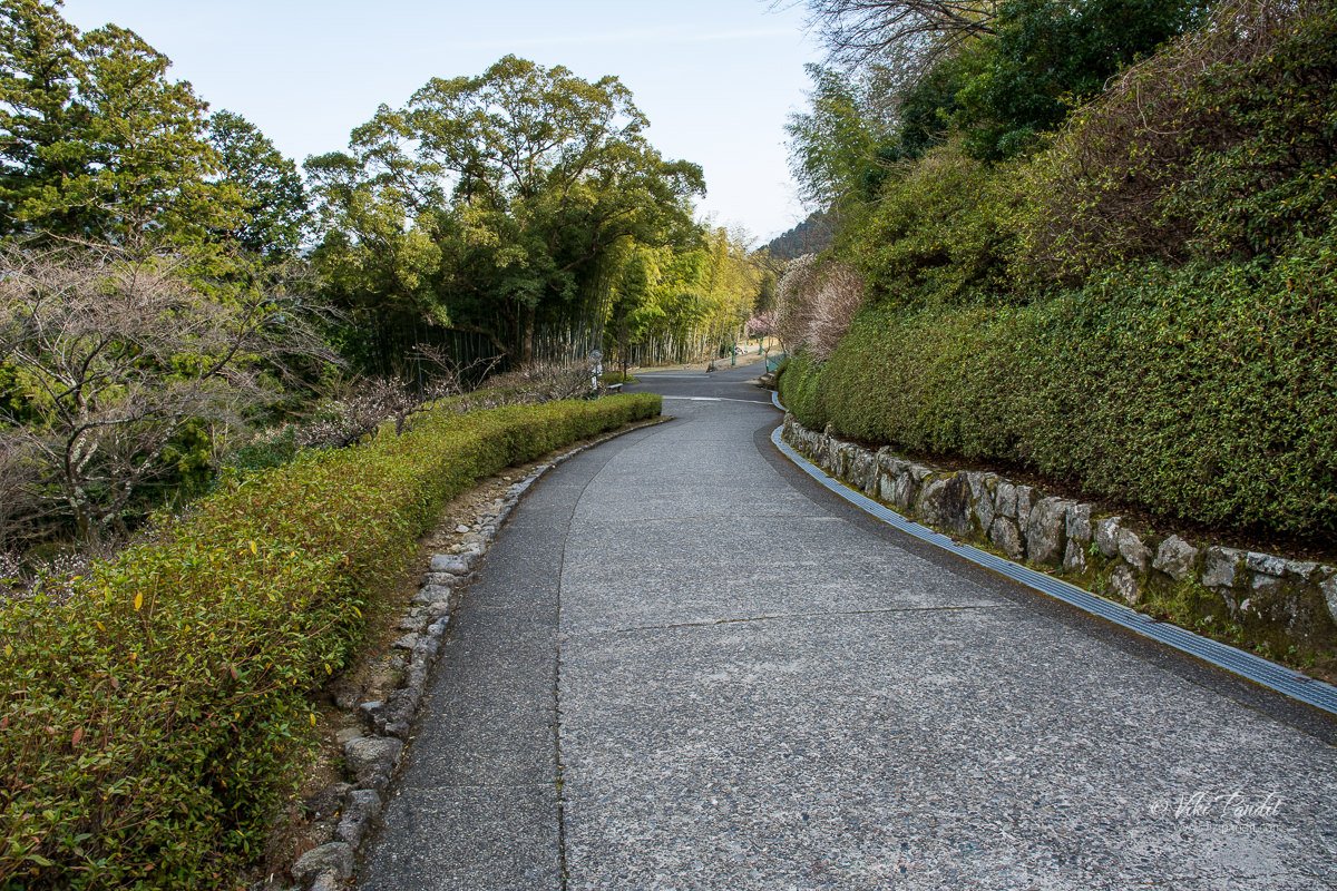
One can also take the road if you don’t want to cut through the forested trail.

After walking for about 15 minutes I was at the gates of Hirou Shrine, one of the three Kumano Grand Shrines. It was also a relief to see the bus stop just nearby.

Hirou-jinja

Hirou Shrine’s gate marks the entrance to the Nachi Falls. I went through the Torii to a wide stone stairway that goes directly to the base of the waterfall. The cedar trees are much more massive here than anywhere on the trail.

At the base, I took a breather in front of the cascading waterfall. Flowing between the peaks of the Kumano Nachi mountain, the Nachi River creates over 48 waterfalls. Nachi Falls, also known as Nachi-no-taki, is the largest of them.

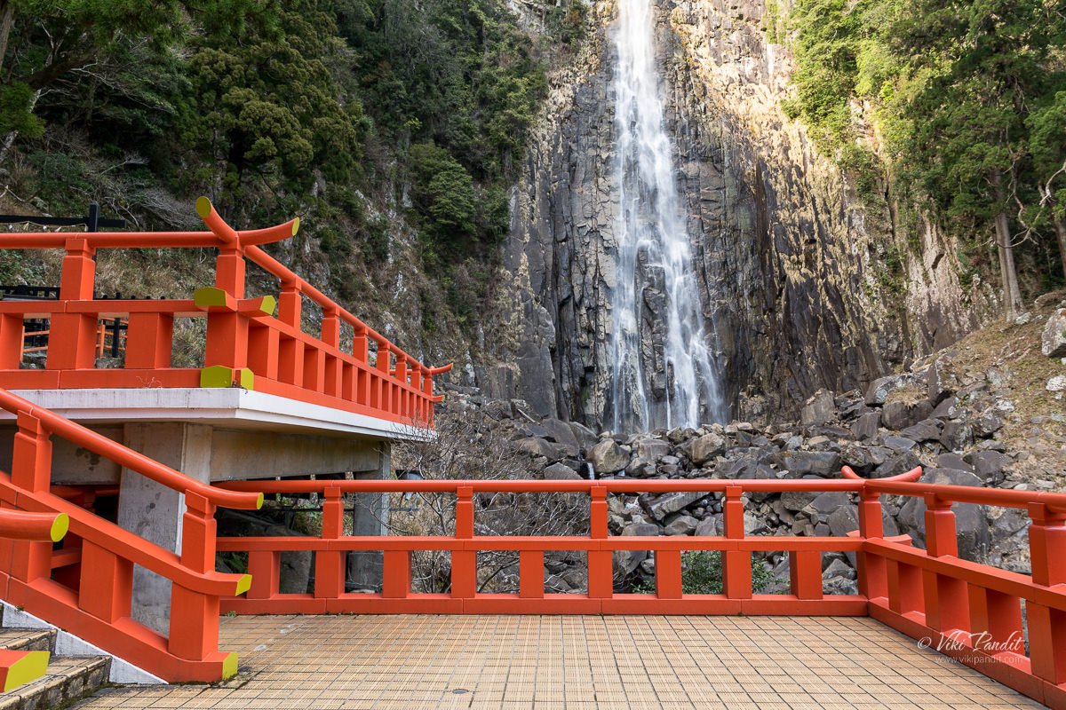
If one wants a closer look at the waterfall, one can enter the shrine and take the stairs up towards a wooden deck. It costs ¥200 to enter the shrine. From the vermilion deck, you can get the best view of Nachi falls as the water falls from the incredible height, hits the rocks below, and transforms into a small stream at the foot of the waterfall.

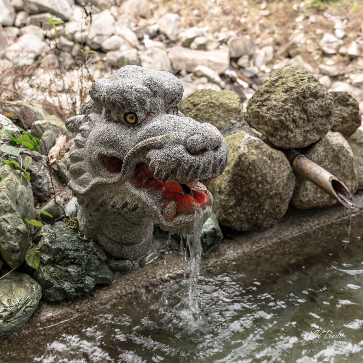
While coming down there is a small reservoir with natural spring flowing through the mouth of a stone-carved dragon head. Drinking spring water is supposed to give one good health. I filled my bottle with some to take back home for my wife.

It gets dark early in these mountains. It was only 4 pm but the light had begun to fade. I went back to the bus stand and waited anxiously for the next bus to show up. Anxious, because the last train to Osaka was at 6.10 pm and I didn’t want to miss it. Missing that last train would have left me stranded in Nachi. Thankfully, the Japanese are very punctual and the bus arrived exactly at 4.25 pm and I reached Kii Katsuura station by 4.50 pm.

Waiting at the platform it was hard not to be still lost in those memorable moments that I spent at the stunning Nachi Falls. I had a wonderful time in the mountains of Nachi. Though the pilgrimage has been in operation since ancient times, it still remains quite off the map for most tourists. That inadvertently resulted in a richer experience for people like me who love silence. If you are planning a day trip to Nachi Falls, I would advise visitors to stay back for a night in Nachi so you can start the tour early in the morning. I missed out on exploring the Kumano Nachi Taisha because of lack of time.

Train from Nachi to Osaka

Nachi is a journey into the realm of nature that brings purification to the soul. For centuries Japanese pilgrims have walked the Kumano Kodo, a more than 1,200-year-old network of trails that pass cedar forests, cascading waterfalls, and picturesque villages in the Kii Mountains.

Nachi being the terminal station, the train pulled into the station about 20 minutes early. I got myself a bag of peanuts and took my seat on the train. It was a near 4-hour journey back to Tennoji. The hike had taken a toll on me. I turned on my music playlist thinking of the charming elevated temple with the lovely view of Nachi Falls. I spent nearly 8 hours traveling for that one memory of the magnificent vermillion three-story pagoda and I will tell you that it was worth it.

Stretching across the Kii Peninsula on the island of Honshu, the pilgrimage takes us off the beaten track into a world of stunning scenery, soothing hot springs, delicious food. This journey through southern Wakayama and the Kumano Kodo will prove to be one of the most exceptional experiences you will have during your trip.

Thanks for reading. Leave me a comment if you liked the post or follow my story as I visit the illuminated Kenrokuen Garden in Kanazawa.

What are the hike challenges?

The Kumano Kodo is a mountain trek with waterfalls and shrines and physically demanding. Set mostly in the deep forest, there are a number of steep ascents and descents along the trail. I would highly recommend walking poles.

Kumano Kodo trail Information

I only covered a fraction of the Kumano Kodo trail. For the full route, please allow 7 days in total, including rest days.

Admission fees

Most of the areas I visited were free. To enter the shrine at the base of Nachi Falls it cost ¥200 per person.

Bus Schedules – Nachi Falls

Provided below are the bus time tables between Kii Katsura Station and Nachi Falls. Please note Nachi Falls is not the terminal stop. There another stop that goes all the way up to Nachisan mountain.
Updated March 17th 2018
Timings & fares are subject to change

Bus fare from Kii Katsura Station (Adult / One Way)
Daimonzaka: ¥420
Nachisan / Nachi-no-Taki-mae( Falls): ¥620
Kii-Katsuura Station to Nachi Falls

Nachi Falls to Kii-Katsuura Station

Mullayanagiri Trek and Ridge Walk

In my search for peace in the wilderness, I was finally able to force some time out from my work schedule, to go on the trek to Mullayanagiri, the highest peak in Karnataka. I had been planning this trek for some time. In fact, I was all set for this trek in November 2014 but had to cancel it at the last minute. 

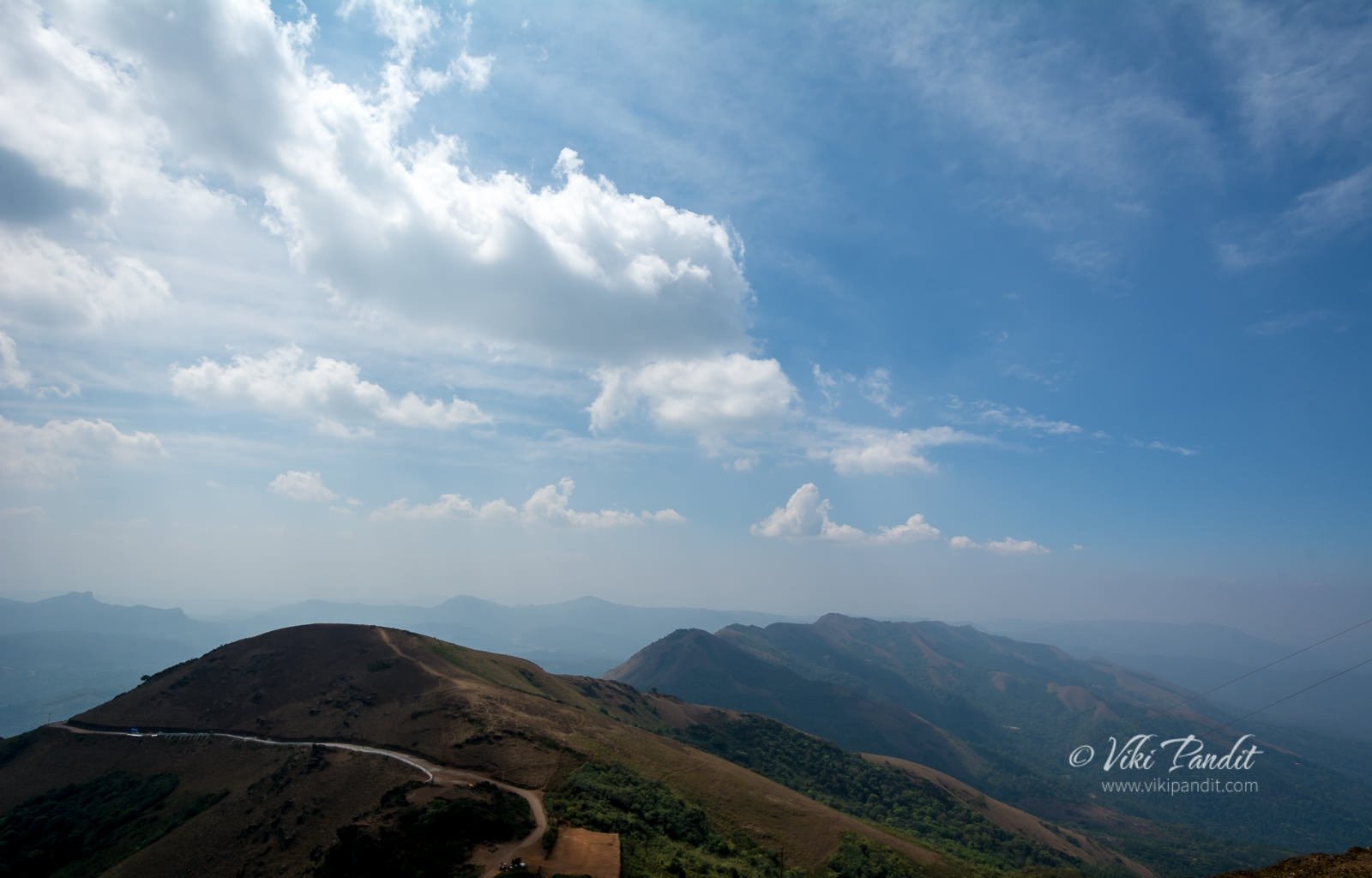
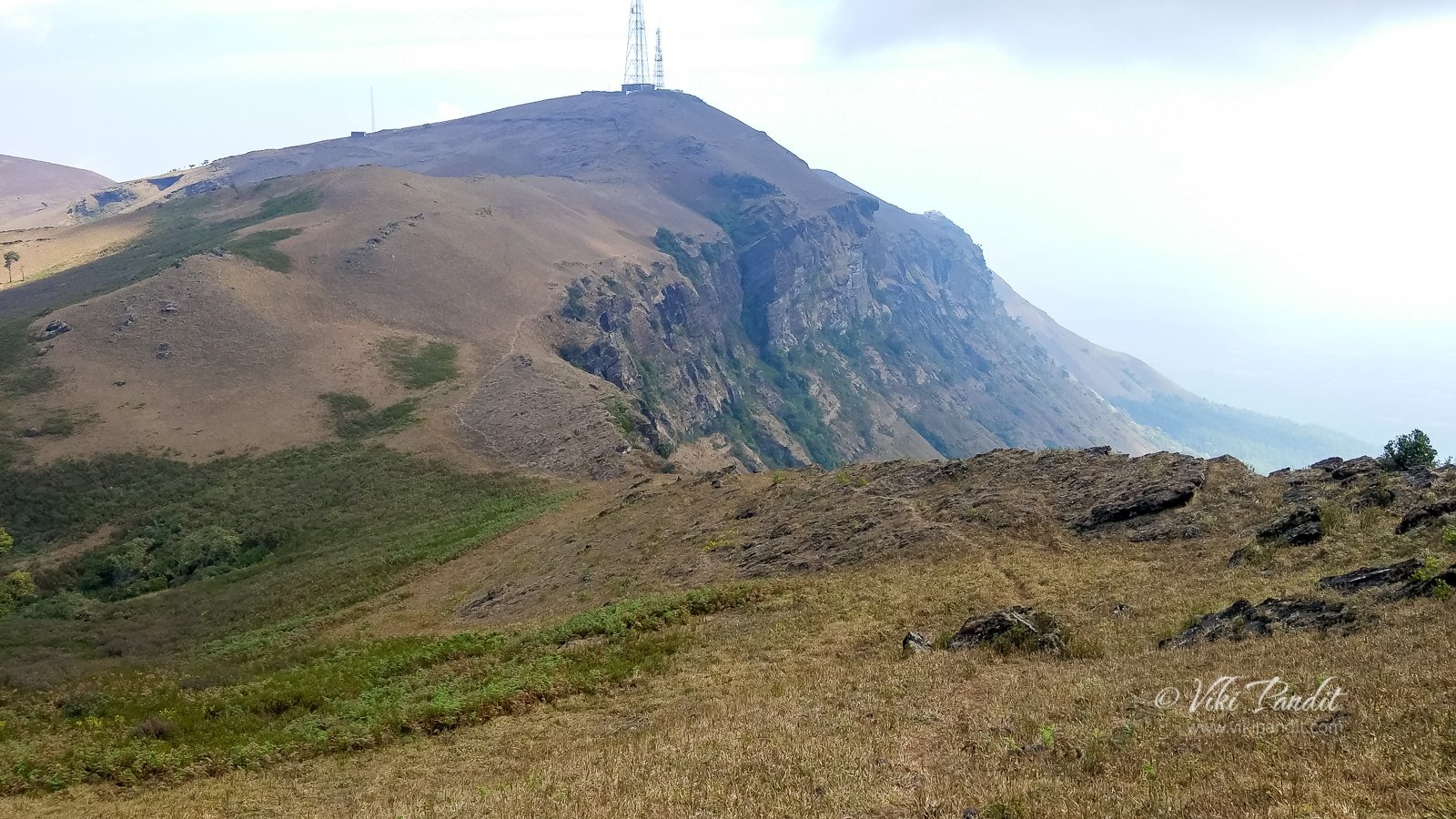
Mullayanagiri is located in Chikmagalur, Karnataka, some 280 km away from Bangalore. With the Bhadra Wildlife Sanctuary only 15 km away, the area is rich in vegetation and varied wildlife.

We started from Bangalore late in the night at around 11 p.m. The travel time to Mullayanagiri is around 4 hours. At the base of Mullayanagiri, there is a wildlife outpost. It was early dawn and since the wild animals use the area as a thoroughfare, we had to stop there for over an hour. A handful of us strolled around for the time the bus waited. It was still dark. The guards at the check-post had lit a bonfire, that kept us warm for some time. By 6.00 am, one of the dhaba (eatery) had opened up. I and a couple of the trekkers took an early breakfast of coffee and omelets.

Once the checkpost opened, we drove up the hilly area. The vibrant sun rose from behind the strips of the cloud. That sunrise is still etched in my mind as the sky soon became a painter’s canvas.

By 8 a.m. we were at our homestay. It was a nice, quaint place in the woods. I could hear the sound of water cascading from a tiny spring nearby. From our cottage, I could see a few exotic birds. I went for a walk taking pictures of some birds. I now understand 400 mm is still way short for birding. Maybe I should invest in a teleconverter.

The Trek to Mullayanagiri Peak

After a quick freshening up and breakfast of Idli, we started on our trek to the Mullayanagiri peak.

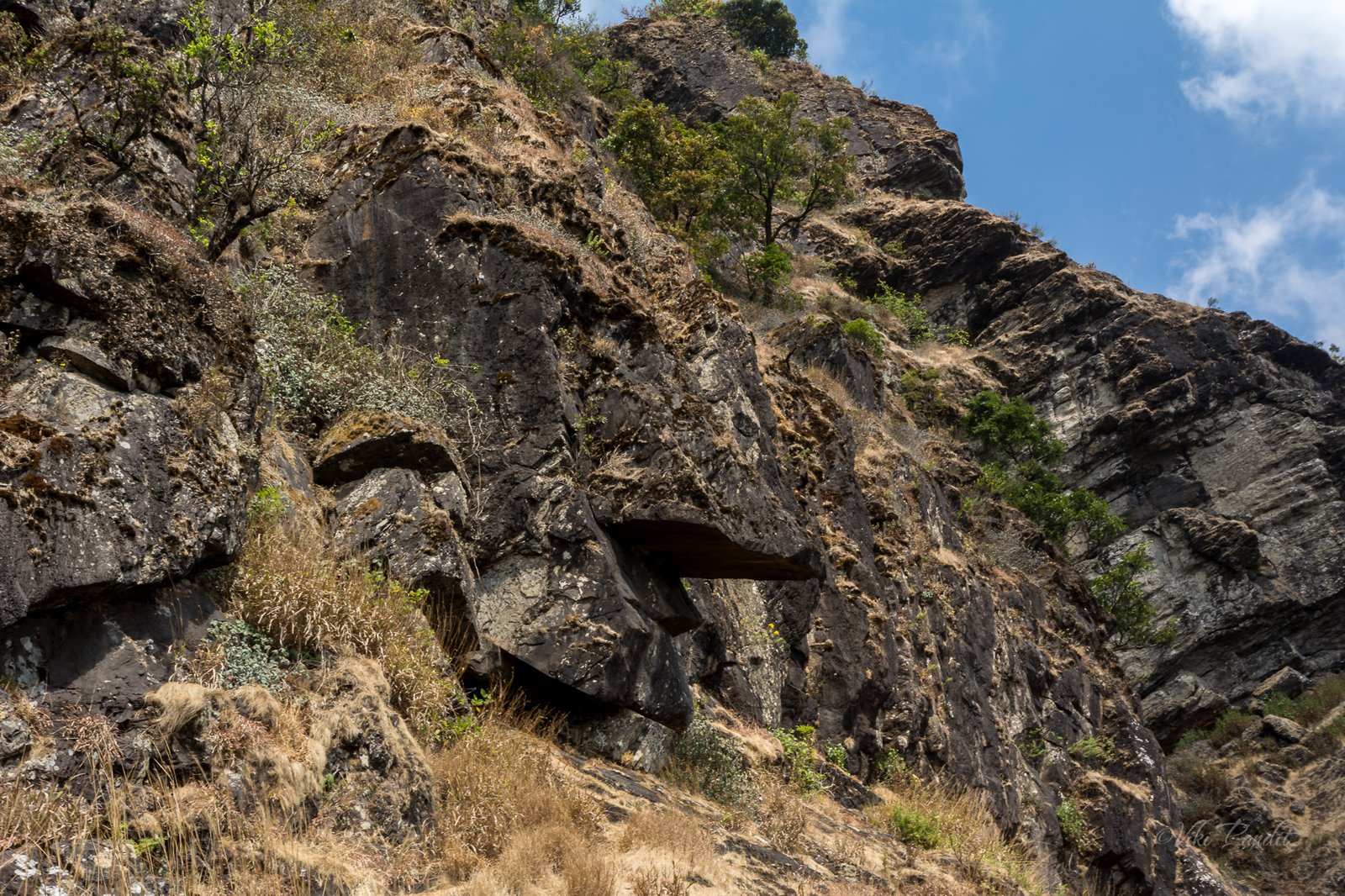
The bus drove us to the starting point of the trek. We started the ascent at around 10 a.m. A few minutes into the trek one of the guys, Ravi started feeling sick. We waited for some time but eventually, when he did not recover, we had to send him back to the cottage with one of our trek guides. The climb is steep and it was tough with my camera backpack. After climbing for about a couple of hours, we passed a big rock that looked totally like a human face.

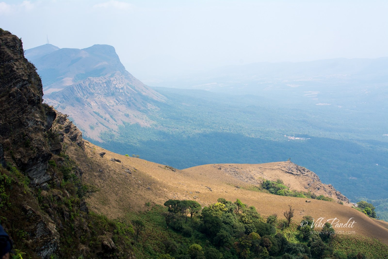
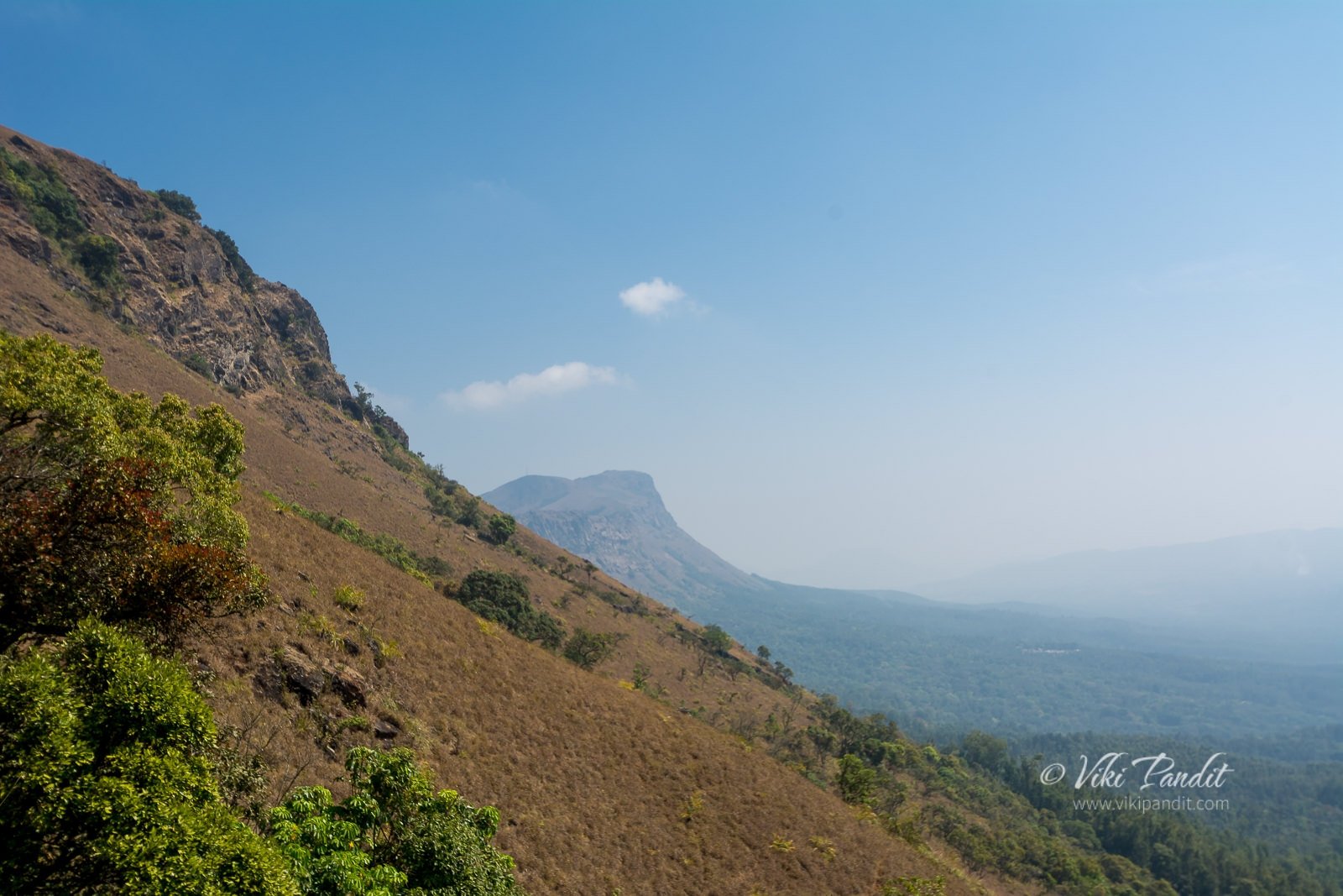
After the first hour of climb, the trek becomes relatively easier as we move into the flatter area. At the top, the hills are smooth like meadows. I must say these meadows would look amazing after monsoons when green grass would cover the whole mountain like a carpet.

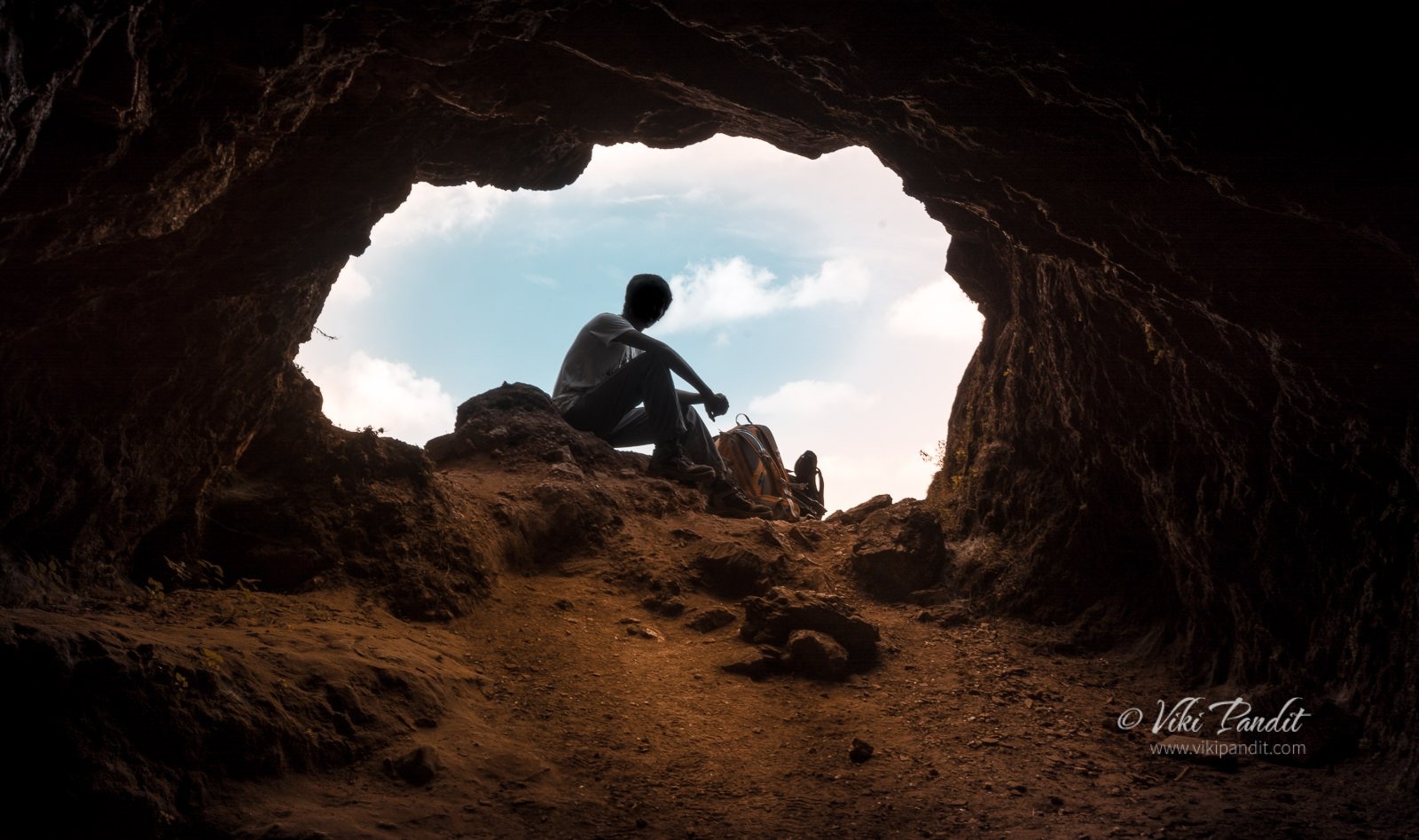
After hiking through the meadows we reached a cave. I had developed some cramps in my right thigh so I took some rest here. Hydrating oneself is very important on a trek. Not only on the trek, one should hydrate the body a couple of days before the trek.

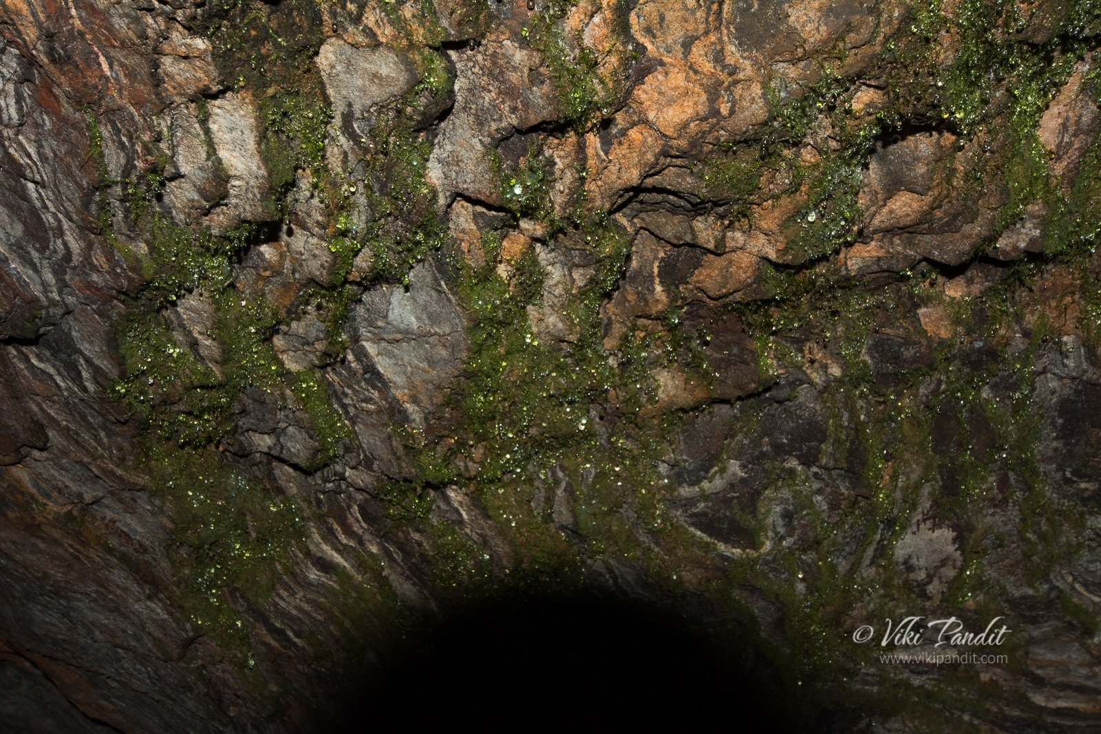
There was a lot of moss on the walls of the cave. At places where the rocks were visible, one could make out the lines dripping water had created.

From the cave, after a bit of hiking, we finally reached the peak.  Mullayanagiri is part of the Baba Budangiri Hill Ranges and it’s amazing to look at from the peak. I found myself in front of a small temple dedicated to Lord Shiva on top of the hill. The small hillock inside the temple premises is the highest point in Karnataka. The front was still clean, but it was very dirty and smelly overall. We went a few steps down where it was comparatively cleaner and decided to have lunch there. 

After lunch, we got back on the trail. The descent from here was relatively easy. 

The trail becomes a bit steep as we neared the end of our hike. The bus was already waiting for us at the base. We hopped in and on popular demand from the group, headed towards the Dabdabbe waterfalls. I decided to wait for the bus, opting to save my energy for the next day. 

Bonfire

Back at the cottage, we freshened up. Some guys started a game of cards. I went for a walk down the road. it was pitch black just a few meters beyond the cottage. I gathered some courage and kept going for about half a kilometer, eventually, I turned back. I wasn’t able to make a call through my phone. The person who owns/runs the place lent me his phone. He is a nice chap. Talks very humbly. I am going to put his phone number in the FAQs below if anyone needs to contact him for homestay.

Dinner was served at 9 p.m. We had rice and sambar. After dinner, we gathered some wood from the surroundings and started a bonfire starting at around 11 p.m. An alien theory was proposed by one of the trekkers, Altanai, who refuses to acknowledge the theory of Evolution. Our discussion gradually moved on from fantasy to more acceptable on philosophical lines. Eventually, I went to sleep at around 1 am.

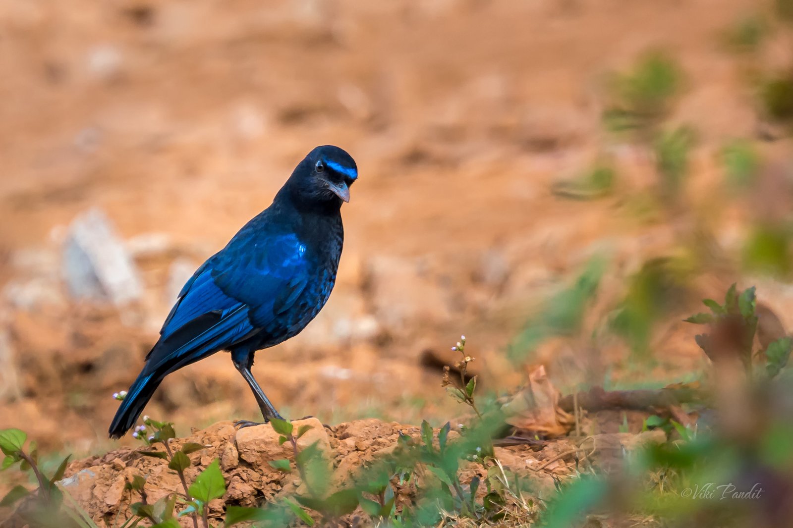
I rose up early, washed up, brushed, and went for a walk towards the bushes, where I had spotted some Bulbuls the day before. I waited for a long time patiently eventually a few of them showed up. I was able to get a few shots. 

Mullayanagiri Ridge Walk

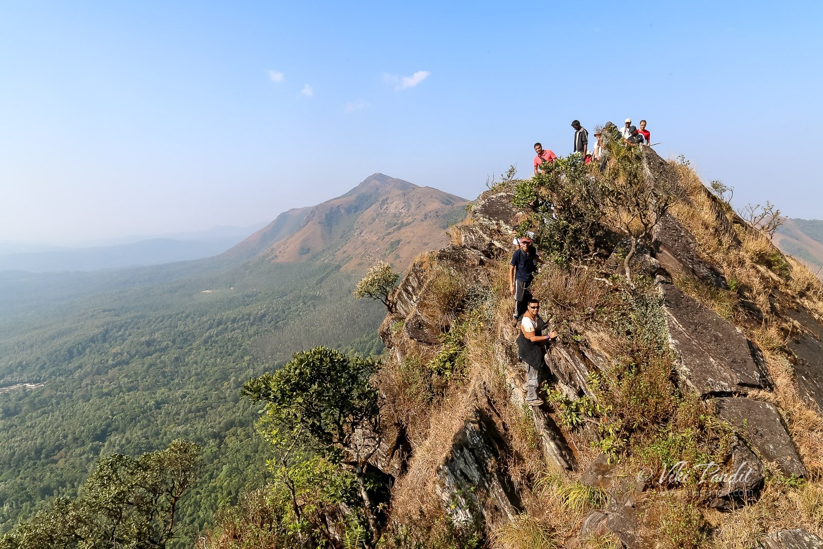
I had noticed the Ridge, the day before and it looked overwhelming, so I decided to leave my camera gear behind and concentrate on the climb instead. The ridge walk is not allowed without permission. It’s a steep climb over edgy rocks but not difficult. At certain points, it’s steep and very narrow, but the rocks make it easy to grab and climb. Without the heavy Camera bag, I was feeling a lot free. For the first time, I was leading the trek.

The rocky climb lasted for about an hour, thereafter we hit the meadows again.

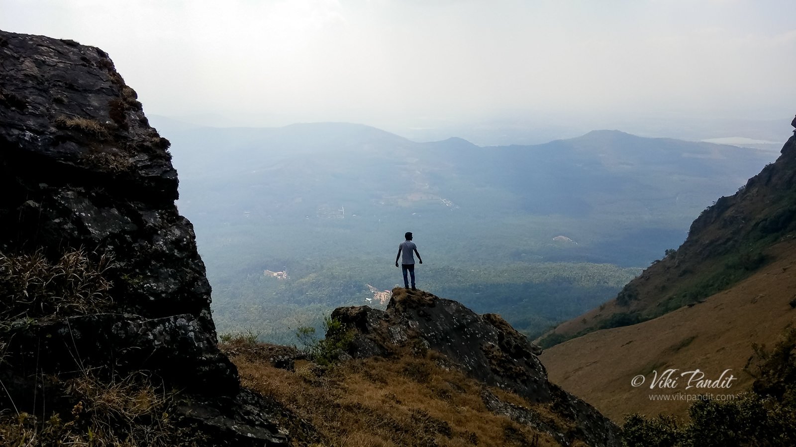
After a couple of hours, we could see the BSNL tower. From there we walked along a steep ridge. It was dangerous and thrilling at the same time. Looking on the right towards the abyss made my head go round. So I just kept my head down and eyes on the trail and kept walking.

It would have been safer to use trekking poles in such unsafe areas. One slip can turn out to be fatal. We reached the end of our walk at around noon. We went back to the cottage to have lunch there. On reaching, I went and collected my camera backpack. After a hearty lunch, we headed back to Bangalore.

On the last couple of treks, I felt the focus of the treks had shifted to making noise, jumping around, and taking “flying photos” to obtain likes on social media. It certainly depends on the group of people going on each time. I had really enjoyed the earlier treks I went to last year. Even the group that went to Gokarna was fun. At one point on the trek, some of us had to wait for an hour while others in the group went for a photo session. Not everyone enjoys nature in the same way. I am strongly feeling the need to go solo if I want to truly enjoy nature in peace.

Drive to Bangalore

On the way, we stopped at Chikmagalur for some refreshments. I was feeling dehydrated so I grabbed a Pepsi. From my window seat, I kept watching the fields passing by. I love to stare at nature, it pleases me, like an ecstasy drug. We reached Silk Board stop at 9 pm and in another 30 minutes, I was back at home.

Mullayanagiri is not for the faint-hearted, especially the ridge walk. The trek to the peak is easy to moderate difficulty. I would suggest keeping yourself as light as possible. It was a mistake on my part to take extra lenses on the trek and it weighed heavily on my first day of the ascent. The meadows are excellent especially when you go on the ridge walk, however, note ridge walk is quite a bit on the dangerous side and should not be challenged in the monsoon season. 

Do you have the homestay details?

Eco Holiday Home. The homestay is located on Baba Budangiri Hills. They provide rooms, tents as well as the Cottage where I stayed. The name of the contact person is Aman. His contact number is +91 9481 365 565
Disclaimer: I loved the homestay. The bathrooms were clean and the food was tasty, but I do not accept any responsibility if you use their services.

Are there other any interesting places around Mullayanagiri?

If you are visiting Mullayanagiri, you could also plan a visit to the Bhadra Wildlife Sanctuary. It is only 15 km away

What is the best time for trekking to Mullayanagiri?

Mullayanagiri is pleasant after the monsoons. The lush green meadows are a sight to behold. Although trekking during that time has its disadvantages. Leeches are everywhere. The mist decreases visibility substantially

Gokarna Beach Trek

[su_progress_bar style=”thin” percent=”30″ text=”Difficulty Level – Easy” bar_color=”#ed97db” fill_color=”#cb0e6b” text_color=”#000000″]

This weekend I head out on a trek on the rocky cliffs along the coastline of Gokarna.

Gokarna is located along the Arabian Sea at the ear-shaped confluence of two rivers, the Gangavali and Aghanashini, around 580 km from Bangalore. Four of the most gorgeous beaches are located to the south of Gokarna. Our trek route was to start from the southern-most Paradise Beach and hike our way northwards towards Half Moon Beach, Om Beach, Kuddle Beach and finally end at Gokarna Beach.

Gokarna means Cow’s ear. There is an interesting piece of story behind how this place got this name. Legend has it that after a vigorous penance by Ravana, Shiva was pleased and offered three boons to him. For one of his wishes, Ravana asked for the Atma-Linga. Shiva took out the Atma-Linga from his own heart and gave it to Ravana with strict instructions that it should not be placed on ground until it was reached its final destination.

The Devas, fearing that Ravana would become all-powerful asked for help from Vishnu to somehow stop him. On the way, carrying the Atma-Linga towards Lanka, Ganesha met him in the garb of a cowherd. Vishnu and Ganesh played a trick on him and saw to that he kept the Linga on the Ground. When Ravana tried to pull it out, the shape of the Linga took a form of the Cow’s ears.

Gokarna is also an important center of Sanskrit learning. The early settlements of this region can be traced back to the Brahmins. It is also the residence of Bhandikeri Math and Togu Math where Sanskrit knowledge has been passed down from generations in Brahmin families.

Ride from Bangalore

My scheduled pick-up was at 7 p.m at Silk Board. Due to heavy Bangalore traffic I was delayed and finally made it at 7.45 p.m. I joined Ishan, Preethi, Srinivasan and Pradyumna at the Silk Board bus stop. Unfortunately Ishan wasn’t going on this trek and Salwat was already out there in Gokarna, so Preethi was our trek lead for the trip. Once there, I got to know that our pick-up Tempo was even more delayed. We introduced ourselves as we waited for the bus to arrive. It finally reached us at around 8:30 p.m.

After picking up the rest, we finally started for Gokarna at around 9:30 p.m. Along the way we stopped at a dhaba for dinner. I had a plate of Idli, the safest food around these parts. For the rest of the journey, I didn’t get much sleep on the bus. At around 8 a.m. in the morning, we stopped at an eatery at Shivamogga for breakfast. The Idli was warm and tasty. It also felt good to stretch the legs. After around an hour we passed through the Shettihalli Wildlife Sanctuary. I was lucky to spot a few peacocks along the way. As we neared the coast, the jackets were off as it grew more and more warmer.

Gokarna

It was noon by the time we reached our destination. The sun was beating down upon us. Salwat, sweating profusely, was waiting for us at the bus depot on Temple Road. We walked towards our home stay which by the way was not very far from the bus stop. At first impression, Gokarna might strike as a laid back town, growing up, trying to find its place in the modern world, but in all actuality it is really old, with a history that stretches back to a mention in the Bhagwad Gita.

For most of the time, it has been a village of fishermen and farmers with the only attraction being a temple, believed to contain Atma-Linga, the soul of Shiva. But Karnataka has entered a period of rapid change in tourism, and Gokarna is being dragged along with it.

Paradise Beach

After quickly freshening up and donning our beachwear’s, we drove by bus to a spot near the Paradise Beach Huts. From here we started the trek along the Paradise Beach trail towards Paradise Beach. The walk took us through a bushy forest along an elevated path. After walking for 15 minutes we started to descend. While going down we were presented with the stunning view of the beach. Cameras were out in a flash and why not. It is a paradise for beach lovers.

We climbed down the rocky hill towards the inviting beach. On the left I noticed a hippie trying to cook up a meal. By the looks of it, it was apparent he had been squatting there for days. The beach is in the shape of a small bay, curved inwards. Once on level land, the guys just ran off, flinging their stuff in the sand and tore towards the big waves.

Salwat informed us not go above waist level in the water. Well, he quickly had to change his advice as the incoming waves were already chest high. I found a secluded spot and took a few long exposure photographs of the beach. Unlike some other beaches I have been, here the rocks are sharp and I got a few bruises on my palms while climbing to finding a good spot.

We stayed at the Paradise Beach for over an hour. Once everyone had their fill of the waves, we started hiking towards the Half Moon Beach.

Half-Moon Beach

The trail to Half Moon Beach is a bit tricky with lots or rocks. On the way we passed Hells Cliff. Well not many can claim to be in “Paradise” and “Hell” on the same day 😉 On Hell’s Beach, there is a small rock. Some of the guys took up the climbing challenge.

Past the rocky terrain we reached a cluster of shacks. It was 4.30 p.m. and we were hungry as hell. We decided to have our lunch in one of the 3 eateries. I was surprised to see Israeli specialties on the menu. Not a die-hard fan of experimentation, I still went ahead and ordered the “Laffa” along with 3 of my friends. The food took time coming but it was tasty. It was like a huge Egg Roll with salads and boiled eggs. I was full just with that. They also have hammocks around which give a hippy feel to the area. I saw very few Indians on both Paradise and Half Moon Beach. They appear to attract mainly foreigners.

After relaxing for some time, we moved on to the Half Moon Beach. The harsh sun had given way to some nice pleasant breeze as we entered Half Moon Beach. The beach was devoid of tourists and I got some lovely photos in the golden hour. We didn’t spend much time here as we wanted to witness the sunset from a good vantage point.

Om Beach

We all were very excited at the prospect of viewing the sunset and we hurried along towards the Rock of Peace. “Rock of Peace” is a huge cliff towering over the side of Om Beach which extends deep into the Ocean. The view from here is fantastic. Om Beach is named so because it is shaped like the auspicious ॐ [Om] symbol. One can easily make out the Om sign from this cliff. The stage was set, but without any clouds the drama was missing. Some hippies had gathered here with drums. The slow beating of drums added to the serene moment.


It was difficult to move away even after the sun had set, but Salwat wanted us to reach the beach before dark, since the trail led through a forested area and it would become more and more difficult to find the trail in the darkness. So we got up and were on our way to the Om Beach. Down at the beach, light was fading fast. I wanted to get a good shot of the Parvati Rocks but it wasn’t to be. Om Beach is beautiful beach that seems to go on forever, surrounded by palm trees.  I have to come here again, to get a shot of the setting sun with the Parvati rocks in the foreground. I believe it will look gorgeous.

I lay on the beach staring at the stars for a long time, alone. I have started to understand that I do not share the same enjoyment from nature as others. Chattering disturbs me. I would just like to be a rock and stare at the wonder of nature.

Kuddle Beach Trek

After some relaxation on the Om Beach we headed out to Kuddle Beach around dinner time. I wasn’t too pleased as we arrived at the Kuddle Beach. Its dirty, full of restaurants and cafe’s. Cows are moving around. Litter is everywhere. Overcrowding, construction of lodges and other activities has definitely had an impact on this beach. There are also some lodges with rooms for as little as ₹1500. Salwat recommended the Kuddle Palace restaurant for dinner. In the restaurant, the guy taking our order appeared to be a Nepali. On asking, he confessed to coming here during season time to work for 4 months. Once the season ends, he heads back to his homeland in Sikkim.

Inside the restaurant, we were like this huge gang. All the tables in the restaurant were moved and joined together to form one big table. It was like a feast from one of those Asterix comics. I was missing the tasty Tibetan dishes I had in Sikkim, so I ordered a Thupka. After dinner I took a walk along the beach, below the stars. Some couples were also wandering along the beach. I was missing Mani, so I called her up. We talked for a long time. Relatively a long time for us would be 6 hours, but this time it was 40 mins. Eventually once everyone was done, we cleared the bill and walked towards the Gokarna Beach.

Gokarna Beach Trek

At the end of the Kuddle Beach, we had to climb up a row of stairs to head towards the Gokarna Beach. After the stairs, we reached an open field. Thankfully there were white markers guiding us along the trail or we would easily have gotten lost. On the way we gathered some dry branches and grass for the bonfire. At the end of the field we passed a Shiva Temple. It was a moonless night and we could barely make it out in the pitch darkness. Right after the temple a series of steps brought us to the edge of the Gokarna Beach.

Gokarna Beach was way cleaner than Kuddle Beach. No shacks or lodgings.  Boats were lined on the coast, belonging to fishermen who now probably earn more ferrying passengers along the coast. The beach was full of crabs. In every direction I could see holes create by crabs. We had a quick bonfire and then headed back to home stay. On the way back some of us we were already discussing to come back in the morning for sunrise.

We reached the home-stay at around 12:30 a.m. I activated the alarm for 4:30 a.m. and went to sleep straight-away at 1 o’clock.

Sunrise on the Gokarna Beach

I got up before the alarm could wake me up. I would like to believe I posses a biological clock that wakes me when I am truly serious about it. Even in Sikkim, I was up daily at around 4 a.m daily. In contrast, in Bangalore, I am rarely up before 10 a.m 😉 It was a pleasant surprise to find almost everyone already up and ready for the sunrise trek at 4:30 a.m. Salwat was tired and so we, in all 13 of us including me, headed out ourselves. The roads were lit but the beach area was pitch dark. We went following the same path we had come down the night before. The bonfire we had lit last night was totally doused by the waves. I was surprised that the tides had come all the way up to this point during the night. We hiked towards the Shiva Temple and took a detour from there towards the peak of that hill.

The Sun rose from behind the bushy forest at around 6:30. We took some clicks and then walked back towards the beach.

As we walked back towards our home-stay in proper daylight for the first time, I could see the endless blue sea with coconut and palm trees lining the beach. Already many had gathered to take a dip in the sea before going into the temple. I understand, Gokarna Beach is frequented more by Indian pilgrims than the random tourist. We walked across the quaint little town, through the streets lined with temples, eateries and traditional tile-roofed brick houses. The presence of beaches and temples together create a contrasting town. On one side we see the over-eager pilgrims and on the other we see the laid back hippies.

Ride Back to Bangalore

After a quick breakfast at Pai’s Restaurant we were on our way back to Bangalore. Deepali, whose hometown is not very far from here treated us to a sweet milk beverage. The day was hot. On the bus, I took a small nap since I had barely slept the last two days. On the way back Salwat offered a stop at the Jog Falls as a bonus. The waterfall was a whimper from what I had seen in the pictures. One should see this place roar in the monsoons. While admiring the falls I was lucky to spot a beautiful rainbow forming at the base of the falls. We also took our lunch there in a nearby restaurant. The menu was limited nor was the food any good.

Rest of the way I choose to sit upfront beside the driver, just looking at the road and the trees go by. Pradyumna was also there with his Kindle, reading. We talked a lot about the places he wants to visit. I gave him a few tips on Hampi. He is a silent type of guy. We stopped at an eatery around 4 in the evening. They had something new, I have never had before, Pepper fries. I also had a cup of coffee before getting back on the bus. Bangalore was still 120 km away. Since it was getting dark, I went back to my seat at the back. The guys started a game of antarakshi. It was fun and kept us entertained all the way to Bangalore.
It was midnight by the time we reached Bangalore. One of the guys Abhishek, shared a cab with me as his place was along the way. I was back in the cozy comfort of my home in half an hour. It is one of my fetishes, every place I visit, I need to get one amazing shot, that summarizes the place. Unfortunately I didn’t get one this time and this is going to haunt me until I go back again and get it.

[su_tabs]
[su_tab title=”Faqs”] [su_accordion]
[su_spoiler title=”Best place to stay in Gokarna”] Hotel Gokarna International (0832-257843 / 08386-256622/ 848) is one of the better lodges on the Kuddle Beach. Note there is another Hotel with same name in the town, so double-check[/su_spoiler]
[su_spoiler title=”Good restaurants in Gokarna?”] Kuddle Palace has good multi-cuisine food and also very cheap. On the Half Moon Beach you can find some shacks. The food is all right, but it takes a long time coming.[/su_spoiler]
[/su_accordion][/su_tab]

[su_tab title=”Places to see in Gokarna”] Along with the amazing beaches, Gokarna is also famous historically.

  1. Visit the Adi Gokarna & Aatma Linga Mahabaleshwara Temple.
  2. Hike to Yana natural rock formations, a couple of hours away
  3. Jogg Falls is 2 hours drive from Gokarna
  4. Dandeli Wildlife Sanctuary is a 6 hour drive from Gokarna. Tours are available through the reserve where you can, if you are lucky, check out the Black Panther, Bison & Iguanas.

[/su_tabs]

Night Trek to Savandurga

Savandurga is an amazing place for a photo-op… but Whoa! the fort of “death” and that too on my first trek!!

History of Savandurga

Located at a distance of 64 km west of Bangalore, Savandurga is reputed to be the highest monolith in Asia. It comprises two looming granite hills, Karigudda, the Black Hill and Biligudda, the White Hill, both around 4000 feet tall. Historically, the hills find a mention in the records of the Hoysala period in the 13th century. In those times it was referred to as Savandi hills. Later during the reign of Hyder Ali, this hill served as a fort prison from where it was said there was no escape but via death. Since then the locals began referring to it as “Mrutyu Kupa” which vaguely translates to “the fort of death.”
The nearest town to Savandurga is Magadi, known for being the birthplace of Kempe Gowda who is kind of looked at as the founder of the city we now call Bangalore. More recently, the hills have been featured in the making of David Lean’s movie A Passage to India.

The Journey to Savandurga

I was going on this night trek to Savandurga along with a trekking group. My pick-up point was at Central Silk Board at 11 p.m. It was my first trek around Bangalore and I was duly very excited. The tempo bus was waiting, filling up as more and more trekkers trickled in. We hit the road by 11:30 p.m. I had been searching for good trekking groups for over a year and this is the first team that impressed me even before I started on the trek. The other trekkies joining us from various parts of bangalore got introduced to each other on the bus during the ride. Most trekkers came in groups – friends from office or were couples. I was the only loner, but I had my camera, that more than made up for it.

I am new to Bangalore but I could vaguely identify the route towards Savandurga, since it goes along the same route as I had taken when I had been to Manchanabele Dam just a few weeks before. Once we left the city behind, the stars were much brighter, a rare sight during monsoon around Bangalore.

Savandurga Forest

Savandurga is surrounded by a thick forest of scrubs, said to harbor around 60 different tree and 119 shrub species. The hills are also home to the endangered Yellow-throated Bulbuls. The road became a bit bumpy as we entered the Savandurga Forest. On the way we passed the Manchanabele Dam. Created by the waters of the Akravathy River, Manchanabele Reservoir itself is a lovely place from where you can get an enticing view of the Savandurga Hill.

We reached the base of the hill near the Narasimhaswamy Temple at around 1 am. Were were going to conquer Biligudda tonight! It is a relatively easier climb compared to Karigudda, which requires permission to climb. We got an energy pack from the organizers comprising a juice tetra-pack, an energy-bar and a pack of biscuits.

Trekking to Savandurga

Within a few minutes our local guide, Anna, came running with his huge torch. He is a local resident and knows his way around the hills. We started the climb at around 1:15 am.

Trekking in Savandurga can be thrilling as well as challenging as I discovered. It’s a smooth monolith and at certain points, very steep. Luckily we didn’t have rains and the trail was dry. I did though make a big mistake being in my Woodland’s. It’s a bad idea to trek in Woodland shoes. They are heavy and not good at getting a grip on the rocky surface. One should always get a rubber sole shoe and preferably one that is light.

We took a break midway through the climb. The clouds were flowing by us and it was time for some ghost stories. During story-telling, Ishan shared with us his experience of when he and his friend landed up in Bhangarh, a ghost village.

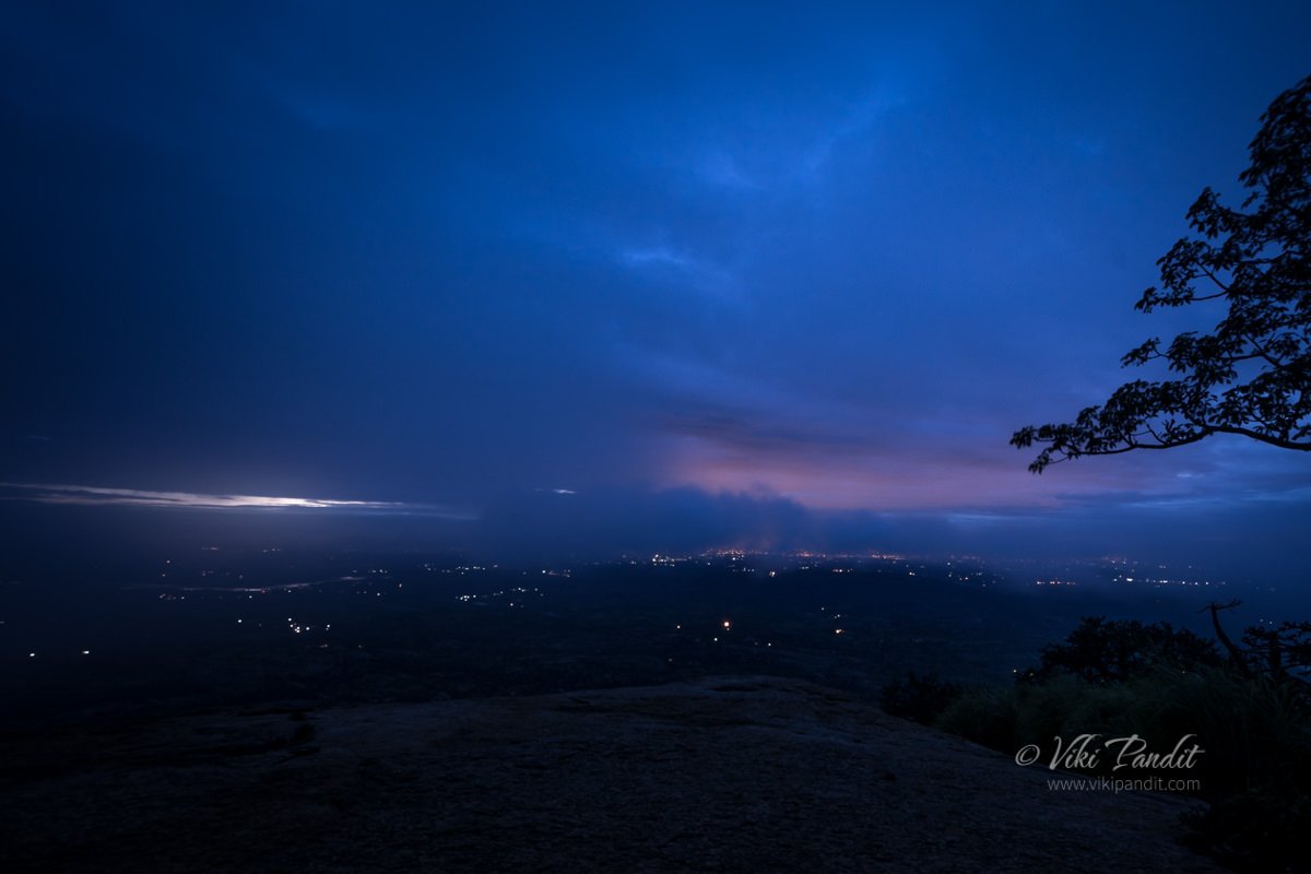
Sitting on the cold rock, I could see the lights from the nearest town of Magadi. Suddenly out of nowhere, a thick cloud enveloped us. In the haze, the light from our torches glowed like beams crisscrossing each other. It was an unforgettable experience. We spent a few minutes there and started again.

After some 45 minutes into the trek, we reached a makeshift shed.  There is a small natural pool beside the Mantapa. We took a break here and had a nice and warm bonfire going.

Some of the guys took a quick nap. I was too excited to even think about sleep. I scouted around for places where I could get a good view of the sunrise.

By 5:30 a.m everyone was wide awake and ready to move on for the final climb. We hit dawn at around 6 a.m. The view was ethereal. It appeared we could just jump and snatch away a bit of the clouds.

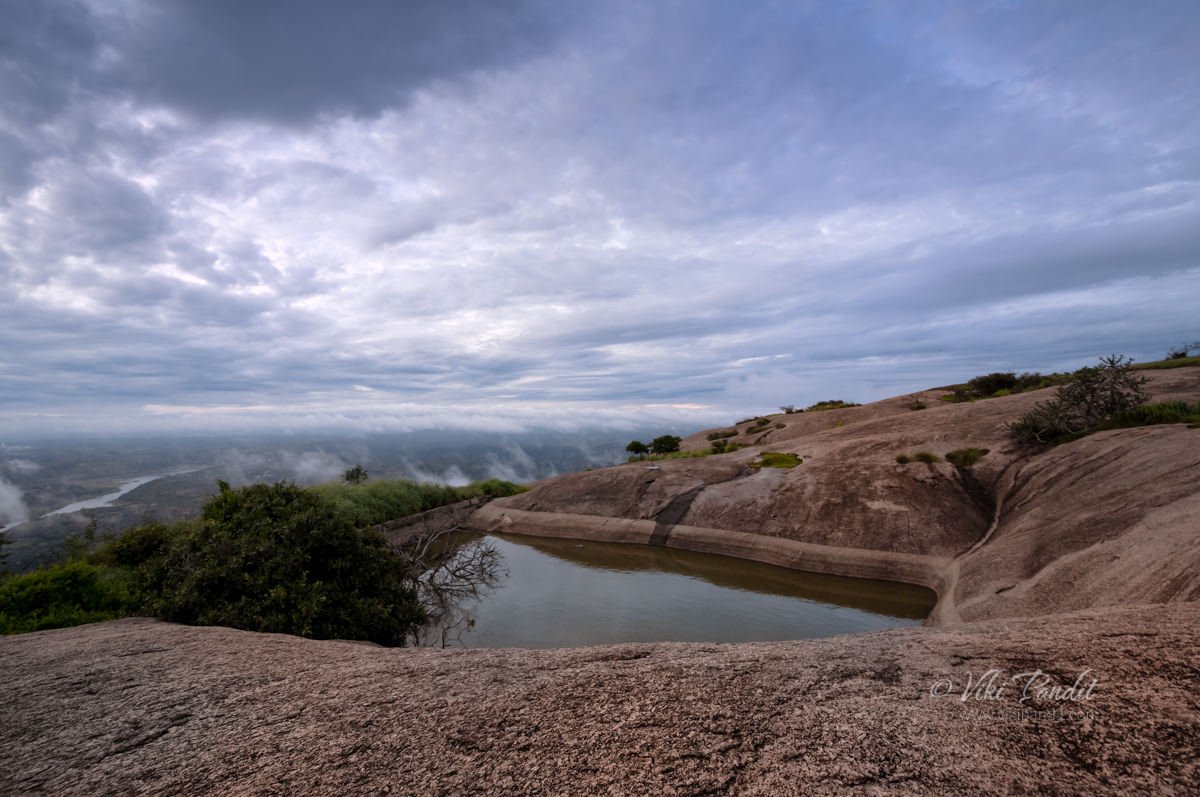
The sun was hidden behind the heavy clouds so we weren’t able catch a glimpse but at some places the rays would somehow peek through. As light improved it also revealed a small pond near our shack.

Savandurga Peak

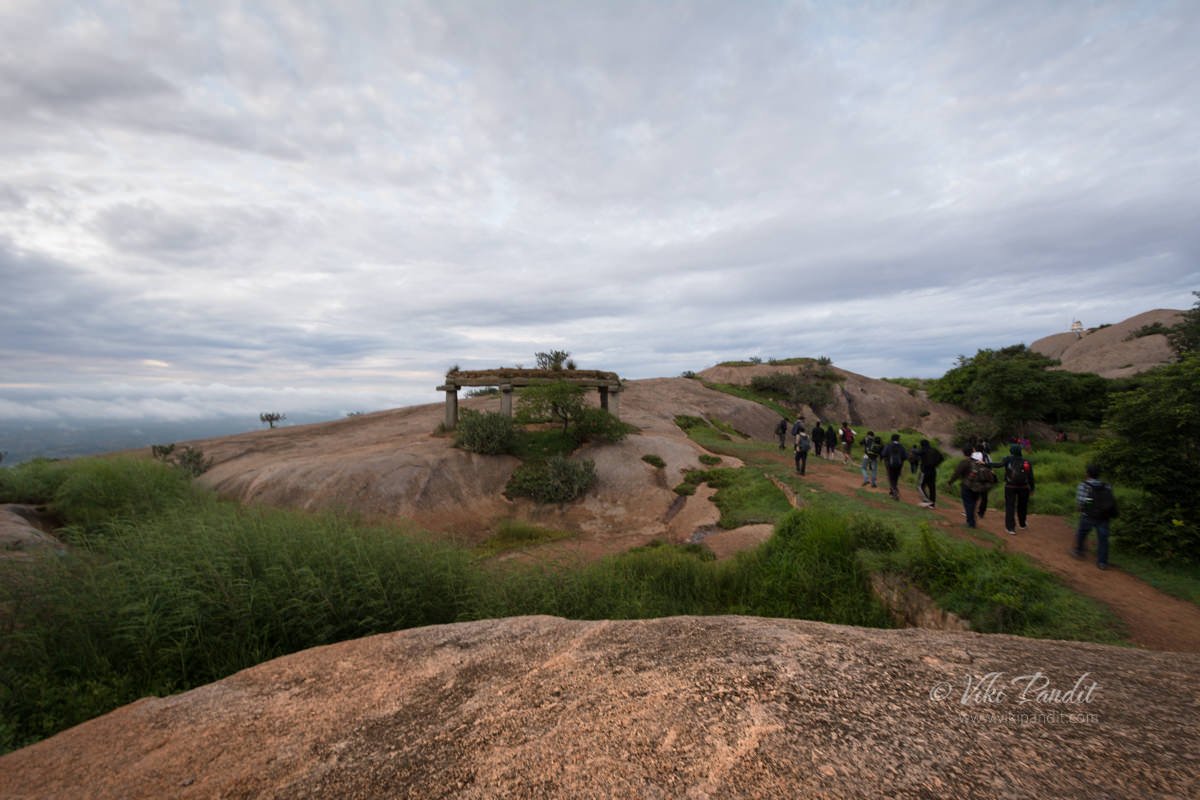
There was a little drizzle and my shoes had become very slippery. The second part of the trek to the top of Biligudda was not very tough and we were there in around 30 mins.

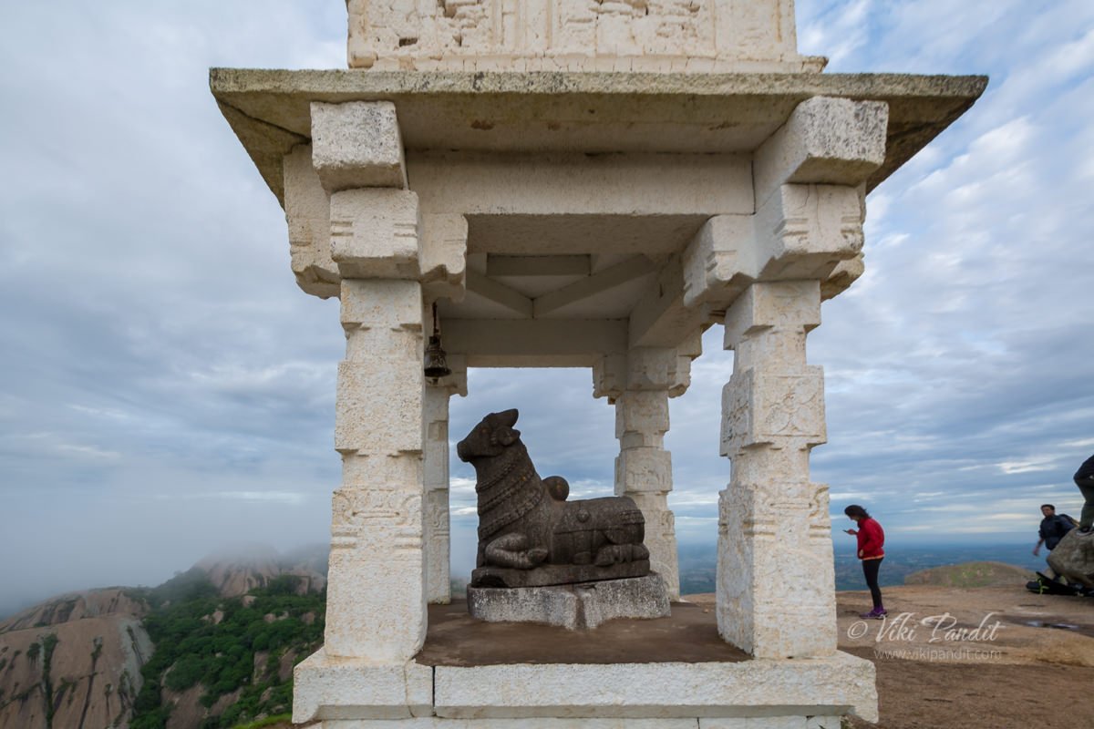
We sat there basking in the conquest. At the top of Biligudda is a small shrine dedicated to Nandi, Lord Shiva’s sacred Bull. This shrine/tower was commissioned by  Kempegowda in the 17th Century.

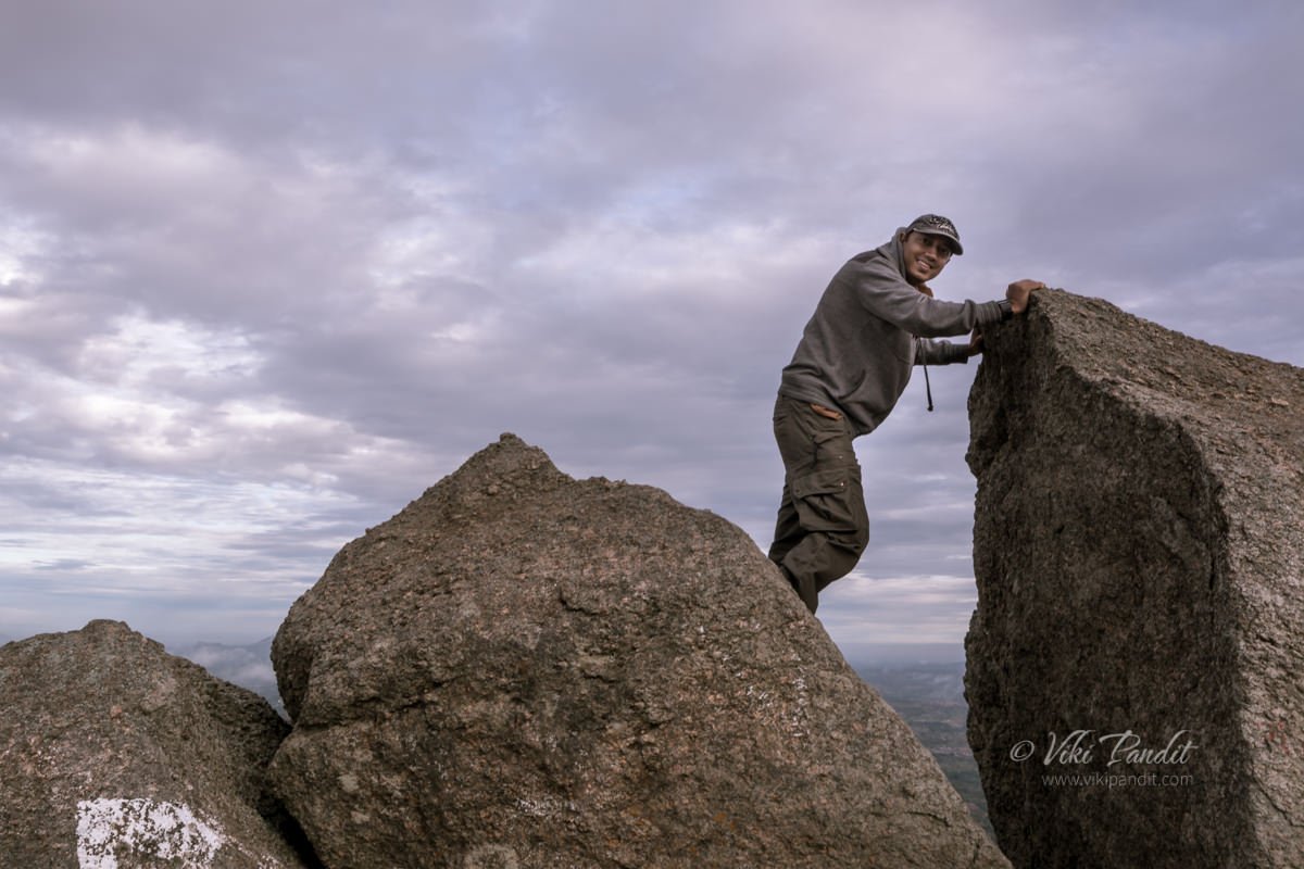
Beside it there is a broken rock structure that is referred to as the Superman Rock. Why? well according to GBL anyone who stands on that rock looks like a superman 🙂

We stayed at the peak for an hour, immersed in the amazing beauty of mother nature. As the Sun started to become harsh and we started the descent at around 8 am. GBL has a “No Littering” policy, so no one is allowed to litter, beyond that they also gave us an option to carry back any plastic garbage left behind by irresponsible trekkers to Bangalore. We collected some 4 big bags of tetra-packs and soft drink bottles. While descending, we took a detour and some of the guys/gals did some rock climbing. I didn’t. Rock climbing is not my thing, so I try to skip as much as I can.

The Descent

While climbing down we passed a fort wall, almost in ruins. It was only now that in the bright light, I was able to see properly the steepness of the hill. At night when we were climbing it didn’t feel so steep. We reached the base in an hour. I was exhausted. At the foothill there is a village by the same name.

From what I hear, Savandurga hills are frequently visited by pilgrims round the year, who come to visit the Narasimha Swamy and  Savandi Veerabhadreshwara Swamy temple situated at the foothills. The Narasimhaswamy Temple was abuzz with people paying respects and praying for happiness.

Just beside the temple, the guys from GBL had arranged for some delicious Tatthe Idli, a local delicacy for breakfast. I loved it and possibly ate a bit too much 🙂 . We had some coffee, took some rest and headed back to the bus. On the way back we stopped for a few minutes at the Big Banyan Tree which is near to 400 years old. Some monkeys came down to check my camera gear and went back annoyed when I didn’t comply 🙂

Thanks for reading! It was my first night trek and it was fabulous.  I do have a sense of achieving something beyond my limits on one of the jewels of the Deccan plateau. The trek is relatively easy and photographers looking for a easy outing amidst mother nature are going to love it.